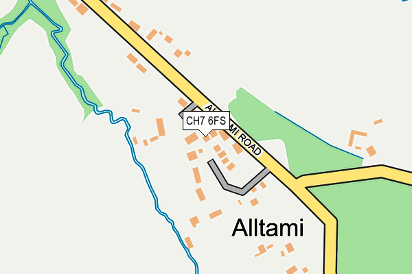
CH7 6FS is located in the Buckley: Mountain electoral ward, within the unitary authority of Flintshire and the Welsh Parliamentary constituency of Alyn and Deeside. The Local Health Board is Betsi Cadwaladr University and the police force is North Wales. This postcode has been in use since June 2017.


GetTheData
Source: OS OpenMap – Local (Ordnance Survey)
Source: OS VectorMap District (Ordnance Survey)
Licence: Open Government Licence (requires attribution)
| Easting | 326976 |
| Northing | 365269 |
| Latitude | 53.179506 |
| Longitude | -3.094097 |
GetTheData
Source: Open Postcode Geo
Licence: Open Government Licence
| Country | Wales |
| Postcode District | CH7 |
➜ See where CH7 is on a map ➜ Where is Alltami? | |
GetTheData
Source: Land Registry Price Paid Data
Licence: Open Government Licence
| Ward | Buckley: Mountain |
| Constituency | Alyn And Deeside |
GetTheData
Source: ONS Postcode Database
Licence: Open Government Licence
| Sunningdale (Aberllanerch Drive) | Buckley | 667m |
| Field Farm Road (St Mellor`s Road) | Buckley | 788m |
| St Andrew`s Drive | Buckley | 998m |
| Cherry Drive (Bryn Road) | Mynydd Isa | 1,111m |
| Cherry Drive (Bryn Road) | Mynydd Isa | 1,114m |
| Buckley Station | 3.1km |
| Hawarden Station | 4.2km |
| Penyffordd Station | 4.8km |
GetTheData
Source: NaPTAN
Licence: Open Government Licence
| Percentage of properties with Next Generation Access | 100.0% |
| Percentage of properties with Superfast Broadband | 100.0% |
| Percentage of properties with Ultrafast Broadband | 0.0% |
| Percentage of properties with Full Fibre Broadband | 0.0% |
Superfast Broadband is between 30Mbps and 300Mbps
Ultrafast Broadband is > 300Mbps
| Percentage of properties unable to receive 2Mbps | 0.0% |
| Percentage of properties unable to receive 5Mbps | 0.0% |
| Percentage of properties unable to receive 10Mbps | 0.0% |
| Percentage of properties unable to receive 30Mbps | 0.0% |
GetTheData
Source: Ofcom
Licence: Ofcom Terms of Use (requires attribution)
GetTheData
Source: ONS Postcode Database
Licence: Open Government Licence


➜ Get more ratings from the Food Standards Agency
GetTheData
Source: Food Standards Agency
Licence: FSA terms & conditions
| Last Collection | |||
|---|---|---|---|
| Location | Mon-Fri | Sat | Distance |
| Alltami | 17:10 | 08:00 | 460m |
| Lower Common | 16:00 | 11:00 | 707m |
| Liverpool Road Post Office | 16:00 | 11:00 | 1,208m |
GetTheData
Source: Dracos
Licence: Creative Commons Attribution-ShareAlike
The below table lists the International Territorial Level (ITL) codes (formerly Nomenclature of Territorial Units for Statistics (NUTS) codes) and Local Administrative Units (LAU) codes for CH7 6FS:
| ITL 1 Code | Name |
|---|---|
| TLL | Wales |
| ITL 2 Code | Name |
| TLL2 | East Wales |
| ITL 3 Code | Name |
| TLL23 | Flintshire and Wrexham |
| LAU 1 Code | Name |
| W06000005 | Flintshire |
GetTheData
Source: ONS Postcode Directory
Licence: Open Government Licence
The below table lists the Census Output Area (OA), Lower Layer Super Output Area (LSOA), and Middle Layer Super Output Area (MSOA) for CH7 6FS:
| Code | Name | |
|---|---|---|
| OA | W00001425 | |
| LSOA | W01000265 | Flintshire 012B |
| MSOA | W02000069 | Flintshire 012 |
GetTheData
Source: ONS Postcode Directory
Licence: Open Government Licence
| CH7 6RW | Alltami Road | 40m |
| CH7 6HG | White Farm Road | 242m |
| CH7 6SB | Bryn Road | 385m |
| CH7 6RN | Ash View | 442m |
| CH7 6RL | Davies Cottages | 443m |
| CH7 6RT | Alltami Road | 508m |
| CH7 3NR | Willow Grove | 512m |
| CH7 3PX | Tryfan Court | 513m |
| CH7 3NY | Pentre Lane | 522m |
| CH7 3DJ | Lon Pritchard | 537m |
GetTheData
Source: Open Postcode Geo; Land Registry Price Paid Data
Licence: Open Government Licence