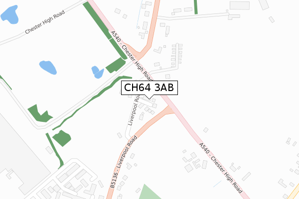
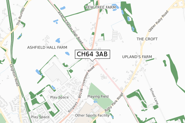
CH64 3AB is located in the Neston electoral ward, within the unitary authority of Cheshire West and Chester and the English Parliamentary constituency of Ellesmere Port and Neston. The Sub Integrated Care Board (ICB) Location is NHS Cheshire and Merseyside ICB - 27D and the police force is Cheshire. This postcode has been in use since July 2019.


GetTheData
Source: OS Open Zoomstack (Ordnance Survey)
Licence: Open Government Licence (requires attribution)
Attribution: Contains OS data © Crown copyright and database right 2025
Source: Open Postcode Geo
Licence: Open Government Licence (requires attribution)
Attribution: Contains OS data © Crown copyright and database right 2025; Contains Royal Mail data © Royal Mail copyright and database right 2025; Source: Office for National Statistics licensed under the Open Government Licence v.3.0
| Easting | 329864 |
| Northing | 379040 |
| Latitude | 53.303659 |
| Longitude | -3.053929 |
GetTheData
Source: Open Postcode Geo
Licence: Open Government Licence
| Country | England |
| Postcode District | CH64 |
➜ See where CH64 is on a map ➜ Where is Neston? | |
GetTheData
Source: Land Registry Price Paid Data
Licence: Open Government Licence
| Ward | Neston |
| Constituency | Ellesmere Port And Neston |
GetTheData
Source: ONS Postcode Database
Licence: Open Government Licence
2023 1 SEP £415,000 |
1, OLD DAIRY CLOSE, NESTON, CH64 3AB 2020 28 FEB £209,995 |
4, OLD DAIRY CLOSE, NESTON, CH64 3AB 2020 13 JAN £354,995 |
3, OLD DAIRY CLOSE, NESTON, CH64 3AB 2019 16 DEC £259,995 |
9, OLD DAIRY CLOSE, NESTON, CH64 3AB 2019 12 NOV £354,995 |
6, OLD DAIRY CLOSE, NESTON, CH64 3AB 2019 18 SEP £354,995 |
5, OLD DAIRY CLOSE, NESTON, CH64 3AB 2019 30 AUG £284,995 |
2019 31 JUL £319,995 |
8, OLD DAIRY CLOSE, NESTON, CH64 3AB 2019 10 JUL £259,995 |
GetTheData
Source: HM Land Registry Price Paid Data
Licence: Contains HM Land Registry data © Crown copyright and database right 2025. This data is licensed under the Open Government Licence v3.0.
| Chester High Road (Liverpool Road) | Neston | 62m |
| Chester High Road (Liverpool Road) | Neston | 82m |
| Liverpool Road (Chester High Road) | Neston | 183m |
| Red Gates (Liverpool Road) | Neston | 222m |
| Red Gates (Liverpool Road) | Neston | 225m |
| Neston Station | 1.4km |
| Heswall Station | 3.2km |
| Eastham Rake Station | 4.9km |
GetTheData
Source: NaPTAN
Licence: Open Government Licence
| Percentage of properties with Next Generation Access | 100.0% |
| Percentage of properties with Superfast Broadband | 100.0% |
| Percentage of properties with Ultrafast Broadband | 100.0% |
| Percentage of properties with Full Fibre Broadband | 100.0% |
Superfast Broadband is between 30Mbps and 300Mbps
Ultrafast Broadband is > 300Mbps
| Percentage of properties unable to receive 2Mbps | 0.0% |
| Percentage of properties unable to receive 5Mbps | 0.0% |
| Percentage of properties unable to receive 10Mbps | 0.0% |
| Percentage of properties unable to receive 30Mbps | 0.0% |
GetTheData
Source: Ofcom
Licence: Ofcom Terms of Use (requires attribution)
GetTheData
Source: ONS Postcode Database
Licence: Open Government Licence


➜ Get more ratings from the Food Standards Agency
GetTheData
Source: Food Standards Agency
Licence: FSA terms & conditions
| Last Collection | |||
|---|---|---|---|
| Location | Mon-Fri | Sat | Distance |
| Clayhill Cottages | 17:55 | 12:00 | 503m |
| Earle Drive | 17:00 | 12:00 | 1,306m |
| Neston Post Office | 18:00 | 12:00 | 1,638m |
GetTheData
Source: Dracos
Licence: Creative Commons Attribution-ShareAlike
The below table lists the International Territorial Level (ITL) codes (formerly Nomenclature of Territorial Units for Statistics (NUTS) codes) and Local Administrative Units (LAU) codes for CH64 3AB:
| ITL 1 Code | Name |
|---|---|
| TLD | North West (England) |
| ITL 2 Code | Name |
| TLD6 | Cheshire |
| ITL 3 Code | Name |
| TLD63 | Cheshire West and Chester |
| LAU 1 Code | Name |
| E06000050 | Cheshire West and Chester |
GetTheData
Source: ONS Postcode Directory
Licence: Open Government Licence
The below table lists the Census Output Area (OA), Lower Layer Super Output Area (LSOA), and Middle Layer Super Output Area (MSOA) for CH64 3AB:
| Code | Name | |
|---|---|---|
| OA | E00093532 | |
| LSOA | E01018535 | Cheshire West and Chester 001B |
| MSOA | E02003841 | Cheshire West and Chester 001 |
GetTheData
Source: ONS Postcode Directory
Licence: Open Government Licence
| CH64 3RH | Liverpool Road | 39m |
| CH64 7TR | Chester High Road | 90m |
| CH64 7TT | Chester High Road | 244m |
| CH64 7TW | Liverpool Road | 312m |
| CH64 7TN | Liverpool Road | 437m |
| CH64 3RU | Buildwas Road | 443m |
| CH64 3RT | Ringway | 536m |
| CH64 7TY | Upper Raby Road | 564m |
| CH64 3SB | The Birches | 610m |
| CH64 3RF | Liverpool Road | 618m |
GetTheData
Source: Open Postcode Geo; Land Registry Price Paid Data
Licence: Open Government Licence