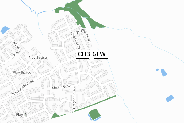
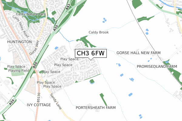
CH3 6FW is located in the Christleton & Huntington electoral ward, within the unitary authority of Cheshire West and Chester and the English Parliamentary constituency of City of Chester. The Sub Integrated Care Board (ICB) Location is NHS Cheshire and Merseyside ICB - 27D and the police force is Cheshire. This postcode has been in use since October 2017.


GetTheData
Source: OS Open Zoomstack (Ordnance Survey)
Licence: Open Government Licence (requires attribution)
Attribution: Contains OS data © Crown copyright and database right 2025
Source: Open Postcode Geo
Licence: Open Government Licence (requires attribution)
Attribution: Contains OS data © Crown copyright and database right 2025; Contains Royal Mail data © Royal Mail copyright and database right 2025; Source: Office for National Statistics licensed under the Open Government Licence v.3.0
| Easting | 343246 |
| Northing | 364352 |
| Latitude | 53.173252 |
| Longitude | -2.850525 |
GetTheData
Source: Open Postcode Geo
Licence: Open Government Licence
| Country | England |
| Postcode District | CH3 |
➜ See where CH3 is on a map ➜ Where is Chester? | |
GetTheData
Source: Land Registry Price Paid Data
Licence: Open Government Licence
| Ward | Christleton & Huntington |
| Constituency | City Of Chester |
GetTheData
Source: ONS Postcode Database
Licence: Open Government Licence
2024 4 OCT £425,000 |
2022 12 OCT £441,500 |
2021 27 MAY £439,000 |
2020 14 DEC £248,000 |
16, SWORD STREET, SAIGHTON, CHESTER, CH3 6FW 2018 2 JUL £369,995 |
18, SWORD STREET, SAIGHTON, CHESTER, CH3 6FW 2018 15 JUN £369,995 |
14, SWORD STREET, SAIGHTON, CHESTER, CH3 6FW 2018 29 MAY £418,995 |
2018 13 APR £329,495 |
2018 23 MAR £232,995 |
8, SWORD STREET, SAIGHTON, CHESTER, CH3 6FW 2018 9 MAR £311,495 |
GetTheData
Source: HM Land Registry Price Paid Data
Licence: Contains HM Land Registry data © Crown copyright and database right 2025. This data is licensed under the Open Government Licence v3.0.
| Rake & Pikel (Chester Road) | Huntington | 757m |
| Sedum Close (Gorse Way) | Huntington | 772m |
| Sedum Close (Gorse Way) | Huntington | 787m |
| Trefoil Close (Caldy Valley Road) | Huntington | 793m |
| Trefoil Close (Caldy Valley Road) | Huntington | 810m |
| Chester Station | 3.3km |
| Bache Station | 4.8km |
GetTheData
Source: NaPTAN
Licence: Open Government Licence
| Percentage of properties with Next Generation Access | 100.0% |
| Percentage of properties with Superfast Broadband | 100.0% |
| Percentage of properties with Ultrafast Broadband | 100.0% |
| Percentage of properties with Full Fibre Broadband | 100.0% |
Superfast Broadband is between 30Mbps and 300Mbps
Ultrafast Broadband is > 300Mbps
| Percentage of properties unable to receive 2Mbps | 0.0% |
| Percentage of properties unable to receive 5Mbps | 0.0% |
| Percentage of properties unable to receive 10Mbps | 0.0% |
| Percentage of properties unable to receive 30Mbps | 0.0% |
GetTheData
Source: Ofcom
Licence: Ofcom Terms of Use (requires attribution)
GetTheData
Source: ONS Postcode Database
Licence: Open Government Licence


➜ Get more ratings from the Food Standards Agency
GetTheData
Source: Food Standards Agency
Licence: FSA terms & conditions
| Last Collection | |||
|---|---|---|---|
| Location | Mon-Fri | Sat | Distance |
| Sainsbury, Caldy Valley, | 17:45 | 12:15 | 1,177m |
| Saighton, | 17:00 | 09:00 | 1,435m |
| Toll Bar Road. | 17:41 | 12:28 | 1,661m |
GetTheData
Source: Dracos
Licence: Creative Commons Attribution-ShareAlike
The below table lists the International Territorial Level (ITL) codes (formerly Nomenclature of Territorial Units for Statistics (NUTS) codes) and Local Administrative Units (LAU) codes for CH3 6FW:
| ITL 1 Code | Name |
|---|---|
| TLD | North West (England) |
| ITL 2 Code | Name |
| TLD6 | Cheshire |
| ITL 3 Code | Name |
| TLD63 | Cheshire West and Chester |
| LAU 1 Code | Name |
| E06000050 | Cheshire West and Chester |
GetTheData
Source: ONS Postcode Directory
Licence: Open Government Licence
The below table lists the Census Output Area (OA), Lower Layer Super Output Area (LSOA), and Middle Layer Super Output Area (MSOA) for CH3 6FW:
| Code | Name | |
|---|---|---|
| OA | E00092548 | |
| LSOA | E01018348 | Cheshire West and Chester 041D |
| MSOA | E02003806 | Cheshire West and Chester 041 |
GetTheData
Source: ONS Postcode Directory
Licence: Open Government Licence
| CH3 6DN | Alanbrooke Road | 106m |
| CH3 6FL | Alanbrooke Road | 144m |
| CH3 6ES | Wellesley Crescent | 183m |
| CH3 6FF | Pioneer Close | 307m |
| CH3 6GH | Corporal Way | 318m |
| CH3 6FD | Granby Road | 329m |
| CH3 6FE | Granby Road | 373m |
| CH3 6GG | Brigadier Close | 379m |
| CH3 6GL | Manners Court | 386m |
| CH3 6GF | Arnhem Way | 387m |
GetTheData
Source: Open Postcode Geo; Land Registry Price Paid Data
Licence: Open Government Licence