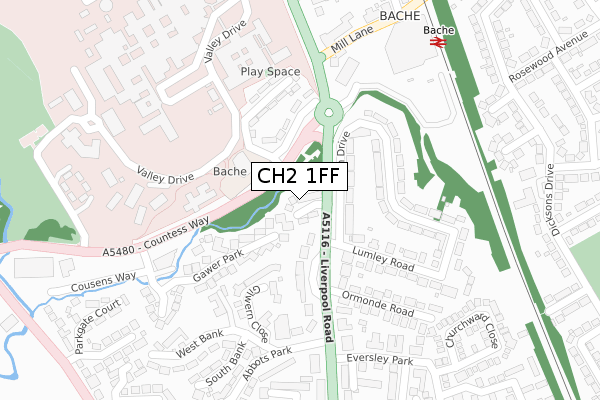
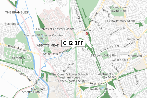
CH2 1FF is located in the Chester City & the Garden Quarter electoral ward, within the unitary authority of Cheshire West and Chester and the English Parliamentary constituency of City of Chester. The Sub Integrated Care Board (ICB) Location is NHS Cheshire and Merseyside ICB - 27D and the police force is Cheshire. This postcode has been in use since November 2017.


GetTheData
Source: OS Open Zoomstack (Ordnance Survey)
Licence: Open Government Licence (requires attribution)
Attribution: Contains OS data © Crown copyright and database right 2025
Source: Open Postcode Geo
Licence: Open Government Licence (requires attribution)
Attribution: Contains OS data © Crown copyright and database right 2025; Contains Royal Mail data © Royal Mail copyright and database right 2025; Source: Office for National Statistics licensed under the Open Government Licence v.3.0
| Easting | 340319 |
| Northing | 368057 |
| Latitude | 53.206231 |
| Longitude | -2.895002 |
GetTheData
Source: Open Postcode Geo
Licence: Open Government Licence
| Country | England |
| Postcode District | CH2 |
➜ See where CH2 is on a map ➜ Where is Chester? | |
GetTheData
Source: Land Registry Price Paid Data
Licence: Open Government Licence
| Ward | Chester City & The Garden Quarter |
| Constituency | City Of Chester |
GetTheData
Source: ONS Postcode Database
Licence: Open Government Licence
2024 28 MAR £560,000 |
2021 5 NOV £640,000 |
7, HUDSON CLOSE, CHESTER, CH2 1FF 2019 3 JAN £724,995 |
2018 7 DEC £499,995 |
3, HUDSON CLOSE, CHESTER, CH2 1FF 2018 30 NOV £499,995 |
1, HUDSON CLOSE, CHESTER, CH2 1FF 2018 30 NOV £499,995 |
2, HUDSON CLOSE, CHESTER, CH2 1FF 2018 9 NOV £499,995 |
2018 19 OCT £404,995 |
6, HUDSON CLOSE, CHESTER, CH2 1FF 2018 12 OCT £399,995 |
GetTheData
Source: HM Land Registry Price Paid Data
Licence: Contains HM Land Registry data © Crown copyright and database right 2025. This data is licensed under the Open Government Licence v3.0.
| Abbot's Drive (Liverpool Road) | Chester | 120m |
| Abbot's Drive (Liverpool Road) | Chester | 185m |
| Egerton Arms Ph (Liverpool Road) | Bache | 228m |
| Maternity Wing (Countess Health Park) | Bache | 300m |
| Main Entrance (Countess Health Park) | Bache | 333m |
| Bache Station | 0.4km |
| Chester Station | 1.5km |
GetTheData
Source: NaPTAN
Licence: Open Government Licence
| Percentage of properties with Next Generation Access | 100.0% |
| Percentage of properties with Superfast Broadband | 100.0% |
| Percentage of properties with Ultrafast Broadband | 0.0% |
| Percentage of properties with Full Fibre Broadband | 0.0% |
Superfast Broadband is between 30Mbps and 300Mbps
Ultrafast Broadband is > 300Mbps
| Median download speed | 55.0Mbps |
| Average download speed | 75.3Mbps |
| Maximum download speed | 159.97Mbps |
| Median upload speed | 10.0Mbps |
| Average upload speed | 15.8Mbps |
| Maximum upload speed | 30.01Mbps |
| Percentage of properties unable to receive 2Mbps | 0.0% |
| Percentage of properties unable to receive 5Mbps | 0.0% |
| Percentage of properties unable to receive 10Mbps | 0.0% |
| Percentage of properties unable to receive 30Mbps | 0.0% |
GetTheData
Source: Ofcom
Licence: Ofcom Terms of Use (requires attribution)
GetTheData
Source: ONS Postcode Database
Licence: Open Government Licence


➜ Get more ratings from the Food Standards Agency
GetTheData
Source: Food Standards Agency
Licence: FSA terms & conditions
| Last Collection | |||
|---|---|---|---|
| Location | Mon-Fri | Sat | Distance |
| Eversley Park. | 17:45 | 11:45 | 259m |
| The Bache Post Office. | 17:00 | 12:15 | 352m |
| Thornton Drive, Newton. | 17:30 | 12:45 | 598m |
GetTheData
Source: Dracos
Licence: Creative Commons Attribution-ShareAlike
The below table lists the International Territorial Level (ITL) codes (formerly Nomenclature of Territorial Units for Statistics (NUTS) codes) and Local Administrative Units (LAU) codes for CH2 1FF:
| ITL 1 Code | Name |
|---|---|
| TLD | North West (England) |
| ITL 2 Code | Name |
| TLD6 | Cheshire |
| ITL 3 Code | Name |
| TLD63 | Cheshire West and Chester |
| LAU 1 Code | Name |
| E06000050 | Cheshire West and Chester |
GetTheData
Source: ONS Postcode Directory
Licence: Open Government Licence
The below table lists the Census Output Area (OA), Lower Layer Super Output Area (LSOA), and Middle Layer Super Output Area (MSOA) for CH2 1FF:
| Code | Name | |
|---|---|---|
| OA | E00092702 | |
| LSOA | E01018374 | Cheshire West and Chester 028C |
| MSOA | E02003797 | Cheshire West and Chester 028 |
GetTheData
Source: ONS Postcode Directory
Licence: Open Government Licence
| CH2 1AT | Abbots Drive | 117m |
| CH2 2AG | Garth Drive | 135m |
| CH2 1AS | Liverpool Road | 142m |
| CH2 1BR | Bache Hall Estate | 160m |
| CH1 4AP | Gilwern Close | 166m |
| CH2 2AF | Garth Drive | 169m |
| CH1 4DA | Gawer Park | 184m |
| CH2 1JR | Bache Hall Court | 211m |
| CH2 2AQ | Lumley Road | 231m |
| CH1 4EA | Gawer Park | 240m |
GetTheData
Source: Open Postcode Geo; Land Registry Price Paid Data
Licence: Open Government Licence