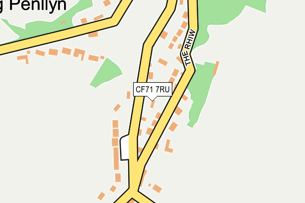
CF71 7RU is in Graig Penllyn, Cowbridge. CF71 7RU is located in the Cowbridge electoral ward, within the unitary authority of Vale of Glamorgan and the Welsh Parliamentary constituency of Vale of Glamorgan. The Local Health Board is Cardiff and Vale University and the police force is South Wales. This postcode has been in use since July 1995.


GetTheData
Source: OS OpenMap – Local (Ordnance Survey)
Source: OS VectorMap District (Ordnance Survey)
Licence: Open Government Licence (requires attribution)
| Easting | 297788 |
| Northing | 177465 |
| Latitude | 51.486867 |
| Longitude | -3.473500 |
GetTheData
Source: Open Postcode Geo
Licence: Open Government Licence
| Locality | Graig Penllyn |
| Town/City | Cowbridge |
| Country | Wales |
| Postcode District | CF71 |
➜ See where CF71 is on a map ➜ Where is Graig Penllyn? | |
GetTheData
Source: Land Registry Price Paid Data
Licence: Open Government Licence
Elevation or altitude of CF71 7RU as distance above sea level:
| Metres | Feet | |
|---|---|---|
| Elevation | 60m | 197ft |
Elevation is measured from the approximate centre of the postcode, to the nearest point on an OS contour line from OS Terrain 50, which has contour spacing of ten vertical metres.
➜ How high above sea level am I? Find the elevation of your current position using your device's GPS.
GetTheData
Source: Open Postcode Elevation
Licence: Open Government Licence
| Ward | Cowbridge |
| Constituency | Vale Of Glamorgan |
GetTheData
Source: ONS Postcode Database
Licence: Open Government Licence
2022 22 NOV £890,000 |
2018 19 MAR £535,000 |
2004 20 SEP £540,000 |
1996 14 MAR £160,000 |
GetTheData
Source: HM Land Registry Price Paid Data
Licence: Contains HM Land Registry data © Crown copyright and database right 2025. This data is licensed under the Open Government Licence v3.0.
| Springfield House (Main Road) | Graig Penllyn | 30m |
| Ty-canol (Main Road) | Graig Penllyn | 372m |
| Park Corner (Main Road) | Graig Penllyn | 431m |
| School (Main Road) | Llangan | 808m |
| Fferm Goch (Main Road) | Llangan | 966m |
| Pencoed Station | 4.6km |
GetTheData
Source: NaPTAN
Licence: Open Government Licence
| Percentage of properties with Next Generation Access | 0.0% |
| Percentage of properties with Superfast Broadband | 0.0% |
| Percentage of properties with Ultrafast Broadband | 0.0% |
| Percentage of properties with Full Fibre Broadband | 0.0% |
Superfast Broadband is between 30Mbps and 300Mbps
Ultrafast Broadband is > 300Mbps
| Percentage of properties unable to receive 2Mbps | 0.0% |
| Percentage of properties unable to receive 5Mbps | 100.0% |
| Percentage of properties unable to receive 10Mbps | 100.0% |
| Percentage of properties unable to receive 30Mbps | 100.0% |
GetTheData
Source: Ofcom
Licence: Ofcom Terms of Use (requires attribution)
GetTheData
Source: ONS Postcode Database
Licence: Open Government Licence


➜ Get more ratings from the Food Standards Agency
GetTheData
Source: Food Standards Agency
Licence: FSA terms & conditions
| Last Collection | |||
|---|---|---|---|
| Location | Mon-Fri | Sat | Distance |
| City | 16:00 | 08:15 | 1,549m |
| Bowmans Well | 16:30 | 11:15 | 2,959m |
| Broadway | 16:45 | 11:15 | 3,029m |
GetTheData
Source: Dracos
Licence: Creative Commons Attribution-ShareAlike
The below table lists the International Territorial Level (ITL) codes (formerly Nomenclature of Territorial Units for Statistics (NUTS) codes) and Local Administrative Units (LAU) codes for CF71 7RU:
| ITL 1 Code | Name |
|---|---|
| TLL | Wales |
| ITL 2 Code | Name |
| TLL2 | East Wales |
| ITL 3 Code | Name |
| TLL22 | Cardiff and Vale of Glamorgan |
| LAU 1 Code | Name |
| W06000014 | Vale of Glamorgan |
GetTheData
Source: ONS Postcode Directory
Licence: Open Government Licence
The below table lists the Census Output Area (OA), Lower Layer Super Output Area (LSOA), and Middle Layer Super Output Area (MSOA) for CF71 7RU:
| Code | Name | |
|---|---|---|
| OA | W00005736 | |
| LSOA | W01001085 | The Vale of Glamorgan 002D |
| MSOA | W02000238 | The Vale of Glamorgan 002 |
GetTheData
Source: ONS Postcode Directory
Licence: Open Government Licence
| CF71 7RS | The Rhiw | 25m |
| CF71 7RT | 79m | |
| CF71 7SA | Cae Rhedyn | 190m |
| CF71 7SB | Salmons Wood | 199m |
| CF35 5DR | 859m | |
| CF35 5AZ | Timbers Green | 934m |
| CF35 5DP | Fferm Goch | 1055m |
| CF71 7RL | The Meadows | 1094m |
| CF35 5DS | Heol Llidiard | 1140m |
| CF71 7RQ | 1238m |
GetTheData
Source: Open Postcode Geo; Land Registry Price Paid Data
Licence: Open Government Licence