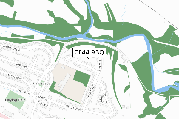
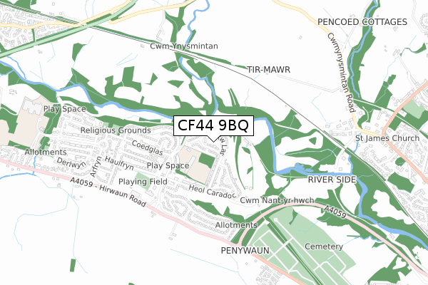
CF44 9BQ is located in the Aberdare West and Llwydcoed electoral ward, within the unitary authority of Rhondda Cynon Taf and the Welsh Parliamentary constituency of Cynon Valley. The Local Health Board is Cwm Taf Morgannwg University and the police force is South Wales. This postcode has been in use since January 2020.


GetTheData
Source: OS Open Zoomstack (Ordnance Survey)
Licence: Open Government Licence (requires attribution)
Attribution: Contains OS data © Crown copyright and database right 2025
Source: Open Postcode Geo
Licence: Open Government Licence (requires attribution)
Attribution: Contains OS data © Crown copyright and database right 2025; Contains Royal Mail data © Royal Mail copyright and database right 2025; Source: Office for National Statistics licensed under the Open Government Licence v.3.0
| Easting | 298614 |
| Northing | 203730 |
| Latitude | 51.723099 |
| Longitude | -3.469207 |
GetTheData
Source: Open Postcode Geo
Licence: Open Government Licence
| Country | Wales |
| Postcode District | CF44 |
➜ See where CF44 is on a map ➜ Where is Aberdare? | |
GetTheData
Source: Land Registry Price Paid Data
Licence: Open Government Licence
| Ward | Aberdare West And Llwydcoed |
| Constituency | Cynon Valley |
GetTheData
Source: ONS Postcode Database
Licence: Open Government Licence
2024 21 JUN £285,000 |
2024 21 JUN £330,000 |
23, LLYS FOTHERGILL, ABERDARE, CF44 9BQ 2024 5 APR £410,000 |
21, LLYS FOTHERGILL, ABERDARE, CF44 9BQ 2023 17 OCT £329,995 |
19, LLYS FOTHERGILL, ABERDARE, CF44 9BQ 2023 11 OCT £420,000 |
25, LLYS FOTHERGILL, ABERDARE, CF44 9BQ 2023 25 AUG £374,995 |
9, LLYS FOTHERGILL, ABERDARE, CF44 9BQ 2023 14 AUG £374,995 |
20, LLYS FOTHERGILL, ABERDARE, CF44 9BQ 2023 28 JUL £329,995 |
24, LLYS FOTHERGILL, ABERDARE, CF44 9BQ 2023 28 JUL £349,995 |
2023 31 MAR £329,995 |
GetTheData
Source: HM Land Registry Price Paid Data
Licence: Contains HM Land Registry data © Crown copyright and database right 2025. This data is licensed under the Open Government Licence v3.0.
| Graiglwyd (Cwmdare Road) | Cwmdare | 154m |
| Graiglwyd (Cwmdare Road) | Cwmdare | 157m |
| College (Station Place) | Trecynon | 190m |
| College (Cwmdare Road) | Trecynon | 212m |
| Maesgwyn | Cwmdare | 264m |
| Aberdare Station | 2km |
| Cwmbach Station | 4.5km |
| Fernhill Station | 6.5km |
GetTheData
Source: NaPTAN
Licence: Open Government Licence
GetTheData
Source: ONS Postcode Database
Licence: Open Government Licence


➜ Get more ratings from the Food Standards Agency
GetTheData
Source: Food Standards Agency
Licence: FSA terms & conditions
| Last Collection | |||
|---|---|---|---|
| Location | Mon-Fri | Sat | Distance |
| Mill Street Trecynon | 17:15 | 10:30 | 825m |
| Beechwood Ave Gla Ndare | 17:15 | 10:30 | 1,139m |
| Trenant Hirwaun | 17:00 | 10:30 | 1,240m |
GetTheData
Source: Dracos
Licence: Creative Commons Attribution-ShareAlike
The below table lists the International Territorial Level (ITL) codes (formerly Nomenclature of Territorial Units for Statistics (NUTS) codes) and Local Administrative Units (LAU) codes for CF44 9BQ:
| ITL 1 Code | Name |
|---|---|
| TLL | Wales |
| ITL 2 Code | Name |
| TLL1 | West Wales and The Valleys |
| ITL 3 Code | Name |
| TLL15 | Central Valleys |
| LAU 1 Code | Name |
| W06000016 | Rhondda Cynon Taf |
GetTheData
Source: ONS Postcode Directory
Licence: Open Government Licence
The below table lists the Census Output Area (OA), Lower Layer Super Output Area (LSOA), and Middle Layer Super Output Area (MSOA) for CF44 9BQ:
| Code | Name | |
|---|---|---|
| OA | W00006089 | |
| LSOA | W01001151 | Rhondda Cynon Taf 003C |
| MSOA | W02000254 | Rhondda Cynon Taf 003 |
GetTheData
Source: ONS Postcode Directory
Licence: Open Government Licence
| CF44 9AD | Brynderwen | 187m |
| CF44 8TB | Nantgwyn | 192m |
| CF44 8RD | Cwmdare Road | 195m |
| CF44 8TA | Graiglwyd | 202m |
| CF44 9AA | Station Place | 214m |
| CF44 8RB | Bryn Terrace | 235m |
| CF44 8RL | Broncynon Terrace | 266m |
| CF44 8RH | Maes Brynna | 268m |
| CF44 8TD | Maesgwyn | 270m |
| CF44 8RN | Hillside | 325m |
GetTheData
Source: Open Postcode Geo; Land Registry Price Paid Data
Licence: Open Government Licence