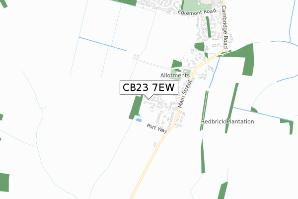
CB23 7EW is located in the Hardwick electoral ward, within the local authority district of South Cambridgeshire and the English Parliamentary constituency of South Cambridgeshire. The Sub Integrated Care Board (ICB) Location is NHS Cambridgeshire and Peterborough ICB - 06H and the police force is Cambridgeshire. This postcode has been in use since November 2019.


GetTheData
Source: OS Open Zoomstack (Ordnance Survey)
Licence: Open Government Licence (requires attribution)
Attribution: Contains OS data © Crown copyright and database right 2024
Source: Open Postcode Geo
Licence: Open Government Licence (requires attribution)
Attribution: Contains OS data © Crown copyright and database right 2024; Contains Royal Mail data © Royal Mail copyright and database right 2024; Source: Office for National Statistics licensed under the Open Government Licence v.3.0
| Easting | 536934 |
| Northing | 258365 |
| Latitude | 52.206517 |
| Longitude | 0.002538 |
GetTheData
Source: Open Postcode Geo
Licence: Open Government Licence
| Country | England |
| Postcode District | CB23 |
➜ See where CB23 is on a map ➜ Where is Hardwick? | |
GetTheData
Source: Land Registry Price Paid Data
Licence: Open Government Licence
| Ward | Hardwick |
| Constituency | South Cambridgeshire |
GetTheData
Source: ONS Postcode Database
Licence: Open Government Licence
2023 15 MAR £427,500 |
2022 25 MAR £380,000 |
2, WEBB CLOSE, HARDWICK, CAMBRIDGE, CB23 7EW 2021 5 FEB £514,950 |
12, WEBB CLOSE, HARDWICK, CAMBRIDGE, CB23 7EW 2021 29 JAN £392,950 |
5, WEBB CLOSE, HARDWICK, CAMBRIDGE, CB23 7EW 2020 9 DEC £514,950 |
2020 13 NOV £364,500 |
16, WEBB CLOSE, HARDWICK, CAMBRIDGE, CB23 7EW 2020 14 OCT £379,950 |
2020 26 JUN £379,000 |
10, WEBB CLOSE, HARDWICK, CAMBRIDGE, CB23 7EW 2020 7 FEB £385,000 |
17, WEBB CLOSE, HARDWICK, CAMBRIDGE, CB23 7EW 2019 6 DEC £360,952 |
GetTheData
Source: HM Land Registry Price Paid Data
Licence: Contains HM Land Registry data © Crown copyright and database right 2024. This data is licensed under the Open Government Licence v3.0.
| Portway Road (Hardwick Road) | Hardwick | 271m |
| Portway Road (Hardwick Road) | Hardwick | 280m |
| St Mary's Church (Main Street) | Hardwick | 439m |
| St Mary's Church (Main Street) | Hardwick | 445m |
| Egremont Road (Limes Road) | Hardwick | 842m |
GetTheData
Source: NaPTAN
Licence: Open Government Licence
GetTheData
Source: ONS Postcode Database
Licence: Open Government Licence


➜ Get more ratings from the Food Standards Agency
GetTheData
Source: Food Standards Agency
Licence: FSA terms & conditions
| Last Collection | |||
|---|---|---|---|
| Location | Mon-Fri | Sat | Distance |
| Cambridge Road | 18:00 | 11:15 | 429m |
| Ellison Lane | 18:00 | 11:15 | 962m |
| Hardwick Post Office | 18:00 | 11:15 | 1,188m |
GetTheData
Source: Dracos
Licence: Creative Commons Attribution-ShareAlike
The below table lists the International Territorial Level (ITL) codes (formerly Nomenclature of Territorial Units for Statistics (NUTS) codes) and Local Administrative Units (LAU) codes for CB23 7EW:
| ITL 1 Code | Name |
|---|---|
| TLH | East |
| ITL 2 Code | Name |
| TLH1 | East Anglia |
| ITL 3 Code | Name |
| TLH12 | Cambridgeshire CC |
| LAU 1 Code | Name |
| E07000012 | South Cambridgeshire |
GetTheData
Source: ONS Postcode Directory
Licence: Open Government Licence
The below table lists the Census Output Area (OA), Lower Layer Super Output Area (LSOA), and Middle Layer Super Output Area (MSOA) for CB23 7EW:
| Code | Name | |
|---|---|---|
| OA | E00092062 | |
| LSOA | E01018252 | South Cambridgeshire 010D |
| MSOA | E02003784 | South Cambridgeshire 010 |
GetTheData
Source: ONS Postcode Directory
Licence: Open Government Licence
| CB23 7AH | Grace Crescent | 171m |
| CB23 7YE | Sadlers Close | 198m |
| CB23 7XA | The Pastures | 202m |
| CB23 7QU | Main Street | 233m |
| CB23 7QE | Manor Crescent | 302m |
| CB23 7QF | Portway Road | 313m |
| CB23 7QS | Main Street | 572m |
| CB23 7XT | Ashmead Drive | 741m |
| CB23 7XR | Egremont Road | 804m |
| CB23 7XS | Sudeley Grove | 804m |
GetTheData
Source: Open Postcode Geo; Land Registry Price Paid Data
Licence: Open Government Licence