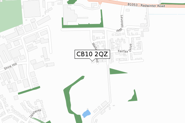
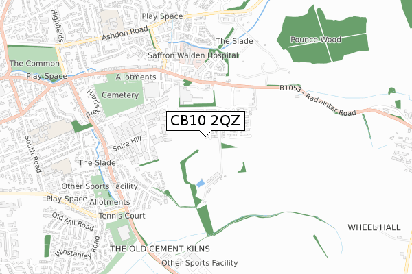
CB10 2QZ is located in the Saffron Walden Shire electoral ward, within the local authority district of Uttlesford and the English Parliamentary constituency of Saffron Walden. The Sub Integrated Care Board (ICB) Location is NHS Hertfordshire and West Essex ICB - 07H and the police force is Essex. This postcode has been in use since August 2019.


GetTheData
Source: OS Open Zoomstack (Ordnance Survey)
Licence: Open Government Licence (requires attribution)
Attribution: Contains OS data © Crown copyright and database right 2025
Source: Open Postcode Geo
Licence: Open Government Licence (requires attribution)
Attribution: Contains OS data © Crown copyright and database right 2025; Contains Royal Mail data © Royal Mail copyright and database right 2025; Source: Office for National Statistics licensed under the Open Government Licence v.3.0
| Easting | 555202 |
| Northing | 238134 |
| Latitude | 52.019933 |
| Longitude | 0.260450 |
GetTheData
Source: Open Postcode Geo
Licence: Open Government Licence
| Country | England |
| Postcode District | CB10 |
➜ See where CB10 is on a map ➜ Where is Saffron Walden? | |
GetTheData
Source: Land Registry Price Paid Data
Licence: Open Government Licence
| Ward | Saffron Walden Shire |
| Constituency | Saffron Walden |
GetTheData
Source: ONS Postcode Database
Licence: Open Government Licence
2021 20 DEC £620,000 |
16, WALLACE ROAD, SAFFRON WALDEN, CB10 2QZ 2021 29 JAN £800,000 |
2020 30 SEP £549,995 |
1, WALLACE ROAD, SAFFRON WALDEN, CB10 2QZ 2020 27 AUG £499,995 |
12, WALLACE ROAD, SAFFRON WALDEN, CB10 2QZ 2020 31 JUL £600,000 |
14, WALLACE ROAD, SAFFRON WALDEN, CB10 2QZ 2020 30 MAR £819,995 |
15, WALLACE ROAD, SAFFRON WALDEN, CB10 2QZ 2019 20 DEC £719,995 |
17, WALLACE ROAD, SAFFRON WALDEN, CB10 2QZ 2019 31 JUL £420,000 |
17, WALLACE ROAD, SAFFRON WALDEN, CB10 2QZ 2019 31 JUL £789,995 |
GetTheData
Source: HM Land Registry Price Paid Data
Licence: Contains HM Land Registry data © Crown copyright and database right 2025. This data is licensed under the Open Government Licence v3.0.
| Tesco (Radwinter Road) | Saffron Walden | 256m |
| Tesco Store (Radwinter Road) | Saffron Walden | 308m |
| Tesco Store (Radwinter Road) | Saffron Walden | 309m |
| Hospital (Access To Hospital) | Saffron Walden | 426m |
| The Spike (Radwinter Road) | Saffron Walden | 438m |
| Audley End Station | 4km |
| Newport (Essex) Station | 5.4km |
| Great Chesterford Station | 6.4km |
GetTheData
Source: NaPTAN
Licence: Open Government Licence
GetTheData
Source: ONS Postcode Database
Licence: Open Government Licence


➜ Get more ratings from the Food Standards Agency
GetTheData
Source: Food Standards Agency
Licence: FSA terms & conditions
| Last Collection | |||
|---|---|---|---|
| Location | Mon-Fri | Sat | Distance |
| Tesco Stores | 17:45 | 11:00 | 217m |
| Elizabeth Way | 17:30 | 12:00 | 568m |
| Thaxted Road | 17:30 | 12:00 | 622m |
GetTheData
Source: Dracos
Licence: Creative Commons Attribution-ShareAlike
The below table lists the International Territorial Level (ITL) codes (formerly Nomenclature of Territorial Units for Statistics (NUTS) codes) and Local Administrative Units (LAU) codes for CB10 2QZ:
| ITL 1 Code | Name |
|---|---|
| TLH | East |
| ITL 2 Code | Name |
| TLH3 | Essex |
| ITL 3 Code | Name |
| TLH35 | West Essex |
| LAU 1 Code | Name |
| E07000077 | Uttlesford |
GetTheData
Source: ONS Postcode Directory
Licence: Open Government Licence
The below table lists the Census Output Area (OA), Lower Layer Super Output Area (LSOA), and Middle Layer Super Output Area (MSOA) for CB10 2QZ:
| Code | Name | |
|---|---|---|
| OA | E00112201 | |
| LSOA | E01022082 | Uttlesford 002G |
| MSOA | E02004592 | Uttlesford 002 |
GetTheData
Source: ONS Postcode Directory
Licence: Open Government Licence
| CB10 2JZ | Radwinter Road | 306m |
| CB11 3JW | Horn Book | 392m |
| CB11 3AN | The Shires | 394m |
| CB11 3JN | Horn Book | 403m |
| CB11 3BP | Upsheres | 405m |
| CB11 3AU | Shire Hill Industrial Estate | 414m |
| CB11 3AQ | Shire Hill | 433m |
| CB11 3JF | Radwinter Road | 460m |
| CB11 3GB | Shire Hill | 468m |
| CB11 3BW | Monks Hill | 473m |
GetTheData
Source: Open Postcode Geo; Land Registry Price Paid Data
Licence: Open Government Licence