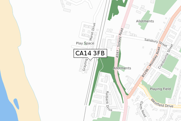
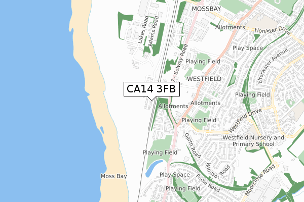
CA14 3FB is located in the Harrington electoral ward, within the unitary authority of Cumberland and the English Parliamentary constituency of Workington. The Sub Integrated Care Board (ICB) Location is NHS North East and North Cumbria ICB - 01H and the police force is Cumbria. This postcode has been in use since December 2018.


GetTheData
Source: OS Open Zoomstack (Ordnance Survey)
Licence: Open Government Licence (requires attribution)
Attribution: Contains OS data © Crown copyright and database right 2024
Source: Open Postcode Geo
Licence: Open Government Licence (requires attribution)
Attribution: Contains OS data © Crown copyright and database right 2024; Contains Royal Mail data © Royal Mail copyright and database right 2024; Source: Office for National Statistics licensed under the Open Government Licence v.3.0
| Easting | 298934 |
| Northing | 527239 |
| Latitude | 54.630134 |
| Longitude | -3.567099 |
GetTheData
Source: Open Postcode Geo
Licence: Open Government Licence
| Country | England |
| Postcode District | CA14 |
➜ See where CA14 is on a map ➜ Where is Workington? | |
GetTheData
Source: Land Registry Price Paid Data
Licence: Open Government Licence
| Ward | Harrington |
| Constituency | Workington |
GetTheData
Source: ONS Postcode Database
Licence: Open Government Licence
2024 26 JAN £195,000 |
2023 28 JUL £185,000 |
27, GRAYLING WAY, WORKINGTON, CA14 3FB 2019 23 AUG £193,995 |
37, GRAYLING WAY, WORKINGTON, CA14 3FB 2019 31 JUL £192,995 |
2019 28 JUN £173,995 |
2019 28 JUN £173,995 |
21, GRAYLING WAY, WORKINGTON, CA14 3FB 2019 21 JUN £193,995 |
11, GRAYLING WAY, WORKINGTON, CA14 3FB 2019 30 APR £189,995 |
9, GRAYLING WAY, WORKINGTON, CA14 3FB 2018 20 DEC £172,995 |
GetTheData
Source: HM Land Registry Price Paid Data
Licence: Contains HM Land Registry data © Crown copyright and database right 2024. This data is licensed under the Open Government Licence v3.0.
| Northcote Street (Mossbay Road) | Moss Bay | 316m |
| Mossbay Road (Westfield Drive) | Moss Bay | 328m |
| Just Pine (Mossbay Road) | Moss Bay | 372m |
| Mossbay Road | Moss Bay | 403m |
| Playing Fields (Mossbay Road) | Moss Bay | 428m |
| Workington Station | 1.8km |
| Harrington Station | 1.9km |
GetTheData
Source: NaPTAN
Licence: Open Government Licence
| Percentage of properties with Next Generation Access | 100.0% |
| Percentage of properties with Superfast Broadband | 100.0% |
| Percentage of properties with Ultrafast Broadband | 100.0% |
| Percentage of properties with Full Fibre Broadband | 100.0% |
Superfast Broadband is between 30Mbps and 300Mbps
Ultrafast Broadband is > 300Mbps
| Percentage of properties unable to receive 2Mbps | 0.0% |
| Percentage of properties unable to receive 5Mbps | 0.0% |
| Percentage of properties unable to receive 10Mbps | 0.0% |
| Percentage of properties unable to receive 30Mbps | 0.0% |
GetTheData
Source: Ofcom
Licence: Ofcom Terms of Use (requires attribution)
GetTheData
Source: ONS Postcode Database
Licence: Open Government Licence


➜ Get more ratings from the Food Standards Agency
GetTheData
Source: Food Standards Agency
Licence: FSA terms & conditions
| Last Collection | |||
|---|---|---|---|
| Location | Mon-Fri | Sat | Distance |
| Shackley Terrace | 17:30 | 11:30 | 431m |
| Mossbay | 17:15 | 11:30 | 468m |
| Westfield Drive | 17:15 | 11:30 | 634m |
GetTheData
Source: Dracos
Licence: Creative Commons Attribution-ShareAlike
The below table lists the International Territorial Level (ITL) codes (formerly Nomenclature of Territorial Units for Statistics (NUTS) codes) and Local Administrative Units (LAU) codes for CA14 3FB:
| ITL 1 Code | Name |
|---|---|
| TLD | North West (England) |
| ITL 2 Code | Name |
| TLD1 | Cumbria |
| ITL 3 Code | Name |
| TLD11 | West Cumbria |
| LAU 1 Code | Name |
| E07000026 | Allerdale |
GetTheData
Source: ONS Postcode Directory
Licence: Open Government Licence
The below table lists the Census Output Area (OA), Lower Layer Super Output Area (LSOA), and Middle Layer Super Output Area (MSOA) for CA14 3FB:
| Code | Name | |
|---|---|---|
| OA | E00096589 | |
| LSOA | E01019111 | Allerdale 009A |
| MSOA | E02003973 | Allerdale 009 |
GetTheData
Source: ONS Postcode Directory
Licence: Open Government Licence
| CA14 5DD | Railbank Drive | 195m |
| CA14 5DE | Sleeper Mill Drive | 202m |
| CA14 3TT | Derwent Road | 255m |
| CA14 5DF | Sea View Drive | 268m |
| CA14 5AF | Moss Bay Road | 276m |
| CA14 3TH | Moss Bay Road | 285m |
| CA14 3TQ | Moss Bay Road | 322m |
| CA14 3TL | Moss Bay Road | 348m |
| CA14 3UA | Cranbourne Street | 370m |
| CA14 3TG | Moss Bay Road | 379m |
GetTheData
Source: Open Postcode Geo; Land Registry Price Paid Data
Licence: Open Government Licence