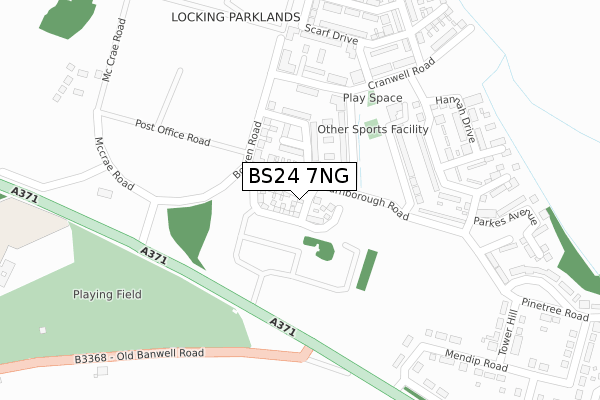
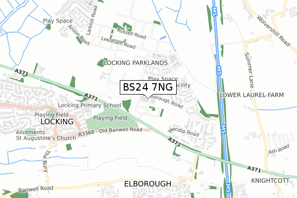
BS24 7NG is located in the Hutton & Locking electoral ward, within the unitary authority of North Somerset and the English Parliamentary constituency of Weston-Super-Mare. The Sub Integrated Care Board (ICB) Location is NHS Bristol, North Somerset and South Gloucestershire ICB - 15C and the police force is Avon and Somerset. This postcode has been in use since November 2019.


GetTheData
Source: OS Open Zoomstack (Ordnance Survey)
Licence: Open Government Licence (requires attribution)
Attribution: Contains OS data © Crown copyright and database right 2024
Source: Open Postcode Geo
Licence: Open Government Licence (requires attribution)
Attribution: Contains OS data © Crown copyright and database right 2024; Contains Royal Mail data © Royal Mail copyright and database right 2024; Source: Office for National Statistics licensed under the Open Government Licence v.3.0
| Easting | 337206 |
| Northing | 159973 |
| Latitude | 51.335362 |
| Longitude | -2.902776 |
GetTheData
Source: Open Postcode Geo
Licence: Open Government Licence
| Country | England |
| Postcode District | BS24 |
➜ See where BS24 is on a map ➜ Where is Locking? | |
GetTheData
Source: Land Registry Price Paid Data
Licence: Open Government Licence
| Ward | Hutton & Locking |
| Constituency | Weston-super-mare |
GetTheData
Source: ONS Postcode Database
Licence: Open Government Licence
2022 14 JAN £521,000 |
2, MANNOCK GARDENS, LOCKING, WESTON-SUPER-MARE, BS24 7NG 2020 19 OCT £449,995 |
2020 30 JUN £479,995 |
14, MANNOCK GARDENS, LOCKING, WESTON-SUPER-MARE, BS24 7NG 2020 21 MAY £484,995 |
22, MANNOCK GARDENS, LOCKING, WESTON-SUPER-MARE, BS24 7NG 2020 9 APR £499,995 |
12, MANNOCK GARDENS, LOCKING, WESTON-SUPER-MARE, BS24 7NG 2020 31 MAR £489,995 |
3, MANNOCK GARDENS, LOCKING, WESTON-SUPER-MARE, BS24 7NG 2020 28 FEB £499,995 |
20, MANNOCK GARDENS, LOCKING, WESTON-SUPER-MARE, BS24 7NG 2020 28 FEB £460,000 |
10, MANNOCK GARDENS, LOCKING, WESTON-SUPER-MARE, BS24 7NG 2019 6 DEC £469,995 |
5, MANNOCK GARDENS, LOCKING, WESTON-SUPER-MARE, BS24 7NG 2019 29 NOV £519,995 |
GetTheData
Source: HM Land Registry Price Paid Data
Licence: Contains HM Land Registry data © Crown copyright and database right 2024. This data is licensed under the Open Government Licence v3.0.
| Chamberlain Road | Hillend | 138m |
| Cranwell Road | Hillend | 187m |
| Old Banwell Road (A371) | Elborough | 330m |
| Hector Close | Hillend | 340m |
| Elborough Turn (A371) | Elborough | 409m |
| Worle Station | 2.6km |
| Weston Milton Station | 3.1km |
| Weston-super-Mare Station | 4.9km |
GetTheData
Source: NaPTAN
Licence: Open Government Licence
GetTheData
Source: ONS Postcode Database
Licence: Open Government Licence


➜ Get more ratings from the Food Standards Agency
GetTheData
Source: Food Standards Agency
Licence: FSA terms & conditions
| Last Collection | |||
|---|---|---|---|
| Location | Mon-Fri | Sat | Distance |
| Pine Tree Road | 16:00 | 08:00 | 560m |
| Castle Hill | 17:30 | 08:45 | 1,611m |
| Upper Village Hutton | 17:30 | 09:30 | 1,775m |
GetTheData
Source: Dracos
Licence: Creative Commons Attribution-ShareAlike
The below table lists the International Territorial Level (ITL) codes (formerly Nomenclature of Territorial Units for Statistics (NUTS) codes) and Local Administrative Units (LAU) codes for BS24 7NG:
| ITL 1 Code | Name |
|---|---|
| TLK | South West (England) |
| ITL 2 Code | Name |
| TLK1 | Gloucestershire, Wiltshire and Bath/Bristol area |
| ITL 3 Code | Name |
| TLK12 | Bath and North East Somerset, North Somerset and South Gloucestershire |
| LAU 1 Code | Name |
| E06000024 | North Somerset |
GetTheData
Source: ONS Postcode Directory
Licence: Open Government Licence
The below table lists the Census Output Area (OA), Lower Layer Super Output Area (LSOA), and Middle Layer Super Output Area (MSOA) for BS24 7NG:
| Code | Name | |
|---|---|---|
| OA | E00074624 | |
| LSOA | E01014769 | North Somerset 023C |
| MSOA | E02003087 | North Somerset 023 |
GetTheData
Source: ONS Postcode Directory
Licence: Open Government Licence
| BS24 7GG | Farnborough Road | 78m |
| BS24 7JQ | Garland Avenue | 105m |
| BS24 7GJ | Chamberlain Road | 118m |
| BS24 7GB | Disbrey Mews | 136m |
| BS24 7FU | Bowen Road | 152m |
| BS24 7GF | Cranwell Road | 173m |
| BS24 7GH | Russell Avenue | 206m |
| BS24 7JT | Cheshire Avenue | 277m |
| BS24 7JS | Hannah Drive | 332m |
| BS24 7AE | Mendip Road | 333m |
GetTheData
Source: Open Postcode Geo; Land Registry Price Paid Data
Licence: Open Government Licence