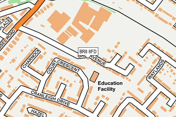
BR8 8FD is located in the Swanley Christchurch and Swanley Village electoral ward, within the local authority district of Sevenoaks and the English Parliamentary constituency of Sevenoaks. The Sub Integrated Care Board (ICB) Location is NHS Kent and Medway ICB - 91Q and the police force is Kent. This postcode has been in use since July 2017.


GetTheData
Source: OS OpenMap – Local (Ordnance Survey)
Source: OS VectorMap District (Ordnance Survey)
Licence: Open Government Licence (requires attribution)
| Easting | 551560 |
| Northing | 168125 |
| Latitude | 51.391928 |
| Longitude | 0.177002 |
GetTheData
Source: Open Postcode Geo
Licence: Open Government Licence
| Country | England |
| Postcode District | BR8 |
➜ See where BR8 is on a map ➜ Where is Swanley? | |
GetTheData
Source: Land Registry Price Paid Data
Licence: Open Government Licence
| Ward | Swanley Christchurch And Swanley Village |
| Constituency | Sevenoaks |
GetTheData
Source: ONS Postcode Database
Licence: Open Government Licence
2022 9 JUN £415,000 |
40, GALA AVENUE, SWANLEY, BR8 8FD 2017 15 DEC £474,950 |
42, GALA AVENUE, SWANLEY, BR8 8FD 2017 13 DEC £473,950 |
12, GALA AVENUE, SWANLEY, BR8 8FD 2017 29 SEP £459,950 |
10, GALA AVENUE, SWANLEY, BR8 8FD 2017 29 SEP £459,950 |
16, GALA AVENUE, SWANLEY, BR8 8FD 2017 29 SEP £459,950 |
14, GALA AVENUE, SWANLEY, BR8 8FD 2017 29 SEP £459,950 |
2017 31 JUL £344,950 |
GetTheData
Source: HM Land Registry Price Paid Data
Licence: Contains HM Land Registry data © Crown copyright and database right 2025. This data is licensed under the Open Government Licence v3.0.
| Station Approach (Goldsel Road) | Swanley | 324m |
| Station Approach (Goldsel Road) | Swanley | 324m |
| Goldsel Road (High Street) | Swanley | 335m |
| Goldsel Road (High Street) | Swanley | 347m |
| High Street | Swanley | 368m |
| Swanley Station | 0.6km |
| Eynsford Station | 3.8km |
| Farningham Road Station | 4.2km |
GetTheData
Source: NaPTAN
Licence: Open Government Licence
| Percentage of properties with Next Generation Access | 100.0% |
| Percentage of properties with Superfast Broadband | 100.0% |
| Percentage of properties with Ultrafast Broadband | 100.0% |
| Percentage of properties with Full Fibre Broadband | 100.0% |
Superfast Broadband is between 30Mbps and 300Mbps
Ultrafast Broadband is > 300Mbps
| Percentage of properties unable to receive 2Mbps | 0.0% |
| Percentage of properties unable to receive 5Mbps | 0.0% |
| Percentage of properties unable to receive 10Mbps | 0.0% |
| Percentage of properties unable to receive 30Mbps | 0.0% |
GetTheData
Source: Ofcom
Licence: Ofcom Terms of Use (requires attribution)
GetTheData
Source: ONS Postcode Database
Licence: Open Government Licence


➜ Get more ratings from the Food Standards Agency
GetTheData
Source: Food Standards Agency
Licence: FSA terms & conditions
| Last Collection | |||
|---|---|---|---|
| Location | Mon-Fri | Sat | Distance |
| Cranleigh Drive (66) | 18:00 | 11:30 | 170m |
| High Street (49) | 18:00 | 12:00 | 347m |
| Goldsel Road (59) | 18:00 | 11:30 | 363m |
GetTheData
Source: Dracos
Licence: Creative Commons Attribution-ShareAlike
The below table lists the International Territorial Level (ITL) codes (formerly Nomenclature of Territorial Units for Statistics (NUTS) codes) and Local Administrative Units (LAU) codes for BR8 8FD:
| ITL 1 Code | Name |
|---|---|
| TLJ | South East (England) |
| ITL 2 Code | Name |
| TLJ4 | Kent |
| ITL 3 Code | Name |
| TLJ46 | West Kent |
| LAU 1 Code | Name |
| E07000111 | Sevenoaks |
GetTheData
Source: ONS Postcode Directory
Licence: Open Government Licence
The below table lists the Census Output Area (OA), Lower Layer Super Output Area (LSOA), and Middle Layer Super Output Area (MSOA) for BR8 8FD:
| Code | Name | |
|---|---|---|
| OA | E00124218 | |
| LSOA | E01024474 | Sevenoaks 003C |
| MSOA | E02005089 | Sevenoaks 003 |
GetTheData
Source: ONS Postcode Directory
Licence: Open Government Licence
| BR8 8NR | Court Crescent | 125m |
| BR8 8NP | Pinks Hill | 144m |
| BR8 8NZ | Cranleigh Drive | 151m |
| BR8 8TN | Waylands | 177m |
| BR8 8TA | Waylands | 179m |
| BR8 8NX | Cranleigh Drive | 209m |
| BR8 8NL | Charnock | 248m |
| BR8 8NW | Pinks Hill | 256m |
| BR8 8NN | Pinks Hill | 258m |
| BR8 8TB | Glendale | 272m |
GetTheData
Source: Open Postcode Geo; Land Registry Price Paid Data
Licence: Open Government Licence