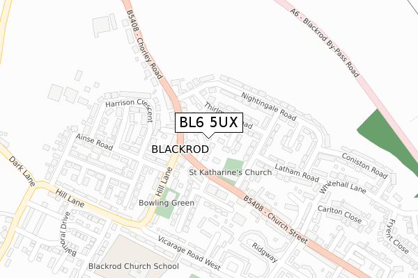
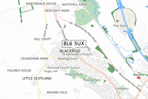
BL6 5UX is located in the Horwich South & Blackrod electoral ward, within the metropolitan district of Bolton and the English Parliamentary constituency of Bolton West. The Sub Integrated Care Board (ICB) Location is NHS Greater Manchester ICB - 00T and the police force is Greater Manchester. This postcode has been in use since August 2018.


GetTheData
Source: OS Open Zoomstack (Ordnance Survey)
Licence: Open Government Licence (requires attribution)
Attribution: Contains OS data © Crown copyright and database right 2025
Source: Open Postcode Geo
Licence: Open Government Licence (requires attribution)
Attribution: Contains OS data © Crown copyright and database right 2025; Contains Royal Mail data © Royal Mail copyright and database right 2025; Source: Office for National Statistics licensed under the Open Government Licence v.3.0
| Easting | 361271 |
| Northing | 411157 |
| Latitude | 53.595561 |
| Longitude | -2.586635 |
GetTheData
Source: Open Postcode Geo
Licence: Open Government Licence
| Country | England |
| Postcode District | BL6 |
➜ See where BL6 is on a map ➜ Where is Blackrod? | |
GetTheData
Source: Land Registry Price Paid Data
Licence: Open Government Licence
| Ward | Horwich South & Blackrod |
| Constituency | Bolton West |
GetTheData
Source: ONS Postcode Database
Licence: Open Government Licence
2020 17 AUG £235,000 |
2019 15 MAR £213,000 |
24, NIGHTINGALE GARDENS, BLACKROD, BOLTON, BL6 5UX 2019 4 MAR £197,500 |
18, NIGHTINGALE GARDENS, BLACKROD, BOLTON, BL6 5UX 2018 16 NOV £217,500 |
GetTheData
Source: HM Land Registry Price Paid Data
Licence: Contains HM Land Registry data © Crown copyright and database right 2025. This data is licensed under the Open Government Licence v3.0.
| Black Horse St/Black Horse (Black Horse St) | Blackrod | 62m |
| Black Horse St/Black Horse (Black Horse St) | Blackrod | 70m |
| Hill Lane (Sth Bnd) (Hill Lane) | Blackrod | 93m |
| Church St/Red Lion (Church St) | Blackrod | 234m |
| Hill Lane (Nth Bnd) (Hill Lane) | Blackrod | 249m |
| Blackrod Station | 1.2km |
| Adlington (Lancs) Station | 2.2km |
| Horwich Parkway Station | 3.7km |
GetTheData
Source: NaPTAN
Licence: Open Government Licence
| Percentage of properties with Next Generation Access | 100.0% |
| Percentage of properties with Superfast Broadband | 100.0% |
| Percentage of properties with Ultrafast Broadband | 100.0% |
| Percentage of properties with Full Fibre Broadband | 0.0% |
Superfast Broadband is between 30Mbps and 300Mbps
Ultrafast Broadband is > 300Mbps
| Median download speed | 65.4Mbps |
| Average download speed | 80.8Mbps |
| Maximum download speed | 350.00Mbps |
| Median upload speed | 16.3Mbps |
| Average upload speed | 13.9Mbps |
| Maximum upload speed | 20.00Mbps |
| Percentage of properties unable to receive 2Mbps | 0.0% |
| Percentage of properties unable to receive 5Mbps | 0.0% |
| Percentage of properties unable to receive 10Mbps | 0.0% |
| Percentage of properties unable to receive 30Mbps | 0.0% |
GetTheData
Source: Ofcom
Licence: Ofcom Terms of Use (requires attribution)
GetTheData
Source: ONS Postcode Database
Licence: Open Government Licence


➜ Get more ratings from the Food Standards Agency
GetTheData
Source: Food Standards Agency
Licence: FSA terms & conditions
| Last Collection | |||
|---|---|---|---|
| Location | Mon-Fri | Sat | Distance |
| 23 Whitehall Lane | 17:30 | 11:30 | 310m |
| Blackrod P O | 18:30 | 11:30 | 589m |
| 205 Crown Lane | 17:35 | 11:20 | 1,299m |
GetTheData
Source: Dracos
Licence: Creative Commons Attribution-ShareAlike
The below table lists the International Territorial Level (ITL) codes (formerly Nomenclature of Territorial Units for Statistics (NUTS) codes) and Local Administrative Units (LAU) codes for BL6 5UX:
| ITL 1 Code | Name |
|---|---|
| TLD | North West (England) |
| ITL 2 Code | Name |
| TLD3 | Greater Manchester |
| ITL 3 Code | Name |
| TLD36 | Greater Manchester North West |
| LAU 1 Code | Name |
| E08000001 | Bolton |
GetTheData
Source: ONS Postcode Directory
Licence: Open Government Licence
The below table lists the Census Output Area (OA), Lower Layer Super Output Area (LSOA), and Middle Layer Super Output Area (MSOA) for BL6 5UX:
| Code | Name | |
|---|---|---|
| OA | E00024201 | |
| LSOA | E01004778 | Bolton 009A |
| MSOA | E02000992 | Bolton 009 |
GetTheData
Source: ONS Postcode Directory
Licence: Open Government Licence
| BL6 5EH | Rydal Close | 44m |
| BL6 5ED | Acresfield Close | 52m |
| BL6 5EB | Thirlmere Road | 56m |
| BL6 5LX | Gregorys Yard | 65m |
| BL6 5JS | Chorley Road | 77m |
| BL6 5EN | Blackhorse Street | 77m |
| BL6 5EW | Blackhorse Street | 81m |
| BL6 5JP | Hill Lane | 102m |
| BL6 5JR | Chorley Road | 109m |
| BL6 5EA | Nightingale Road | 115m |
GetTheData
Source: Open Postcode Geo; Land Registry Price Paid Data
Licence: Open Government Licence