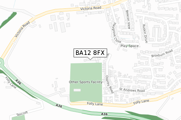
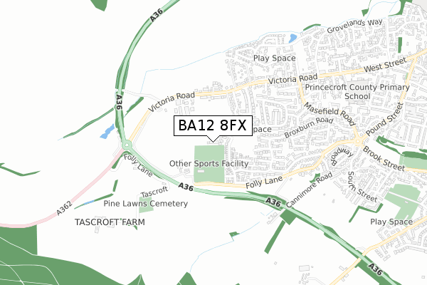
BA12 8FX is located in the Warminster Broadway electoral ward, within the unitary authority of Wiltshire and the English Parliamentary constituency of South West Wiltshire. The Sub Integrated Care Board (ICB) Location is NHS Bath and North East Somerset, Swindon and Wiltshire ICB - 92 and the police force is Wiltshire. This postcode has been in use since July 2018.


GetTheData
Source: OS Open Zoomstack (Ordnance Survey)
Licence: Open Government Licence (requires attribution)
Attribution: Contains OS data © Crown copyright and database right 2024
Source: Open Postcode Geo
Licence: Open Government Licence (requires attribution)
Attribution: Contains OS data © Crown copyright and database right 2024; Contains Royal Mail data © Royal Mail copyright and database right 2024; Source: Office for National Statistics licensed under the Open Government Licence v.3.0
| Easting | 385397 |
| Northing | 144518 |
| Latitude | 51.199682 |
| Longitude | -2.210379 |
GetTheData
Source: Open Postcode Geo
Licence: Open Government Licence
| Country | England |
| Postcode District | BA12 |
➜ See where BA12 is on a map ➜ Where is Warminster? | |
GetTheData
Source: Land Registry Price Paid Data
Licence: Open Government Licence
| Ward | Warminster Broadway |
| Constituency | South West Wiltshire |
GetTheData
Source: ONS Postcode Database
Licence: Open Government Licence
2024 3 MAY £345,000 |
2023 25 JUL £114,000 |
52, FALCON ROAD, WARMINSTER, BA12 8FX 2023 20 JUL £369,995 |
59, FALCON ROAD, WARMINSTER, BA12 8FX 2023 15 JUN £424,995 |
42, FALCON ROAD, WARMINSTER, BA12 8FX 2023 26 APR £399,995 |
75, FALCON ROAD, WARMINSTER, BA12 8FX 2023 20 APR £449,995 |
73, FALCON ROAD, WARMINSTER, BA12 8FX 2023 24 FEB £564,995 |
71, FALCON ROAD, WARMINSTER, BA12 8FX 2023 27 JAN £519,995 |
36, FALCON ROAD, WARMINSTER, BA12 8FX 2022 2 DEC £514,995 |
65, FALCON ROAD, WARMINSTER, BA12 8FX 2022 11 NOV £459,995 |
GetTheData
Source: HM Land Registry Price Paid Data
Licence: Contains HM Land Registry data © Crown copyright and database right 2024. This data is licensed under the Open Government Licence v3.0.
| Beacon View (Victoria Road) | Warminster | 381m |
| Beacon View (Victoria Road) | Warminster | 392m |
| St Andrews Road | Warminster | 437m |
| Folly Lane (Frome Road) | Bugley | 510m |
| St Andrews Road (Thornhill Road) | Warminster | 587m |
| Warminster Station | 2.5km |
GetTheData
Source: NaPTAN
Licence: Open Government Licence
GetTheData
Source: ONS Postcode Database
Licence: Open Government Licence


➜ Get more ratings from the Food Standards Agency
GetTheData
Source: Food Standards Agency
Licence: FSA terms & conditions
| Last Collection | |||
|---|---|---|---|
| Location | Mon-Fri | Sat | Distance |
| Victoria Road | 17:30 | 12:00 | 321m |
| Langholm Avenue | 17:30 | 12:00 | 552m |
| Woodland Road | 17:30 | 12:00 | 880m |
GetTheData
Source: Dracos
Licence: Creative Commons Attribution-ShareAlike
The below table lists the International Territorial Level (ITL) codes (formerly Nomenclature of Territorial Units for Statistics (NUTS) codes) and Local Administrative Units (LAU) codes for BA12 8FX:
| ITL 1 Code | Name |
|---|---|
| TLK | South West (England) |
| ITL 2 Code | Name |
| TLK1 | Gloucestershire, Wiltshire and Bath/Bristol area |
| ITL 3 Code | Name |
| TLK15 | Wiltshire |
| LAU 1 Code | Name |
| E06000054 | Wiltshire |
GetTheData
Source: ONS Postcode Directory
Licence: Open Government Licence
The below table lists the Census Output Area (OA), Lower Layer Super Output Area (LSOA), and Middle Layer Super Output Area (MSOA) for BA12 8FX:
| Code | Name | |
|---|---|---|
| OA | E00163791 | |
| LSOA | E01032110 | Wiltshire 043A |
| MSOA | E02006693 | Wiltshire 043 |
GetTheData
Source: ONS Postcode Directory
Licence: Open Government Licence
| BA12 8SL | Haygrove Close | 279m |
| BA12 8HD | Victoria Road | 301m |
| BA12 8HQ | Victoria Road | 330m |
| BA12 8JD | Haygrove Farm Mews | 372m |
| BA12 8HP | Beacon View | 374m |
| BA12 8EU | St Andrews Road | 374m |
| BA12 7RQ | Folly Lane | 379m |
| BA12 7RG | Folly Lane | 392m |
| BA12 8ER | St Andrews Road | 394m |
| BA12 8ET | St Andrews Road | 405m |
GetTheData
Source: Open Postcode Geo; Land Registry Price Paid Data
Licence: Open Government Licence