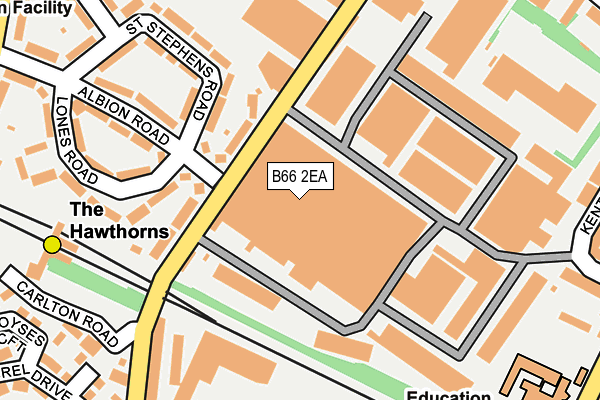
B66 2EA is located in the Holyhead electoral ward, within the metropolitan district of Birmingham and the English Parliamentary constituency of Birmingham, Ladywood. The Sub Integrated Care Board (ICB) Location is NHS Birmingham and Solihull ICB - 15E and the police force is West Midlands. This postcode has been in use since January 1980.


GetTheData
Source: OS OpenMap – Local (Ordnance Survey)
Source: OS VectorMap District (Ordnance Survey)
Licence: Open Government Licence (requires attribution)
| Easting | 402755 |
| Northing | 289780 |
| Latitude | 52.505925 |
| Longitude | -1.960835 |
GetTheData
Source: Open Postcode Geo
Licence: Open Government Licence
| Country | England |
| Postcode District | B66 |
➜ See where B66 is on a map ➜ Where is Birmingham? | |
GetTheData
Source: Land Registry Price Paid Data
Licence: Open Government Licence
Elevation or altitude of B66 2EA as distance above sea level:
| Metres | Feet | |
|---|---|---|
| Elevation | 150m | 492ft |
Elevation is measured from the approximate centre of the postcode, to the nearest point on an OS contour line from OS Terrain 50, which has contour spacing of ten vertical metres.
➜ How high above sea level am I? Find the elevation of your current position using your device's GPS.
GetTheData
Source: Open Postcode Elevation
Licence: Open Government Licence
| Ward | Holyhead |
| Constituency | Birmingham, Ladywood |
GetTheData
Source: ONS Postcode Database
Licence: Open Government Licence
| Junction Rd (Wattville Rd) | Handsworth | 345m |
| Junction Rd (Wattville Rd) | Handsworth | 346m |
| Albion Rd (Halfords Lane) | Europa Village | 348m |
| Albion Rd (Halfords Lane) | Europa Village | 351m |
| Hawthorns Metro Stop (Halfords Lane) | Smethwick | 361m |
| The Hawthorns (Midland Metro Stop) (Middlemore Lane) | Smethwick | 259m |
| Handsworth Booth Street (Midland Metro Stop) (Booth Street) | Handsworth | 734m |
| Kenrick Park (Midland Metro Stop) (Roebuck Lane) | West Bromwich | 1,515m |
| Winson Green Outer Circle (Midland Metro Stop) (Boulton Road) | Winson Green | 1,695m |
| The Hawthorns Station | 0.2km |
| Smethwick Rolfe Street Station | 1.3km |
| Smethwick Galton Bridge Station | 1.4km |
GetTheData
Source: NaPTAN
Licence: Open Government Licence
GetTheData
Source: ONS Postcode Database
Licence: Open Government Licence


➜ Get more ratings from the Food Standards Agency
GetTheData
Source: Food Standards Agency
Licence: FSA terms & conditions
| Last Collection | |||
|---|---|---|---|
| Location | Mon-Fri | Sat | Distance |
| St Stephens Road / Albion Road | 17:30 | 12:00 | 140m |
| Junction Road / George St | 17:30 | 12:30 | 449m |
| Holyhead Road / Middlemore Road | 17:45 | 12:30 | 457m |
GetTheData
Source: Dracos
Licence: Creative Commons Attribution-ShareAlike
The below table lists the International Territorial Level (ITL) codes (formerly Nomenclature of Territorial Units for Statistics (NUTS) codes) and Local Administrative Units (LAU) codes for B66 2EA:
| ITL 1 Code | Name |
|---|---|
| TLG | West Midlands (England) |
| ITL 2 Code | Name |
| TLG3 | West Midlands |
| ITL 3 Code | Name |
| TLG31 | Birmingham |
| LAU 1 Code | Name |
| E08000025 | Birmingham |
GetTheData
Source: ONS Postcode Directory
Licence: Open Government Licence
The below table lists the Census Output Area (OA), Lower Layer Super Output Area (LSOA), and Middle Layer Super Output Area (MSOA) for B66 2EA:
| Code | Name | |
|---|---|---|
| OA | E00047427 | |
| LSOA | E01009349 | Birmingham 036D |
| MSOA | E02001862 | Birmingham 036 |
GetTheData
Source: ONS Postcode Directory
Licence: Open Government Licence
| B71 4LS | Middlemore Road | 100m |
| B71 4LH | Albion Road | 115m |
| B66 2EP | Middlemore Road | 159m |
| B71 4LR | St Stephens Road | 174m |
| B71 4LN | Lones Road | 183m |
| B71 4LL | Albion Road | 193m |
| B21 0AY | Middlemore Road | 199m |
| B71 4LW | Lones Road | 261m |
| B71 4LP | St Stephens Road | 279m |
| B66 2DZ | Parkrose Industrial Estate | 285m |
GetTheData
Source: Open Postcode Geo; Land Registry Price Paid Data
Licence: Open Government Licence