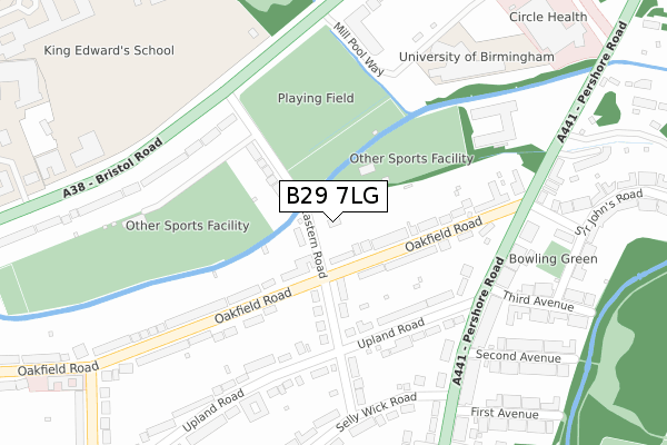
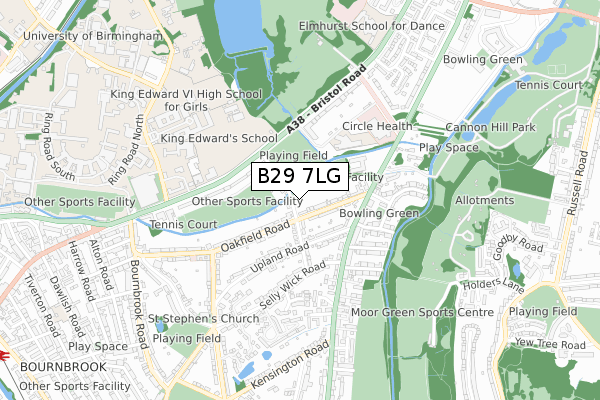
B29 7LG is located in the Bournbrook & Selly Park electoral ward, within the metropolitan district of Birmingham and the English Parliamentary constituency of Birmingham, Selly Oak. The Sub Integrated Care Board (ICB) Location is NHS Birmingham and Solihull ICB - 15E and the police force is West Midlands. This postcode has been in use since May 2018.


GetTheData
Source: OS Open Zoomstack (Ordnance Survey)
Licence: Open Government Licence (requires attribution)
Attribution: Contains OS data © Crown copyright and database right 2025
Source: Open Postcode Geo
Licence: Open Government Licence (requires attribution)
Attribution: Contains OS data © Crown copyright and database right 2025; Contains Royal Mail data © Royal Mail copyright and database right 2025; Source: Office for National Statistics licensed under the Open Government Licence v.3.0
| Easting | 405714 |
| Northing | 283334 |
| Latitude | 52.447953 |
| Longitude | -1.917349 |
GetTheData
Source: Open Postcode Geo
Licence: Open Government Licence
| Country | England |
| Postcode District | B29 |
➜ See where B29 is on a map ➜ Where is Birmingham? | |
GetTheData
Source: Land Registry Price Paid Data
Licence: Open Government Licence
| Ward | Bournbrook & Selly Park |
| Constituency | Birmingham, Selly Oak |
GetTheData
Source: ONS Postcode Database
Licence: Open Government Licence
2018 8 JUN £1,129,265 |
34, EASTERN ROAD, SELLY PARK, BIRMINGHAM, B29 7LG 2018 4 MAY £1,180,000 |
GetTheData
Source: HM Land Registry Price Paid Data
Licence: Contains HM Land Registry data © Crown copyright and database right 2025. This data is licensed under the Open Government Licence v3.0.
| Eastern Rd (Bristol Rd) | Birmingham University | 227m |
| Eastern Rd (Bristol Rd) | Birmingham University | 262m |
| Upland Rd (Pershore Rd) | Bournbrook | 264m |
| Upland Rd (Pershore Rd) | Bournbrook | 267m |
| First Avenue (Pershore Rd) | Selly Park | 332m |
| University Station | 1.4km |
| Selly Oak Station | 1.4km |
| Bournville Station | 2.4km |
GetTheData
Source: NaPTAN
Licence: Open Government Licence
| Percentage of properties with Next Generation Access | 100.0% |
| Percentage of properties with Superfast Broadband | 100.0% |
| Percentage of properties with Ultrafast Broadband | 0.0% |
| Percentage of properties with Full Fibre Broadband | 0.0% |
Superfast Broadband is between 30Mbps and 300Mbps
Ultrafast Broadband is > 300Mbps
| Percentage of properties unable to receive 2Mbps | 0.0% |
| Percentage of properties unable to receive 5Mbps | 0.0% |
| Percentage of properties unable to receive 10Mbps | 0.0% |
| Percentage of properties unable to receive 30Mbps | 0.0% |
GetTheData
Source: Ofcom
Licence: Ofcom Terms of Use (requires attribution)
GetTheData
Source: ONS Postcode Database
Licence: Open Government Licence


➜ Get more ratings from the Food Standards Agency
GetTheData
Source: Food Standards Agency
Licence: FSA terms & conditions
| Last Collection | |||
|---|---|---|---|
| Location | Mon-Fri | Sat | Distance |
| Eastern Road / Upland Road | 17:30 | 12:30 | 215m |
| Eastern Road / Bristol Road | 17:30 | 12:30 | 226m |
| Selly Park | 17:30 | 12:30 | 301m |
GetTheData
Source: Dracos
Licence: Creative Commons Attribution-ShareAlike
| Risk of B29 7LG flooding from rivers and sea | Medium |
| ➜ B29 7LG flood map | |
GetTheData
Source: Open Flood Risk by Postcode
Licence: Open Government Licence
The below table lists the International Territorial Level (ITL) codes (formerly Nomenclature of Territorial Units for Statistics (NUTS) codes) and Local Administrative Units (LAU) codes for B29 7LG:
| ITL 1 Code | Name |
|---|---|
| TLG | West Midlands (England) |
| ITL 2 Code | Name |
| TLG3 | West Midlands |
| ITL 3 Code | Name |
| TLG31 | Birmingham |
| LAU 1 Code | Name |
| E08000025 | Birmingham |
GetTheData
Source: ONS Postcode Directory
Licence: Open Government Licence
The below table lists the Census Output Area (OA), Lower Layer Super Output Area (LSOA), and Middle Layer Super Output Area (MSOA) for B29 7LG:
| Code | Name | |
|---|---|---|
| OA | E00047107 | |
| LSOA | E01009283 | Birmingham 079E |
| MSOA | E02001905 | Birmingham 079 |
GetTheData
Source: ONS Postcode Directory
Licence: Open Government Licence
| B29 7JX | Eastern Road | 101m |
| B29 7EJ | Oakfield Road | 142m |
| B29 7HH | Oakfield Road | 144m |
| B29 7JR | Upland Road | 190m |
| B29 7JP | Eastern Road | 192m |
| B29 7HA | Pershore Road | 223m |
| B29 7HQ | Pershore Road | 275m |
| B29 7HB | Pershore Road | 276m |
| B29 7HG | Pershore Road | 282m |
| B29 7EG | Oakfield Road | 284m |
GetTheData
Source: Open Postcode Geo; Land Registry Price Paid Data
Licence: Open Government Licence