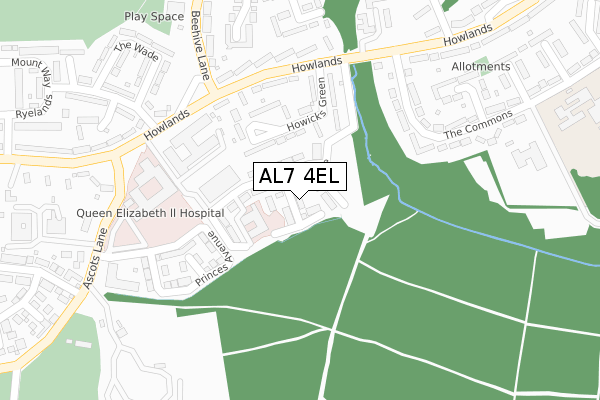
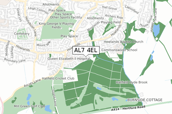
AL7 4EL is located in the Howlands electoral ward, within the local authority district of Welwyn Hatfield and the English Parliamentary constituency of Welwyn Hatfield. The Sub Integrated Care Board (ICB) Location is NHS Hertfordshire and West Essex ICB - 06K and the police force is Hertfordshire. This postcode has been in use since April 2018.


GetTheData
Source: OS Open Zoomstack (Ordnance Survey)
Licence: Open Government Licence (requires attribution)
Attribution: Contains OS data © Crown copyright and database right 2025
Source: Open Postcode Geo
Licence: Open Government Licence (requires attribution)
Attribution: Contains OS data © Crown copyright and database right 2025; Contains Royal Mail data © Royal Mail copyright and database right 2025; Source: Office for National Statistics licensed under the Open Government Licence v.3.0
| Easting | 525300 |
| Northing | 210921 |
| Latitude | 51.782937 |
| Longitude | -0.184946 |
GetTheData
Source: Open Postcode Geo
Licence: Open Government Licence
| Country | England |
| Postcode District | AL7 |
➜ See where AL7 is on a map ➜ Where is Welwyn Garden City? | |
GetTheData
Source: Land Registry Price Paid Data
Licence: Open Government Licence
| Ward | Howlands |
| Constituency | Welwyn Hatfield |
GetTheData
Source: ONS Postcode Database
Licence: Open Government Licence
15, VICTORIA CLOSE, WELWYN GARDEN CITY, AL7 4EL 2018 20 JUN £624,995 |
11, VICTORIA CLOSE, WELWYN GARDEN CITY, AL7 4EL 2018 15 JUN £559,995 |
13, VICTORIA CLOSE, WELWYN GARDEN CITY, AL7 4EL 2018 13 JUN £569,995 |
➜ Welwyn Garden City house prices
GetTheData
Source: HM Land Registry Price Paid Data
Licence: Contains HM Land Registry data © Crown copyright and database right 2025. This data is licensed under the Open Government Licence v3.0.
| Howlands House (Howlands) | Welwyn Garden City | 246m |
| New Qeii Hospital (Howlands) | Welwyn Garden City | 247m |
| Howlands House (Howlands) | Welwyn Garden City | 259m |
| New Qeii Hospital (Howlands) | Welwyn Garden City | 264m |
| Ryelands (Howlands) | Welwyn Garden City | 435m |
| Welwyn Garden City Station | 2.4km |
| Hatfield (Herts) Station | 3km |
| Welwyn North Station | 4.5km |
GetTheData
Source: NaPTAN
Licence: Open Government Licence
| Percentage of properties with Next Generation Access | 100.0% |
| Percentage of properties with Superfast Broadband | 100.0% |
| Percentage of properties with Ultrafast Broadband | 100.0% |
| Percentage of properties with Full Fibre Broadband | 100.0% |
Superfast Broadband is between 30Mbps and 300Mbps
Ultrafast Broadband is > 300Mbps
Ofcom does not currently provide download speed data for AL7 4EL. This is because there are less than four broadband connections in this postcode.
Ofcom does not currently provide upload speed data for AL7 4EL. This is because there are less than four broadband connections in this postcode.
| Percentage of properties unable to receive 2Mbps | 0.0% |
| Percentage of properties unable to receive 5Mbps | 0.0% |
| Percentage of properties unable to receive 10Mbps | 0.0% |
| Percentage of properties unable to receive 30Mbps | 0.0% |
GetTheData
Source: Ofcom
Licence: Ofcom Terms of Use (requires attribution)
GetTheData
Source: ONS Postcode Database
Licence: Open Government Licence


➜ Get more ratings from the Food Standards Agency
GetTheData
Source: Food Standards Agency
Licence: FSA terms & conditions
| Last Collection | |||
|---|---|---|---|
| Location | Mon-Fri | Sat | Distance |
| Howlands | 17:30 | 12:00 | 386m |
| The Commons | 17:30 | 12:00 | 408m |
| Beehive Lane | 17:30 | 12:00 | 416m |
GetTheData
Source: Dracos
Licence: Creative Commons Attribution-ShareAlike
The below table lists the International Territorial Level (ITL) codes (formerly Nomenclature of Territorial Units for Statistics (NUTS) codes) and Local Administrative Units (LAU) codes for AL7 4EL:
| ITL 1 Code | Name |
|---|---|
| TLH | East |
| ITL 2 Code | Name |
| TLH2 | Bedfordshire and Hertfordshire |
| ITL 3 Code | Name |
| TLH23 | Hertfordshire CC |
| LAU 1 Code | Name |
| E07000241 | Welwyn Hatfield |
GetTheData
Source: ONS Postcode Directory
Licence: Open Government Licence
The below table lists the Census Output Area (OA), Lower Layer Super Output Area (LSOA), and Middle Layer Super Output Area (MSOA) for AL7 4EL:
| Code | Name | |
|---|---|---|
| OA | E00173215 | |
| LSOA | E01023946 | Welwyn Hatfield 008D |
| MSOA | E02004987 | Welwyn Hatfield 008 |
GetTheData
Source: ONS Postcode Directory
Licence: Open Government Licence
| AL7 4RJ | Howicks Green | 109m |
| AL7 4RH | Howicks Green | 165m |
| AL7 4HG | Howlands | 199m |
| AL7 4HF | Howlands | 245m |
| AL7 4SB | The Commons | 248m |
| AL7 4HQ | Howlands | 257m |
| AL7 4RZ | The Commons | 258m |
| AL7 4HE | Howlands | 273m |
| AL7 4QL | Moorend | 286m |
| AL7 4QH | Moorside | 302m |
GetTheData
Source: Open Postcode Geo; Land Registry Price Paid Data
Licence: Open Government Licence