Worsley Running Track (Closed)
Worsley Running Track (Closed) is located in Worsley, Manchester (M28).
| Address | Walkden Road, Worsley, Manchester, M28 7ER |
| Management Type | Not Known |
| Management Group | Not Known |
| Owner Type | Not known |
| Owner Group | Not Known |
| Education Phase | Not Known |
| Closure Date | 1st Jan 2004 |
| Closure Reason | Unclassified |
Facilities
| Closure Date | 1st Jan 2004 |
| Closure Reason | Unclassified |
| Accessibility | Free Public Access |
| Management Type | Not Known |
| Date Record Checked | 19th Oct 2006 |
| Opening Times | Detailed Timings |
Facility specifics
| Floodlit | No |
| Infield Surface Type | Grass |
| Track Surface Type | Cinder |
Where is Worsley Running Track (Closed)?
| Sub Building Name | |
| Building Name | |
| Building Number | 0 |
| Dependent Thoroughfare | |
| Thoroughfare Name | Walkden Road |
| Double Dependent Locality | |
| Dependent Locality | Worsley |
| PostTown | Manchester |
| Postcode | M28 7ER |
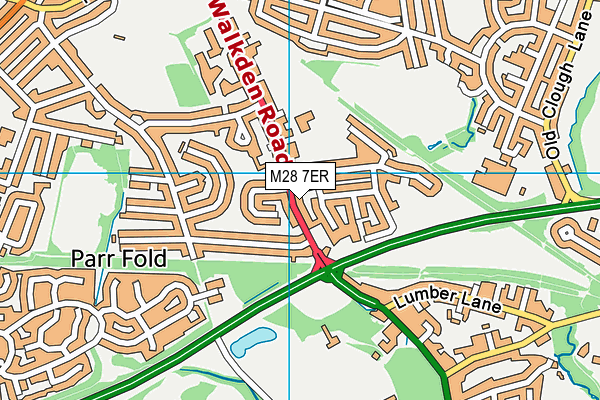
Worsley Running Track (Closed) on a map

Worsley Running Track (Closed) geodata
| Easting | 374520 |
| Northing | 402006 |
| Latitude | 53.514109 |
| Longitude | -2.385712 |
| Local Authority Name | Salford |
| Local Authority Code | E08000006 |
| Parliamentary Constituency Name | Worsley and Eccles South |
| Parliamentary Constituency Code | E14001054 |
| Region Name | North West |
| Region Code | E15000002 |
| Ward Name | Walkden South |
| Ward Code | E05013035 |
| Output Area Code | E00028932 |
About this data
This data is open data sourced from Active Places Power and licenced under the Active Places Open Data Licence.
| Created On | 14th Dec 2014 |
| Audited On | 26th Jan 2015 |
| Checked On | 19th Oct 2006 |
