West Bromwich Albion (Palm Training Ground) - Walsall
West Bromwich Albion (Palm Training Ground) is located in Walsall (WS5), and offers Grass Pitches, and Health and Fitness Gym.
| Address | 430, Birmingham Road, Walsall, WS5 3LQ |
| Car Park | Yes |
| Car Park Capacity | 50 |
| Management Type | Sport Club |
| Management Group | Others |
| Owner Type | Sports Club |
| Owner Group | Sports Club |
| Education Phase | Not applicable |
Facilities
| Accessibility | Private Use |
| Management Type | Sport Club |
| Changing Rooms | Yes |
| Date Record Created | 24th Nov 2017 |
| Date Record Checked | 19th Jul 2023 |
| Opening Times | Dawn To Dusk |
Facility specifics
Disabled access
| Disabled Access | Yes |
| Disabled Parking | Yes |
| Finding/Reaching Entrance | Yes |
| Reception Area | Yes |
| Doorways | Yes |
| Disabled Changing Facilities | Yes |
| Activity Areas | Yes |
| Disabled Toilets | Yes |
| Social Areas | Yes |
| Spectator Areas | Yes |
| Emergency Exits | Yes |
| Accessibility | Private Use |
| Management Type | Sport Club |
| Year Built | 2003 |
| Changing Rooms | Yes |
| Date Record Created | 24th Nov 2017 |
| Date Record Checked | 19th Jul 2023 |
Opening times
| Access description | Private Use |
|---|
| Opening time | 08:00 |
| Closing time | 17:00 |
| Period open for | Monday-Friday |
Facility specifics
Disabled access
| Disabled Access | Yes |
| Disabled Parking | Yes |
| Finding/Reaching Entrance | Yes |
| Reception Area | Yes |
| Doorways | Yes |
| Disabled Changing Facilities | Yes |
| Activity Areas | Yes |
| Disabled Toilets | Yes |
| Social Areas | Yes |
| Spectator Areas | Yes |
| Emergency Exits | Yes |
Contact
Disabled access
Disabled access for West Bromwich Albion (Palm Training Ground)
| Disabled Access | Yes |
| Disabled Parking | Yes |
| Finding/Reaching Entrance | Yes |
| Reception Area | Yes |
| Doorways | Yes |
| Disabled Changing Facilities | Yes |
| Activity Areas | Yes |
| Disabled Toilets | Yes |
| Social Areas | Yes |
| Spectator Areas | Yes |
| Emergency Exits | Yes |
Where is West Bromwich Albion (Palm Training Ground)?
| Sub Building Name | |
| Building Name | |
| Building Number | 430 |
| Dependent Thoroughfare | |
| Thoroughfare Name | BIRMINGHAM ROAD |
| Double Dependent Locality | |
| Dependent Locality | |
| PostTown | WALSALL |
| Postcode | WS5 3LQ |
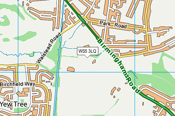
West Bromwich Albion (Palm Training Ground) on a map

West Bromwich Albion (Palm Training Ground) geodata
| Easting | 403460.86 |
| Northing | 296032.19 |
| Latitude | 52.562112 |
| Longitude | -1.950379 |
| Local Authority Name | Walsall |
| Local Authority Code | E08000030 |
| Parliamentary Constituency Name | Walsall South |
| Parliamentary Constituency Code | E14001012 |
| Region Name | West Midlands |
| Region Code | E15000005 |
| Ward Name | Paddock |
| Ward Code | E05001310 |
| Output Area Code | E00052213 |
About this data
This data is open data sourced from Active Places Power and licenced under the Active Places Open Data Licence.
| toid | osgb5000005154451067 |
| Created On | 24th Nov 2017 |
| Audited On | 19th Jul 2023 |
| Checked On | 19th Jul 2023 |
