Thetford Forest Park - Santon Downham
Thetford Forest Park is located in Santon Downham, Brandon (IP27), and offers Cycling.
| Address | Thetford Road, Santon Downham, Brandon, IP27 0AF |
| Car Park | Yes |
| Car Park Capacity | 1600 |
| Management Type | Trust |
| Management Group | Trust |
| Owner Type | Other |
| Owner Group | Others |
| Education Phase | Not applicable |
Aliases
Thetford Forest Park is also known as:
Facilities
| Status Notes | There are 8 mountain bikes pits along the red graded trail. |
| Accessibility | Free Public Access |
| Management Type | Trust |
| Year Built | 2010 |
| Changing Rooms | No |
| Date Record Created | 21st Feb 2017 |
| Date Record Checked | 14th Jul 2023 |
| Opening Times | Dawn To Dusk |
Facility specifics
| Bike Wash | Yes |
| Black Trails | No |
| Blue Trails | Yes |
| Extreme Trails | No |
| Green Trails | Yes |
| Length of Blue Trails | 28m |
| Length of Green Trails | 8m |
| Length of Red Trails | 16m |
| Overall Width | 10m |
| Red Trails | Yes |
| Surface | Various |
| Total Length | 20000m |
Disabled access
| Disabled Access | Yes |
| Disabled Parking | Yes |
| Disabled Toilets | Yes |
| Accessibility | Pay and Play |
| Management Type | Trust |
| Year Built | 2010 |
| Changing Rooms | No |
| Date Record Created | 13th Aug 2018 |
| Date Record Checked | 20th Dec 2022 |
| Opening Times | Dawn To Dusk |
Facility specifics
| Automatic Start Gate | No |
| Floodlit | No |
| Overall Width | 2m |
| Start Gate | No |
| Surface | Various |
| Total Length | 100m |
Disabled access
| Disabled Access | Yes |
| Disabled Parking | Yes |
| Disabled Toilets | Yes |
Contact
Disabled access
Disabled access for Thetford Forest Park
| Disabled Access | Yes |
| Disabled Parking | Yes |
| Disabled Toilets | Yes |
Where is Thetford Forest Park?
8192:htmlspecialchars(): Passing null to parameter #1 ($string) of type string is deprecated
| Sub Building Name | |
8192:htmlspecialchars(): Passing null to parameter #1 ($string) of type string is deprecated
| Building Name | |
| Building Number | 0 |
8192:htmlspecialchars(): Passing null to parameter #1 ($string) of type string is deprecated
| Dependent Thoroughfare | |
| Thoroughfare Name | THETFORD ROAD |
8192:htmlspecialchars(): Passing null to parameter #1 ($string) of type string is deprecated
| Double Dependent Locality | |
| Dependent Locality | SANTON DOWNHAM |
| PostTown | BRANDON |
| Postcode | IP27 0AF |
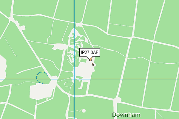
Thetford Forest Park on a map

Thetford Forest Park geodata
| Easting | 581131 |
| Northing | 285162 |
| Latitude | 52.434417 |
| Longitude | 0.663057 |
| Local Authority Name | West Suffolk |
| Local Authority Code | E07000245 |
| Parliamentary Constituency Name | West Suffolk |
| Parliamentary Constituency Code | E14001034 |
| Region Name | Eastern |
| Region Code | E15000006 |
| Ward Name | Brandon East |
| Ward Code | E05012768 |
| Output Area Code | E00152528 |
About this data
This data is open data sourced from Active Places Power and licenced under the Active Places Open Data Licence.
| toid | osgb1000004757231 |
| Created On | 21st Feb 2017 |
| Audited On | 20th Dec 2022 |
| Checked On | 14th Jul 2023 |
