St Josephs College (Norbury Hill Playing Field) - London
St Josephs College (Norbury Hill Playing Field) is located in London (SW16), and offers Grass Pitches.
| Address | Norbury Hill, London, SW16 3RU |
| Management Type | School/College/University (in house) |
| Management Group | Education |
| Owner Type | Voluntary Aided School |
| Owner Group | Education |
| Education Phase | Secondary |
Facilities
| Accessibility | Private Use |
| Management Type | School/College/University (in house) |
| Changing Rooms | No |
| Date Record Checked | 12th May 2023 |
| Opening Times | Dawn To Dusk |
Facility specifics
Disabled access
| Disabled Access | Yes |
| Activity Areas | Yes |
| Accessibility | Private Use |
| Management Type | School/College/University (in house) |
| Changing Rooms | No |
| Date Record Checked | 12th May 2023 |
| Opening Times | Dawn To Dusk |
Facility specifics
Disabled access
| Disabled Access | Yes |
| Activity Areas | Yes |
| Status Notes | 1 AGW only. |
| Accessibility | Private Use |
| Management Type | School/College/University (in house) |
| Changing Rooms | No |
| Date Record Created | 20th Oct 2016 |
| Date Record Checked | 12th May 2023 |
| Opening Times | Dawn To Dusk |
Facility specifics
Disabled access
| Disabled Access | Yes |
| Activity Areas | Yes |
| Accessibility | Private Use |
| Management Type | School/College/University (in house) |
| Date Record Created | 20th Nov 2020 |
| Date Record Checked | 12th May 2023 |
| Opening Times | Dawn To Dusk |
Facility specifics
Disabled access
| Disabled Access | Yes |
| Activity Areas | Yes |
Contact
Disabled access
Disabled access for St Josephs College (Norbury Hill Playing Field)
| Disabled Access | Yes |
| Activity Areas | Yes |
Where is St Josephs College (Norbury Hill Playing Field)?
| Sub Building Name | |
| Building Name | |
| Building Number | 0 |
| Dependent Thoroughfare | |
| Thoroughfare Name | NORBURY HILL |
| Double Dependent Locality | |
| Dependent Locality | |
| PostTown | LONDON |
| Postcode | SW16 3RU |
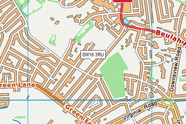
St Josephs College (Norbury Hill Playing Field) on a map

St Josephs College (Norbury Hill Playing Field) geodata
| Easting | 531577.19 |
| Northing | 170500.79 |
| Latitude | 51.41826 |
| Longitude | -0.109175 |
| Local Authority Name | Croydon |
| Local Authority Code | E09000008 |
| Parliamentary Constituency Name | Croydon North |
| Parliamentary Constituency Code | E14000655 |
| Region Name | London |
| Region Code | E15000007 |
| Ward Name | Norbury Park |
| Ward Code | E05011473 |
| Output Area Code | E00005420 |
About this data
This data is open data sourced from Active Places Power and licenced under the Active Places Open Data Licence.
| Created On | 23rd Oct 2009 |
| Audited On | 12th May 2023 |
| Checked On | 12th May 2023 |
