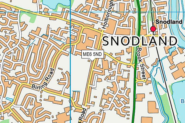
Snodland Recreation Ground
Snodland Recreation Ground is located in Snodland (ME6).
| Address | Malling Road, Snodland, ME6 5ND |
| Management Type | Local Authority (in house) |
| Management Group | Local Authority |
| Owner Type | Local Authority |
| Owner Group | Local Authority |
| Education Phase | Not applicable |
Facilities
| Accessibility | Free Public Access |
| Management Type | Local Authority (in house) |
| Changing Rooms | No |
| Date Record Created | 25th May 2017 |
| Date Record Checked | 3rd Jan 2023 |
| Opening Times | Dawn To Dusk |
Facility specifics
Disabled access
| Disabled Access | Yes |
| Finding/Reaching Entrance | Yes |
Contact
| Contact Type | Enquiries |
| Email | [email protected] |
| Telephone | 01634240228 |
8192:str_replace(): Passing null to parameter #3 ($subject) of type array|string is deprecated
Disabled access
Disabled access for Snodland Recreation Ground
| Disabled Access | Yes |
| Finding/Reaching Entrance | Yes |
Where is Snodland Recreation Ground ?
8192:htmlspecialchars(): Passing null to parameter #1 ($string) of type string is deprecated
| Sub Building Name | |
8192:htmlspecialchars(): Passing null to parameter #1 ($string) of type string is deprecated
| Building Name | |
| Building Number | 0 |
8192:htmlspecialchars(): Passing null to parameter #1 ($string) of type string is deprecated
| Dependent Thoroughfare | |
| Thoroughfare Name | MALLING ROAD |
8192:htmlspecialchars(): Passing null to parameter #1 ($string) of type string is deprecated
| Double Dependent Locality | |
8192:htmlspecialchars(): Passing null to parameter #1 ($string) of type string is deprecated
| Dependent Locality | |
| PostTown | SNODLAND |
| Postcode | ME6 5ND |
Snodland Recreation Ground on a map

Snodland Recreation Ground geodata
| Easting | 570166.11 |
| Northing | 161590.46 |
| Latitude | 51.327955 |
| Longitude | 0.44103 |
| Local Authority Name | Tonbridge and Malling |
| Local Authority Code | E07000115 |
| Parliamentary Constituency Name | Chatham and Aylesford |
| Parliamentary Constituency Code | E14000626 |
| Region Name | South East |
| Region Code | E15000008 |
| Ward Name | Snodland West and Holborough Lakes |
| Ward Code | E05009586 |
| Output Area Code | E00125741 |
About this data
This data is open data sourced from Active Places Power and licenced under the Active Places Open Data Licence.
| toid | osgb1000001031870 |
| Created On | 25th May 2017 |
| Audited On | 3rd Jan 2023 |
| Checked On | 3rd Jan 2023 |
