Roker Park (Closed) - Stotfold
Roker Park (Closed) is located in Stotfold, Hitchin (SG5).
| Address | ROKER PARK, The Green, Stotfold, Hitchin, SG5 4AN |
| Car Park | Yes |
| Car Park Capacity | 100 |
| Management Type | Sport Club |
| Management Group | Others |
| Owner Type | Local Authority |
| Owner Group | Local Authority |
| Education Phase | Not applicable |
| Closure Date | 4th Apr 2020 |
| Closure Reason | Redevelopment - loss due to development project (e.g. major schemes such as HS2, new roads, area regeneration or smaller local development) |
Aliases
Roker Park (Closed) is also known as:
Facilities
| Closure Date | 4th Apr 2020 |
| Closure Reason | Redevelopment - loss due to development project (e.g. major schemes such as HS2, new roads, area regeneration or smaller local development) |
| Accessibility | Sports Club / Community Association |
| Management Type | Sport Club |
| Year Built | 1963 |
| Changing Rooms | Yes |
| Year Changing Rooms Refurbished | 2008 |
| Date Record Checked | 16th Nov 2020 |
| Opening Times | Dawn To Dusk |
Facility specifics
Disabled access
| Disabled Access | Yes |
| Finding/Reaching Entrance | Yes |
| Reception Area | Yes |
| Doorways | Yes |
| Activity Areas | Yes |
| Social Areas | Yes |
| Spectator Areas | Yes |
| Emergency Exits | Yes |
Contact
Disabled access
Disabled access for Roker Park (Closed)
| Disabled Access | Yes |
| Finding/Reaching Entrance | Yes |
| Reception Area | Yes |
| Doorways | Yes |
| Activity Areas | Yes |
| Social Areas | Yes |
| Spectator Areas | Yes |
| Emergency Exits | Yes |
Where is Roker Park (Closed)?
8192:htmlspecialchars(): Passing null to parameter #1 ($string) of type string is deprecated
| Sub Building Name | |
| Building Name | ROKER PARK |
| Building Number | 0 |
8192:htmlspecialchars(): Passing null to parameter #1 ($string) of type string is deprecated
| Dependent Thoroughfare | |
| Thoroughfare Name | THE GREEN |
8192:htmlspecialchars(): Passing null to parameter #1 ($string) of type string is deprecated
| Double Dependent Locality | |
| Dependent Locality | STOTFOLD |
| PostTown | HITCHIN |
| Postcode | SG5 4AN |
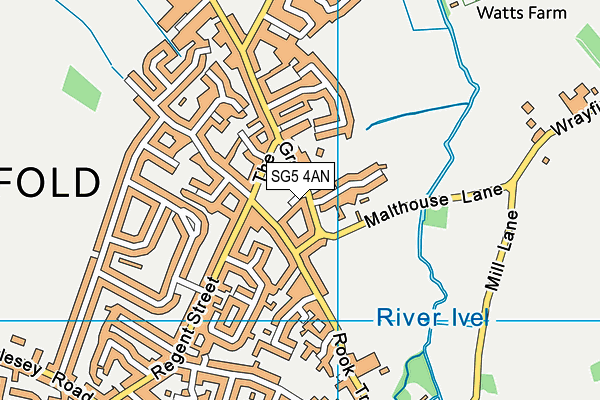
Roker Park (Closed) on a map

Roker Park (Closed) geodata
| Easting | 521958.4 |
| Northing | 237427.8 |
| Latitude | 52.021873 |
| Longitude | -0.224018 |
| Local Authority Name | Central Bedfordshire |
| Local Authority Code | E06000056 |
| Parliamentary Constituency Name | North East Bedfordshire |
| Parliamentary Constituency Code | E14000841 |
| Region Name | Eastern |
| Region Code | E15000006 |
| Ward Name | Stotfold and Langford |
| Ward Code | E05008805 |
| Output Area Code | E00088099 |
About this data
This data is open data sourced from Active Places Power and licenced under the Active Places Open Data Licence.
| toid | osgb1000009475931 |
| Created On | 26th Jul 2007 |
| Audited On | 17th Dec 2019 |
| Checked On | 11th Apr 2020 |
