Rainham Recreation Ground (Closed)
Rainham Recreation Ground (Closed) is located in Rainham (RM13).
| Address | Upminster Road South, Rainham, RM13 9YX |
| Management Type | Local Authority (in house) |
| Management Group | Local Authority |
| Owner Type | Local Authority |
| Owner Group | Local Authority |
| Education Phase | Not Known |
| Closure Date | 1st Jan 2005 |
| Closure Reason | Unclassified |
Facilities
| Closure Date | 1st Jan 2005 |
| Closure Reason | Unclassified |
| Accessibility | Pay and Play |
| Management Type | Not Known |
| Changing Rooms | No |
| Date Record Checked | 19th Aug 2010 |
| Opening Times | Detailed Timings |
Facility specifics
Contact
Where is Rainham Recreation Ground (Closed)?
| Sub Building Name | |
| Building Name | |
| Building Number | 0 |
| Dependent Thoroughfare | |
| Thoroughfare Name | Upminster Road South |
| Double Dependent Locality | |
| Dependent Locality | |
| PostTown | Rainham |
| Postcode | RM13 9YX |
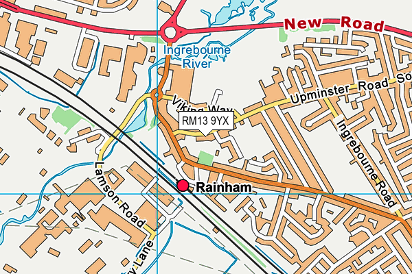
Rainham Recreation Ground (Closed) on a map

Rainham Recreation Ground (Closed) geodata
| Easting | 552270.65 |
| Northing | 182365.27 |
| Latitude | 51.519686 |
| Longitude | 0.193308 |
| Local Authority Name | Havering |
| Local Authority Code | E09000016 |
| Parliamentary Constituency Name | Dagenham and Rainham |
| Parliamentary Constituency Code | E14000657 |
| Region Name | London |
| Region Code | E15000007 |
| Ward Name | Rainham & Wennington |
| Ward Code | E05013979 |
| Output Area Code | E00011692 |
About this data
This data is open data sourced from Active Places Power and licenced under the Active Places Open Data Licence.
| Created On | 28th Sep 2005 |
| Audited On | 26th Jan 2015 |
| Checked On | 19th Aug 2010 |
