Rachel Madocks School - Waterlooville
Rachel Madocks School is located in Waterlooville (PO8), and offers Sports Hall.
| Address | Eagle Avenue, Waterlooville, PO8 9XP |
| Car Park | Yes |
| Car Park Capacity | 60 |
| Management Type | School/College/University (in house) |
| Management Group | Education |
| Owner Type | Community Special School |
| Owner Group | Education |
| Education Phase | Not applicable |
Facilities
| Accessibility | Private Use |
| Management Type | School/College/University (in house) |
| Year Built | 1989 |
| Changing Rooms | Yes |
| Date Record Checked | 31st May 2023 |
Opening times
| Access description | Private Use |
|---|
| Opening time | 09:00 |
| Closing time | 18:00 |
| Period open for | Monday-Friday |
Facility specifics
| Area | 180m² |
| Floor Matting | Don't Know |
| Gymnastics Trampoline Use | Don't Know |
| Length | 18m |
| Moveable Balance Apparatus | Don't Know |
| Moveable Large Apparatus | Don't Know |
| Moveable Rebound Apparatus | Don't Know |
| Moveable Trampolines | Don't Know |
| Width | 10m |
| Small Apparatus | Don't Know |
| Swinging and Hanging Apparatus | Don't Know |
Disabled access
| Disabled Access | Yes |
| Disabled Parking | Yes |
| Finding/Reaching Entrance | Yes |
| Reception Area | Yes |
| Doorways | Yes |
| Disabled Changing Facilities | Yes |
| Activity Areas | Yes |
| Disabled Toilets | Yes |
| Social Areas | Yes |
| Spectator Areas | Yes |
| Emergency Exits | Yes |
Contact
Disabled access
Disabled access for Rachel Madocks School
| Disabled Access | Yes |
| Disabled Parking | Yes |
| Finding/Reaching Entrance | Yes |
| Reception Area | Yes |
| Doorways | Yes |
| Disabled Changing Facilities | Yes |
| Activity Areas | Yes |
| Disabled Toilets | Yes |
| Social Areas | Yes |
| Spectator Areas | Yes |
| Emergency Exits | Yes |
Where is Rachel Madocks School?
| Sub Building Name | |
| Building Name | |
| Building Number | 0 |
| Dependent Thoroughfare | |
| Thoroughfare Name | EAGLE AVENUE |
| Double Dependent Locality | |
| Dependent Locality | |
| PostTown | WATERLOOVILLE |
| Postcode | PO8 9XP |
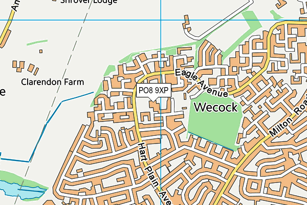
Rachel Madocks School on a map

Rachel Madocks School geodata
| Easting | 467968.4 |
| Northing | 111595.2 |
| Latitude | 50.899843 |
| Longitude | -1.034839 |
| Local Authority Name | Havant |
| Local Authority Code | E07000090 |
| Parliamentary Constituency Name | Meon Valley |
| Parliamentary Constituency Code | E14000811 |
| Region Name | South East |
| Region Code | E15000008 |
| Ward Name | Hart Plain |
| Ward Code | E05004572 |
| Output Area Code | E00116512 |
About this data
This data is open data sourced from Active Places Power and licenced under the Active Places Open Data Licence.
| toid | osgb1000014025229 |
| Created On | 2nd Nov 2004 |
| Audited On | 31st May 2023 |
| Checked On | 31st May 2023 |
