Ndyfl Hollingwood Mssc
Ndyfl Hollingwood Mssc is located in Hollingwood, Chesterfield (S43), and offers Grass Pitches.
| Address | 34, Station Road, Hollingwood, Chesterfield, S43 2HP |
| Management Type | Other |
| Management Group | Others |
| Owner Type | Local Authority |
| Owner Group | Local Authority |
| Education Phase | Not applicable |
Aliases
Ndyfl Hollingwood Mssc is also known as:
- Ringwood Centre Pitches
- Brsa Sports Ground
Facilities
| Accessibility | Sports Club / Community Association |
| Management Type | Other |
| Year Built | 1970 |
| Year Refurbished | 2006 |
| Changing Rooms | Yes |
| Date Record Checked | 4th Sep 2023 |
| Opening Times | Dawn To Dusk |
Facility specifics
| Accessibility | Sports Club / Community Association |
| Management Type | Other |
| Changing Rooms | Yes |
| Date Record Checked | 4th Sep 2023 |
| Opening Times | Dawn To Dusk |
Facility specifics
| Accessibility | Private Use |
| Management Type | Other |
| Year Built | 2022 |
| Changing Rooms | Yes |
| Date Record Created | 4th Sep 2023 |
| Date Record Checked | 4th Sep 2023 |
| Opening Times | Dawn To Dusk |
Facility specifics
| Accessibility | Private Use |
| Management Type | Other |
| Year Built | 2022 |
| Changing Rooms | No |
| Date Record Created | 4th Sep 2023 |
| Date Record Checked | 4th Sep 2023 |
| Opening Times | Dawn To Dusk |
Facility specifics
Contact
Where is Ndyfl Hollingwood Mssc?
8192:htmlspecialchars(): Passing null to parameter #1 ($string) of type string is deprecated
| Sub Building Name | |
8192:htmlspecialchars(): Passing null to parameter #1 ($string) of type string is deprecated
| Building Name | |
| Building Number | 34 |
8192:htmlspecialchars(): Passing null to parameter #1 ($string) of type string is deprecated
| Dependent Thoroughfare | |
| Thoroughfare Name | STATION ROAD |
8192:htmlspecialchars(): Passing null to parameter #1 ($string) of type string is deprecated
| Double Dependent Locality | |
| Dependent Locality | HOLLINGWOOD |
| PostTown | CHESTERFIELD |
| Postcode | S43 2HP |
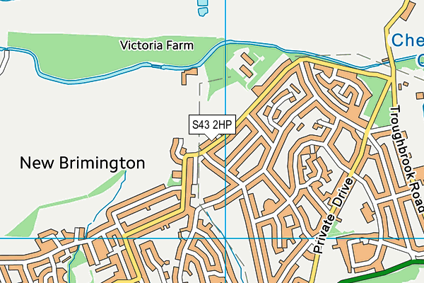
Ndyfl Hollingwood Mssc on a map

Ndyfl Hollingwood Mssc geodata
| Easting | 440999 |
| Northing | 374383 |
| Latitude | 53.264866 |
| Longitude | -1.386787 |
| Local Authority Name | Chesterfield |
| Local Authority Code | E07000034 |
| Parliamentary Constituency Name | Chesterfield |
| Parliamentary Constituency Code | E14000632 |
| Region Name | East Midlands |
| Region Code | E15000004 |
| Ward Name | Hollingwood and Inkersall |
| Ward Code | E05003329 |
| Output Area Code | E00098890 |
About this data
This data is open data sourced from Active Places Power and licenced under the Active Places Open Data Licence.
| toid | osgb1000026326582 |
| Created On | 14th Oct 2006 |
| Audited On | 19th Oct 2022 |
| Checked On | 4th Sep 2023 |
