Montacute Recreation Ground
Montacute Recreation Ground is located in Montacute, Yeovil (TA15), and offers Grass Pitches.
| Address | MONTACUTE RECREATION GROUND, Montacute Road, Montacute, Yeovil, TA15 6UJ |
| Management Type | Local Authority (in house) |
| Management Group | Local Authority |
| Owner Type | Local Authority |
| Owner Group | Local Authority |
| Education Phase | Not applicable |
Facilities
| Accessibility | Sports Club / Community Association |
| Management Type | Local Authority (in house) |
| Changing Rooms | No |
| Date Record Created | 1st Apr 2016 |
| Date Record Checked | 20th Oct 2022 |
| Opening Times | Dawn To Dusk |
Facility specifics
| Accessibility | Sports Club / Community Association |
| Management Type | Local Authority (in house) |
| Changing Rooms | Yes |
| Date Record Created | 18th Sep 2020 |
| Date Record Checked | 20th Oct 2022 |
| Opening Times | Dawn To Dusk |
Facility specifics
Contact
Where is Montacute Recreation Ground?
| Sub Building Name | |
| Building Name | MONTACUTE RECREATION GROUND |
| Building Number | 0 |
| Dependent Thoroughfare | |
| Thoroughfare Name | MONTACUTE ROAD |
| Double Dependent Locality | |
| Dependent Locality | MONTACUTE |
| PostTown | YEOVIL |
| Postcode | TA15 6UJ |
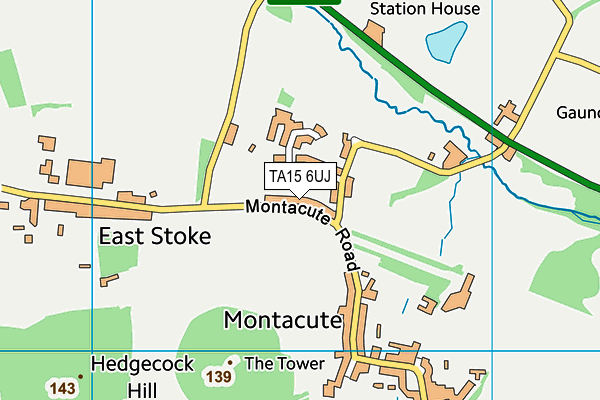
Montacute Recreation Ground on a map

Montacute Recreation Ground geodata
| Easting | 349508.84 |
| Northing | 117292.33 |
| Latitude | 50.952839 |
| Longitude | -2.720186 |
| Local Authority Name | South Somerset |
| Local Authority Code | E07000189 |
| Parliamentary Constituency Name | Yeovil |
| Parliamentary Constituency Code | E14001060 |
| Region Name | South West |
| Region Code | E15000009 |
| Ward Name | Northstone, Ivelchester & St. Michael's |
| Ward Code | E05012535 |
| Output Area Code | E00148815 |
About this data
This data is open data sourced from Active Places Power and licenced under the Active Places Open Data Licence.
| Created On | 1st Apr 2016 |
| Audited On | 20th Oct 2022 |
| Checked On | 20th Oct 2022 |
