Loxley Driving Range
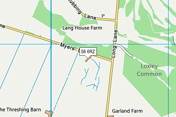
Loxley Driving Range is located in Loxley, Sheffield (S6), and offers Golf.
| Address | Myers Lane, Loxley, Sheffield, S6 6RZ |
| Car Park | Yes |
| Car Park Capacity | 40 |
| Management Type | Commercial Management |
| Management Group | Commercial |
| Owner Type | Commercial |
| Owner Group | Commercial |
| Education Phase | Not applicable |
Facilities
| Accessibility | Pay and Play |
| Management Type | Commercial Management |
| Year Built | 1990 |
| Changing Rooms | No |
| Date Record Created | 3rd Mar 2017 |
| Date Record Checked | 12th Dec 2022 |
Opening times
| Access description | Pay and Play |
|---|
| Opening time | 09:00 |
| Closing time | 22:00 |
| Period open for | Every day |
Facility specifics
Disabled access
| Disabled Access | Yes |
| Activity Areas | Yes |
Contact
Disabled access
Disabled access for Loxley Driving Range
| Disabled Access | Yes |
| Activity Areas | Yes |
Where is Loxley Driving Range?
| Sub Building Name | |
| Building Name | |
| Building Number | 0 |
| Dependent Thoroughfare | |
| Thoroughfare Name | MYERS LANE |
| Double Dependent Locality | |
| Dependent Locality | LOXLEY |
| PostTown | SHEFFIELD |
| Postcode | S6 6RZ |
Loxley Driving Range on a map

Loxley Driving Range geodata
| Easting | 430337 |
| Northing | 390857 |
| Latitude | 53.413655 |
| Longitude | -1.545057 |
| Local Authority Name | Sheffield |
| Local Authority Code | E08000019 |
| Parliamentary Constituency Name | Sheffield, Hallam |
| Parliamentary Constituency Code | E14000922 |
| Region Name | Yorkshire and the Humber |
| Region Code | E15000003 |
| Ward Name | Stannington |
| Ward Code | E05010880 |
| Output Area Code | E00041175 |
About this data
This data is open data sourced from Active Places Power and licenced under the Active Places Open Data Licence.
| toid | osgb1000000106030640 |
| Created On | 3rd Mar 2017 |
| Audited On | 12th Dec 2022 |
| Checked On | 12th Dec 2022 |
