Hallmoor School (Closed) - Kitts Green
Hallmoor School (Closed) is located in Kitts Green, Birmingham (B33).
| Address | Hallmoor Road, Kitts Green, Birmingham, B33 9QY |
| Management Type | School/College/University (in house) |
| Management Group | Education |
| Owner Type | Community Special School |
| Owner Group | Education |
| Education Phase | Not applicable |
| Closure Date | 17th Oct 2016 |
| Closure Reason | Strategic Review - facility/site to be replaced at existing site |
Facilities
| Closure Date | 17th Oct 2016 |
| Closure Reason | Strategic Review - facility/site to be replaced at another site |
| Accessibility | Private Use |
| Management Type | School/College/University (in house) |
| Year Built | 1952 |
| Changing Rooms | Yes |
| Date Record Checked | 17th Oct 2016 |
| Opening Times | Detailed Timings |
Facility specifics
| Area | 180m² |
| Floor Matting | Don't Know |
| Gymnastics Trampoline Use | Don't Know |
| Length | 18m |
| Moveable Balance Apparatus | Don't Know |
| Moveable Large Apparatus | Don't Know |
| Moveable Rebound Apparatus | Don't Know |
| Moveable Trampolines | Don't Know |
| Width | 10m |
| Small Apparatus | Don't Know |
| Swinging and Hanging Apparatus | Don't Know |
Disabled access
| Disabled Access | Yes |
| Finding/Reaching Entrance | Yes |
| Reception Area | Yes |
| Doorways | Yes |
| Disabled Changing Facilities | Yes |
| Activity Areas | Yes |
| Disabled Toilets | Yes |
| Social Areas | Yes |
| Spectator Areas | Yes |
| Emergency Exits | Yes |
Contact
Disabled access
Disabled access for Hallmoor School (Closed)
| Disabled Access | Yes |
| Finding/Reaching Entrance | Yes |
| Reception Area | Yes |
| Doorways | Yes |
| Disabled Changing Facilities | Yes |
| Activity Areas | Yes |
| Disabled Toilets | Yes |
| Social Areas | Yes |
| Spectator Areas | Yes |
| Emergency Exits | Yes |
Where is Hallmoor School (Closed)?
| Sub Building Name | |
| Building Name | |
| Building Number | 0 |
| Dependent Thoroughfare | |
| Thoroughfare Name | Hallmoor Road |
| Double Dependent Locality | |
| Dependent Locality | Kitts Green |
| PostTown | Birmingham |
| Postcode | B33 9QY |
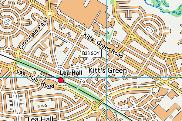
Hallmoor School (Closed) on a map

Hallmoor School (Closed) geodata
| Easting | 414779.7 |
| Northing | 287131.4 |
| Latitude | 52.481908 |
| Longitude | -1.783801 |
| Local Authority Name | Birmingham |
| Local Authority Code | E08000025 |
| Parliamentary Constituency Name | Birmingham, Hodge Hill |
| Parliamentary Constituency Code | E14000563 |
| Region Name | West Midlands |
| Region Code | E15000005 |
| Ward Name | Glebe Farm & Tile Cross |
| Ward Code | E05011138 |
| Output Area Code | E00047156 |
About this data
This data is open data sourced from Active Places Power and licenced under the Active Places Open Data Licence.
| Created On | 11th Feb 2005 |
| Audited On | 12th Jan 2009 |
| Checked On | 12th Jan 2009 |
