Haldon Forest Park - Kennford
Haldon Forest Park is located in Kennford (EX6), and offers Cycling.
| Address | HALDON FOREST PARK, Bullers Hill, Kennford, EX6 7XR |
| Car Park | Yes |
| Car Park Capacity | 350 |
| Management Type | Other |
| Management Group | Others |
| Owner Type | Other |
| Owner Group | Others |
| Education Phase | Not applicable |
Facilities
| Accessibility | Pay and Play |
| Management Type | Other |
| Year Built | 2000 |
| Changing Rooms | No |
| Date Record Created | 24th Feb 2017 |
| Date Record Checked | 15th Aug 2023 |
| Opening Times | Dawn To Dusk |
Facility specifics
| Bike Wash | Yes |
| Black Trails | Yes |
| Blue Trails | Yes |
| Extreme Trails | No |
| Green Trails | Yes |
| Length of Black Trails | 0.97m |
| Length of Blue Trails | 6.4m |
| Length of Green Trails | 2.4m |
| Length of Red Trails | 9.6m |
| Overall Width | 3m |
| Red Trails | Yes |
| Surface | Various |
| Total Length | 19370m |
Disabled access
| Disabled Access | Yes |
| Disabled Parking | Yes |
| Finding/Reaching Entrance | Yes |
| Reception Area | Yes |
| Disabled Toilets | Yes |
| Social Areas | Yes |
| Emergency Exits | Yes |
| Accessibility | Free Public Access |
| Management Type | Other |
| Year Built | 2000 |
| Changing Rooms | No |
| Date Record Created | 25th Jan 2018 |
| Date Record Checked | 15th Aug 2023 |
| Opening Times | Dawn To Dusk |
Facility specifics
| Automatic Start Gate | No |
| Floodlit | No |
| Overall Width | 5m |
| Start Gate | No |
| Surface | Macadam |
| Total Length | 100m |
Disabled access
| Disabled Access | Yes |
| Disabled Parking | Yes |
| Finding/Reaching Entrance | Yes |
| Reception Area | Yes |
| Disabled Toilets | Yes |
| Social Areas | Yes |
| Emergency Exits | Yes |
Contact
Disabled access
Disabled access for Haldon Forest Park
| Disabled Access | Yes |
| Disabled Parking | Yes |
| Finding/Reaching Entrance | Yes |
| Reception Area | Yes |
| Disabled Toilets | Yes |
| Social Areas | Yes |
| Emergency Exits | Yes |
Where is Haldon Forest Park?
8192:htmlspecialchars(): Passing null to parameter #1 ($string) of type string is deprecated
| Sub Building Name | |
| Building Name | HALDON FOREST PARK |
| Building Number | 0 |
8192:htmlspecialchars(): Passing null to parameter #1 ($string) of type string is deprecated
| Dependent Thoroughfare | |
| Thoroughfare Name | BULLERS HILL |
8192:htmlspecialchars(): Passing null to parameter #1 ($string) of type string is deprecated
| Double Dependent Locality | |
8192:htmlspecialchars(): Passing null to parameter #1 ($string) of type string is deprecated
| Dependent Locality | |
| PostTown | KENNFORD |
| Postcode | EX6 7XR |
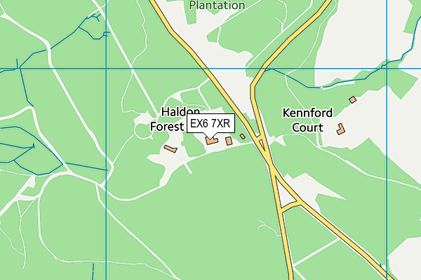
Haldon Forest Park on a map

Haldon Forest Park geodata
| Easting | 288394 |
| Northing | 84743 |
| Latitude | 50.651644 |
| Longitude | -3.580081 |
| Local Authority Name | Teignbridge |
| Local Authority Code | E07000045 |
| Parliamentary Constituency Name | Central Devon |
| Parliamentary Constituency Code | E14000623 |
| Region Name | South West |
| Region Code | E15000009 |
| Ward Name | Kenn Valley |
| Ward Code | E05011905 |
| Output Area Code | E00102530 |
About this data
This data is open data sourced from Active Places Power and licenced under the Active Places Open Data Licence.
| toid | osgb1000012215989 |
| Created On | 24th Feb 2017 |
| Audited On | 15th Aug 2023 |
| Checked On | 15th Aug 2023 |
