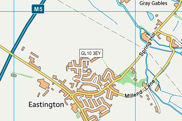
Eastington Primary School Playing Field
Eastington Primary School Playing Field is located in Eastington, Stonehouse (GL10).
| Address | Bush Close, Eastington, Stonehouse, GL10 3EY |
| Management Type | School/College/University (in house) |
| Management Group | Education |
| Owner Type | Community school |
| Owner Group | Education |
| Education Phase | Primary |
Facilities
| Accessibility | Private Use |
| Management Type | School/College/University (in house) |
| Changing Rooms | No |
| Date Record Created | 25th Oct 2018 |
| Date Record Checked | 15th Mar 2023 |
| Opening Times | Dawn To Dusk |
Facility specifics
Disabled access
| Notes | The Postcode for the playing field is GL10 3EY it is in a separate location to the main school which has a postcode of GL10 3SB. The main School building has disability access except there are no disabled parking bays. The field has limited access if at all. |
Contact
Disabled access
Disabled access for Eastington Primary School Playing Field
| Notes | The Postcode for the playing field is GL10 3EY it is in a separate location to the main school which has a postcode of GL10 3SB. The main School building has disability access except there are no disabled parking bays. The field has limited access if at all. |
Where is Eastington Primary School Playing Field?
8192:htmlspecialchars(): Passing null to parameter #1 ($string) of type string is deprecated
| Sub Building Name | |
8192:htmlspecialchars(): Passing null to parameter #1 ($string) of type string is deprecated
| Building Name | |
| Building Number | 0 |
8192:htmlspecialchars(): Passing null to parameter #1 ($string) of type string is deprecated
| Dependent Thoroughfare | |
| Thoroughfare Name | BUSH CLOSE |
8192:htmlspecialchars(): Passing null to parameter #1 ($string) of type string is deprecated
| Double Dependent Locality | |
| Dependent Locality | EASTINGTON |
| PostTown | STONEHOUSE |
| Postcode | GL10 3EY |
Eastington Primary School Playing Field on a map

Eastington Primary School Playing Field geodata
| Easting | 377703.36 |
| Northing | 205546.76 |
| Latitude | 51.748169 |
| Longitude | -2.324367 |
| Local Authority Name | Stroud |
| Local Authority Code | E07000082 |
| Parliamentary Constituency Name | Stroud |
| Parliamentary Constituency Code | E14000980 |
| Region Name | South West |
| Region Code | E15000009 |
| Ward Name | Severn |
| Ward Code | E05013195 |
| Output Area Code | E00113743 |
About this data
This data is open data sourced from Active Places Power and licenced under the Active Places Open Data Licence.
| toid | osgb1000002498200665 |
| Created On | 25th Oct 2018 |
| Audited On | 15th Mar 2023 |
| Checked On | 15th Mar 2023 |
