Colsterworth Sports And Social Club - Woolsthorpe By Colsterworth
Colsterworth Sports And Social Club is located in Woolsthorpe By Colsterworth, Grantham (NG33), and offers Grass Pitches.
| Address | Old Post Lane, Woolsthorpe By Colsterworth, Grantham, NG33 5PG |
| Car Park | Yes |
| Car Park Capacity | 30 |
| Management Type | Sport Club |
| Management Group | Others |
| Owner Type | Sports Club |
| Owner Group | Sports Club |
| Education Phase | Not applicable |
Facilities
| Accessibility | Sports Club / Community Association |
| Management Type | Sport Club |
| Changing Rooms | Yes |
| Date Record Created | 22nd Jan 2018 |
| Date Record Checked | 10th Aug 2023 |
| Opening Times | Dawn To Dusk |
Facility specifics
Disabled access
| Disabled Access | Yes |
| Activity Areas | Yes |
| Disabled Toilets | Yes |
| Accessibility | Sports Club / Community Association |
| Management Type | Sport Club |
| Changing Rooms | Yes |
| Date Record Created | 21st Feb 2019 |
| Date Record Checked | 10th Aug 2023 |
| Opening Times | Dawn To Dusk |
Facility specifics
Disabled access
| Disabled Access | Yes |
| Activity Areas | Yes |
| Disabled Toilets | Yes |
Contact
Disabled access
Disabled access for Colsterworth Sports And Social Club
| Disabled Access | Yes |
| Activity Areas | Yes |
| Disabled Toilets | Yes |
Where is Colsterworth Sports And Social Club ?
| Sub Building Name | |
| Building Name | |
| Building Number | 0 |
| Dependent Thoroughfare | |
| Thoroughfare Name | OLD POST LANE |
| Double Dependent Locality | |
| Dependent Locality | WOOLSTHORPE BY COLSTERWORTH |
| PostTown | GRANTHAM |
| Postcode | NG33 5PG |
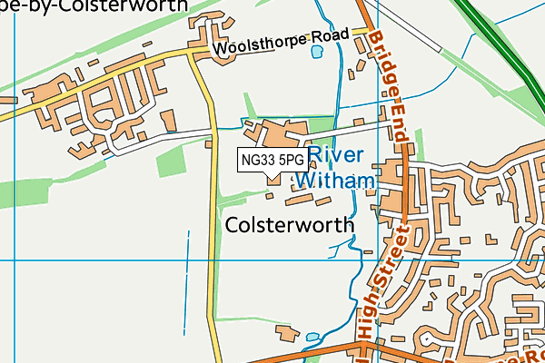
Colsterworth Sports And Social Club on a map

Colsterworth Sports And Social Club geodata
| Easting | 492700.47 |
| Northing | 324231.61 |
| Latitude | 52.807678 |
| Longitude | -0.626236 |
| Local Authority Name | South Kesteven |
| Local Authority Code | E07000141 |
| Parliamentary Constituency Name | Grantham and Stamford |
| Parliamentary Constituency Code | E14000714 |
| Region Name | East Midlands |
| Region Code | E15000004 |
| Ward Name | Isaac Newton |
| Ward Code | E05010166 |
| Output Area Code | E00133742 |
About this data
This data is open data sourced from Active Places Power and licenced under the Active Places Open Data Licence.
| toid | osgb1000026651515 |
| Created On | 22nd Jan 2018 |
| Audited On | 10th Aug 2023 |
| Checked On | 10th Aug 2023 |
