Church Lane Playing Field - Stoke By Clare
Church Lane Playing Field is located in Stoke By Clare, Sudbury (CO10), and offers Grass Pitches.
| Address | Church Park, Stoke By Clare, Sudbury, CO10 8JB |
| Management Type | Sport Club |
| Management Group | Others |
| Owner Type | Commercial |
| Owner Group | Commercial |
| Education Phase | Not applicable |
Facilities
| Accessibility | Sports Club / Community Association |
| Management Type | Sport Club |
| Year Built | 1975 |
| Changing Rooms | No |
| Date Record Checked | 19th Oct 2023 |
| Opening Times | Dawn To Dusk |
Facility specifics
Disabled access
| Disabled Access | Yes |
| Activity Areas | Yes |
| Notes | Car parking is on public road, shared with public and residents. Field has no pavilion or designated changing rooms. No designated parking or toilets. Nearest disabled toilet is in Village Hall, 300m away. |
Contact
Disabled access
Disabled access for Church Lane Playing Field
| Disabled Access | Yes |
| Activity Areas | Yes |
| Notes | Car parking is on public road, shared with public and residents. Field has no pavilion or designated changing rooms. No designated parking or toilets. Nearest disabled toilet is in Village Hall, 300m away. |
Where is Church Lane Playing Field?
| Sub Building Name | |
| Building Name | |
| Building Number | 0 |
| Dependent Thoroughfare | |
| Thoroughfare Name | CHURCH PARK |
| Double Dependent Locality | |
| Dependent Locality | STOKE BY CLARE |
| PostTown | SUDBURY |
| Postcode | CO10 8JB |
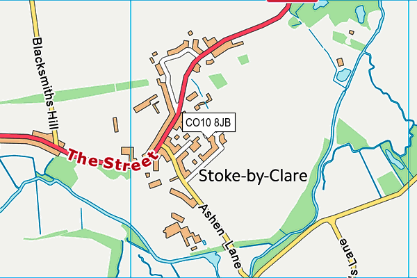
Church Lane Playing Field on a map

Church Lane Playing Field geodata
| Easting | 574356.81 |
| Northing | 243415.19 |
| Latitude | 52.061674 |
| Longitude | 0.541985 |
| Local Authority Name | West Suffolk |
| Local Authority Code | E07000245 |
| Parliamentary Constituency Name | West Suffolk |
| Parliamentary Constituency Code | E14001034 |
| Region Name | Eastern |
| Region Code | E15000006 |
| Ward Name | Clare, Hundon & Kedington |
| Ward Code | E05012771 |
| Output Area Code | E00153558 |
About this data
This data is open data sourced from Active Places Power and licenced under the Active Places Open Data Licence.
| Created On | 14th Oct 2006 |
| Audited On | 19th Oct 2023 |
| Checked On | 19th Oct 2023 |
