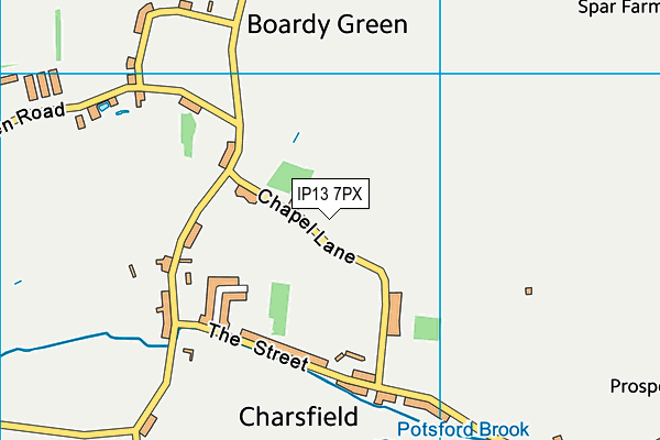
Charsfield
Charsfield is located in Charsfield, Woodbridge (IP13), and offers Grass Pitches, and Outdoor Tennis Courts.
| Address | CHAPEL HOUSE, Chapel Lane, Charsfield, Woodbridge, IP13 7PX |
| Car Park | Yes |
| Car Park Capacity | 20 |
| Management Type | Sport Club |
| Management Group | Others |
| Owner Type | Sports Club |
| Owner Group | Sports Club |
| Education Phase | Not applicable |
Facilities
| Accessibility | Free Public Access |
| Management Type | Local Authority (in house) |
| Changing Rooms | No |
| Date Record Created | 30th Jan 2017 |
| Date Record Checked | 6th Sep 2023 |
| Opening Times | Dawn To Dusk |
Facility specifics
Disabled access
| Disabled Access | Yes |
| Finding/Reaching Entrance | Yes |
| Status Notes | One of the courts is a MUGA |
| Accessibility | Sports Club / Community Association |
| Management Type | Sport Club |
| Year Built | 2008 |
| Changing Rooms | No |
| Date Record Created | 30th Jan 2017 |
| Date Record Checked | 6th Sep 2023 |
| Opening Times | Dawn To Dusk |
Facility specifics
| Floodlit | No |
| Overmarked | No |
| Surface Type | Macadam |
Disabled access
| Disabled Access | Yes |
| Finding/Reaching Entrance | Yes |
Contact
Disabled access
Disabled access for Charsfield
| Disabled Access | Yes |
| Finding/Reaching Entrance | Yes |
Where is Charsfield?
| Sub Building Name | |
| Building Name | CHAPEL HOUSE |
| Building Number | 0 |
| Dependent Thoroughfare | |
| Thoroughfare Name | CHAPEL LANE |
| Double Dependent Locality | |
| Dependent Locality | CHARSFIELD |
| PostTown | WOODBRIDGE |
| Postcode | IP13 7PX |
Charsfield on a map

Charsfield geodata
| Easting | 625835.09 |
| Northing | 256420.56 |
| Latitude | 52.159835 |
| Longitude | 1.30034 |
| Local Authority Name | East Suffolk |
| Local Authority Code | E07000244 |
| Parliamentary Constituency Name | Central Suffolk and North Ipswich |
| Parliamentary Constituency Code | E14000624 |
| Region Name | Eastern |
| Region Code | E15000006 |
| Ward Name | Carlford & Fynn Valley |
| Ward Code | E05012737 |
| Output Area Code | E00153739 |
About this data
This data is open data sourced from Active Places Power and licenced under the Active Places Open Data Licence.
| toid | osgb1000002018247755 |
| Created On | 30th Jan 2017 |
| Audited On | 6th Sep 2023 |
| Checked On | 6th Sep 2023 |
