Brinton Park - Kidderminster
Brinton Park is located in Kidderminster (DY11), and offers Outdoor Tennis Courts, and Grass Pitches.
| Address | Park Lane, Kidderminster, DY11 6TB |
| Car Park | Yes |
| Car Park Capacity | 25 |
| Management Type | Local Authority (in house) |
| Management Group | Local Authority |
| Owner Type | Local Authority |
| Owner Group | Local Authority |
| Education Phase | Not applicable |
Facilities
| Accessibility | Free Public Access |
| Management Type | Local Authority (in house) |
| Year Built | 2000 |
| Changing Rooms | No |
| Date Record Checked | 5th Sep 2023 |
| Opening Times | Dawn To Dusk |
Facility specifics
| Floodlit | No |
| Overmarked | No |
| Surface Type | Macadam |
Disabled access
| Disabled Access | Yes |
| Finding/Reaching Entrance | Yes |
| Activity Areas | Yes |
| Emergency Exits | Yes |
| Accessibility | Free Public Access |
| Management Type | Local Authority (in house) |
| Changing Rooms | No |
| Date Record Created | 7th Jul 2022 |
| Date Record Checked | 5th Sep 2023 |
| Opening Times | Dawn To Dusk |
Facility specifics
Disabled access
| Disabled Access | Yes |
| Finding/Reaching Entrance | Yes |
| Activity Areas | Yes |
| Emergency Exits | Yes |
Contact
Disabled access
Disabled access for Brinton Park
| Disabled Access | Yes |
| Finding/Reaching Entrance | Yes |
| Activity Areas | Yes |
| Emergency Exits | Yes |
Where is Brinton Park?
8192:htmlspecialchars(): Passing null to parameter #1 ($string) of type string is deprecated
| Sub Building Name | |
8192:htmlspecialchars(): Passing null to parameter #1 ($string) of type string is deprecated
| Building Name | |
| Building Number | 0 |
8192:htmlspecialchars(): Passing null to parameter #1 ($string) of type string is deprecated
| Dependent Thoroughfare | |
| Thoroughfare Name | PARK LANE |
8192:htmlspecialchars(): Passing null to parameter #1 ($string) of type string is deprecated
| Double Dependent Locality | |
8192:htmlspecialchars(): Passing null to parameter #1 ($string) of type string is deprecated
| Dependent Locality | |
| PostTown | KIDDERMINSTER |
| Postcode | DY11 6TB |
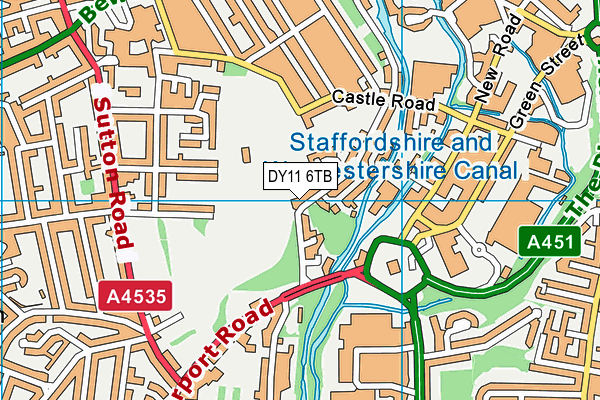
Brinton Park on a map

Brinton Park geodata
| Easting | 382603.46 |
| Northing | 275921.8 |
| Latitude | 52.381051 |
| Longitude | -2.257 |
| Local Authority Name | Wyre Forest |
| Local Authority Code | E07000239 |
| Parliamentary Constituency Name | Wyre Forest |
| Parliamentary Constituency Code | E14001058 |
| Region Name | West Midlands |
| Region Code | E15000005 |
| Ward Name | Blakebrook & Habberley South |
| Ward Code | E05010505 |
| Output Area Code | E00165634 |
About this data
This data is open data sourced from Active Places Power and licenced under the Active Places Open Data Licence.
| Created On | 10th Feb 2014 |
| Audited On | 5th Sep 2023 |
| Checked On | 5th Sep 2023 |
