Branfil Primary School (Little Gaynes Lane Playing Field) - Upminster
Branfil Primary School (Little Gaynes Lane Playing Field) is located in Upminster (RM14), and offers Grass Pitches.
| Address | Cedar Avenue, Upminster, RM14 2LW |
| Management Type | School/College/University (in house) |
| Management Group | Education |
| Owner Type | Community school |
| Owner Group | Education |
| Education Phase | Primary |
Facilities
| Accessibility | Private Use |
| Management Type | School/College/University (in house) |
| Changing Rooms | No |
| Date Record Created | 19th Apr 2017 |
| Date Record Checked | 11th Oct 2023 |
| Opening Times | Dawn To Dusk |
Facility specifics
Disabled access
| Disabled Access | Yes |
| Activity Areas | Yes |
Contact
Disabled access
Disabled access for Branfil Primary School (Little Gaynes Lane Playing Field)
| Disabled Access | Yes |
| Activity Areas | Yes |
Where is Branfil Primary School (Little Gaynes Lane Playing Field)?
| Sub Building Name | |
| Building Name | |
| Building Number | 0 |
| Dependent Thoroughfare | |
| Thoroughfare Name | CEDAR AVENUE |
| Double Dependent Locality | |
| Dependent Locality | |
| PostTown | UPMINSTER |
| Postcode | RM14 2LW |
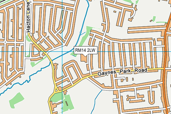
Branfil Primary School (Little Gaynes Lane Playing Field) on a map

Branfil Primary School (Little Gaynes Lane Playing Field) geodata
| Easting | 555202 |
| Northing | 185935.23 |
| Latitude | 51.550964 |
| Longitude | 0.237096 |
| Local Authority Name | Havering |
| Local Authority Code | E09000016 |
| Parliamentary Constituency Name | Hornchurch and Upminster |
| Parliamentary Constituency Code | E14000751 |
| Region Name | London |
| Region Code | E15000007 |
| Ward Name | Upminster |
| Ward Code | E05013986 |
| Output Area Code | E00011916 |
About this data
This data is open data sourced from Active Places Power and licenced under the Active Places Open Data Licence.
| toid | osgb1000000479546 |
| Created On | 19th Apr 2017 |
| Audited On | 11th Oct 2023 |
| Checked On | 11th Oct 2023 |
