Bradfield Playing Field - Southend Bradfield
Bradfield Playing Field is located in Southend Bradfield, Reading (RG7), and offers Grass Pitches.
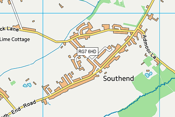
| Address | Heath Road, Southend Bradfield, Reading, RG7 6HD |
| Car Park | Yes |
| Car Park Capacity | 25 |
| Management Type | Community Organisation |
| Management Group | Others |
| Owner Type | Sports Club |
| Owner Group | Sports Club |
| Education Phase | Not applicable |
Facilities
| Accessibility | Sports Club / Community Association |
| Management Type | Community Organisation |
| Changing Rooms | Yes |
| Date Record Checked | 12th Oct 2023 |
| Opening Times | Dawn To Dusk |
Facility specifics
Disabled access
| Disabled Access | Yes |
| Disabled Parking | Yes |
| Finding/Reaching Entrance | Yes |
| Doorways | Yes |
| Activity Areas | Yes |
| Disabled Toilets | Yes |
| Emergency Exits | Yes |
| Accessibility | Sports Club / Community Association |
| Management Type | Community Organisation |
| Year Built | 2012 |
| Changing Rooms | Yes |
| Date Record Checked | 12th Oct 2023 |
| Opening Times | Dawn To Dusk |
Facility specifics
Disabled access
| Disabled Access | Yes |
| Disabled Parking | Yes |
| Finding/Reaching Entrance | Yes |
| Doorways | Yes |
| Activity Areas | Yes |
| Disabled Toilets | Yes |
| Emergency Exits | Yes |
Contact
Disabled access
Disabled access for Bradfield Playing Field
| Disabled Access | Yes |
| Disabled Parking | Yes |
| Finding/Reaching Entrance | Yes |
| Doorways | Yes |
| Activity Areas | Yes |
| Disabled Toilets | Yes |
| Emergency Exits | Yes |
Where is Bradfield Playing Field?
| Sub Building Name | |
| Building Name | |
| Building Number | 0 |
| Dependent Thoroughfare | |
| Thoroughfare Name | HEATH ROAD |
| Double Dependent Locality | |
| Dependent Locality | SOUTHEND BRADFIELD |
| PostTown | READING |
| Postcode | RG7 6HD |
Bradfield Playing Field on a map

Bradfield Playing Field geodata
| Easting | 459355 |
| Northing | 170714 |
| Latitude | 51.432328 |
| Longitude | -1.147569 |
| Local Authority Name | West Berkshire |
| Local Authority Code | E06000037 |
| Parliamentary Constituency Name | Newbury |
| Parliamentary Constituency Code | E14000830 |
| Region Name | South East |
| Region Code | E15000008 |
| Ward Name | Bradfield |
| Ward Code | E05012134 |
| Output Area Code | E00082167 |
About this data
This data is open data sourced from Active Places Power and licenced under the Active Places Open Data Licence.
| Created On | 18th May 2007 |
| Audited On | 12th Oct 2023 |
| Checked On | 12th Oct 2023 |
