Belmont Abbey - Clehonger
Belmont Abbey is located in Clehonger (HR2), and offers Grass Pitches.
| Address | PLAYING FIELD AND PAVILLION, B4349 From Arkstone Court Road To A465, Clehonger, HR2 9RZ |
| Car Park | Yes |
| Car Park Capacity | 64 |
| Management Type | Local Authority (in house) |
| Management Group | Local Authority |
| Owner Type | Local Authority |
| Owner Group | Local Authority |
| Education Phase | Not applicable |
Facilities
| Accessibility | Free Public Access |
| Management Type | School/College/University (in house) |
| Changing Rooms | Yes |
| Date Record Created | 23rd Feb 2017 |
| Date Record Checked | 3rd Oct 2022 |
| Opening Times | Dawn To Dusk |
Facility specifics
Disabled access
| Disabled Access | Yes |
| Finding/Reaching Entrance | Yes |
| Emergency Exits | Yes |
Contact
Disabled access
Disabled access for Belmont Abbey
| Disabled Access | Yes |
| Finding/Reaching Entrance | Yes |
| Emergency Exits | Yes |
Where is Belmont Abbey?
| Sub Building Name | |
| Building Name | PLAYING FIELD AND PAVILLION |
| Building Number | 0 |
| Dependent Thoroughfare | |
| Thoroughfare Name | B4349 FROM ARKSTONE COURT ROAD TO A465 |
| Double Dependent Locality | |
| Dependent Locality | |
| PostTown | CLEHONGER |
| Postcode | HR2 9RZ |
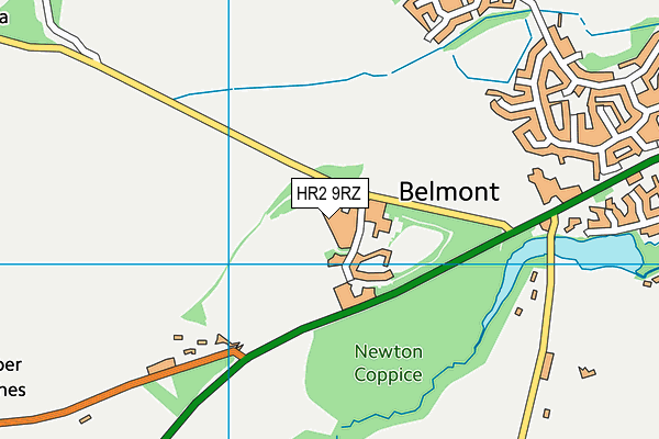
Belmont Abbey on a map

Belmont Abbey geodata
| Easting | 348015 |
| Northing | 237989 |
| Latitude | 52.037853 |
| Longitude | -2.759275 |
| Local Authority Name | Herefordshire, County of |
| Local Authority Code | E06000019 |
| Parliamentary Constituency Name | Hereford and South Herefordshire |
| Parliamentary Constituency Code | E14000743 |
| Region Name | West Midlands |
| Region Code | E15000005 |
| Ward Name | Stoney Street |
| Ward Code | E05012959 |
| Output Area Code | E00071098 |
About this data
This data is open data sourced from Active Places Power and licenced under the Active Places Open Data Licence.
| toid | osgb1000028333257 |
| Created On | 23rd Feb 2017 |
| Audited On | 3rd Oct 2022 |
| Checked On | 3rd Oct 2022 |
