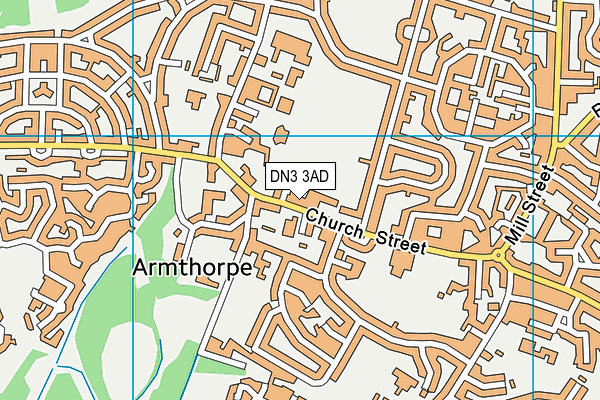
Armthorpe Sports Pavilion
Armthorpe Sports Pavilion is located in Armthorpe, Doncaster (DN3), and offers Grass Pitches.
| Address | ARMTHORPE WELFARE CRICKET AND RUGBY FORMAL LAND, Church Street, Armthorpe, Doncaster, DN3 3AD |
| Management Type | Community Organisation |
| Management Group | Others |
| Owner Type | Community Organisation |
| Owner Group | Community Organisation |
| Education Phase | Not applicable |
Aliases
Armthorpe Sports Pavilion is also known as:
- Armthorpe Welfare Fc (Site 2)
Facilities
| Accessibility | Sports Club / Community Association |
| Management Type | Community Organisation |
| Changing Rooms | Yes |
| Date Record Checked | 7th Aug 2023 |
| Opening Times | Dawn To Dusk |
Facility specifics
Disabled access
| Disabled Access | Yes |
| Disabled Parking | Yes |
| Finding/Reaching Entrance | Yes |
| Activity Areas | Yes |
| Social Areas | Yes |
| Spectator Areas | Yes |
| Emergency Exits | Yes |
Contact
Disabled access
Disabled access for Armthorpe Sports Pavilion
| Disabled Access | Yes |
| Disabled Parking | Yes |
| Finding/Reaching Entrance | Yes |
| Activity Areas | Yes |
| Social Areas | Yes |
| Spectator Areas | Yes |
| Emergency Exits | Yes |
Where is Armthorpe Sports Pavilion?
| Sub Building Name | |
| Building Name | ARMTHORPE WELFARE CRICKET AND RUGBY FORMAL LAND |
| Building Number | 0 |
| Dependent Thoroughfare | |
| Thoroughfare Name | CHURCH STREET |
| Double Dependent Locality | |
| Dependent Locality | ARMTHORPE |
| PostTown | DONCASTER |
| Postcode | DN3 3AD |
Armthorpe Sports Pavilion on a map

Armthorpe Sports Pavilion geodata
| Easting | 462468 |
| Northing | 404931 |
| Latitude | 53.537323 |
| Longitude | -1.058918 |
| Local Authority Name | Doncaster |
| Local Authority Code | E08000017 |
| Parliamentary Constituency Name | Doncaster Central |
| Parliamentary Constituency Code | E14000668 |
| Region Name | Yorkshire and the Humber |
| Region Code | E15000003 |
| Ward Name | Armthorpe |
| Ward Code | E05010729 |
| Output Area Code | E00172398 |
About this data
This data is open data sourced from Active Places Power and licenced under the Active Places Open Data Licence.
| toid | osgb5000005176523334 |
| Created On | 6th Dec 2009 |
| Audited On | 7th Aug 2023 |
| Checked On | 7th Aug 2023 |
