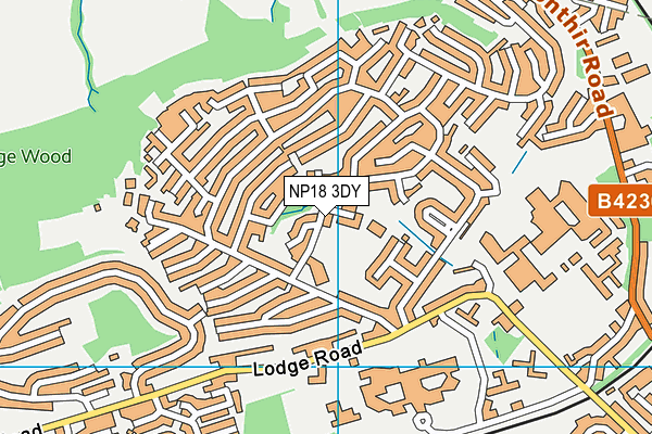
Ysgol Gymraeg Nant Gwenlli is located in Caerleon, Newport and falls under the local authority of Newport. The type of establishment is welsh establishment.
| Address | Ysgol Gymraeg Nant Gwenlli Roman Way Caerleon Newport NP18 3DY |
GetTheData
Source: Get Information About Schools
Licence: Open Government Licence
| Phase of Education | Not applicable |
| Type of Establishment | Welsh establishment |
| Official Sixth Form | Not applicable |
| Diocese | Not applicable |
| Special Classes | Not applicable |
GetTheData
Source: Get Information About Schools
Licence: Open Government Licence
| Street Address | Roman Way |
| Locality | Caerleon |
| Town | Newport |
| Postcode | NP18 3DY |
| ➜ More NP18 3DY open data | |
GetTheData
Source: Get Information About Schools
Licence: Open Government Licence

GetTheData
Source: OS VectorMap District (Ordnance Survey)
Licence: Open Government Licence (requires attribution)
| Ofsted Special Measures | Not applicable |
GetTheData
Source: Get Information About Schools
Licence: Open Government Licence
| Establishment Name | Ysgol Gymraeg Nant Gwenlli |
| Establishment Number | 2331 |
| Unique Reference Number | 402460 |
| Local Authority | Newport |
| Local Authority Code | 680 |
| Previous Local Authority Code | 999 |
| Government Statistical Service Local Authority Code | W06000022 |
| Government Office Region | Wales (pseudo) |
| District | Newport |
| District Code | W06000022 |
| Ward | Caerleon |
| Parliamentary Constituency | Newport West |
| Urban/Rural Description | (England/Wales) Rural town and fringe |
| Middle Super Output Area | Newport 001 |
| Lower Super Output Area | Newport 001D |
GetTheData
Source: Get Information About Schools
Licence: Open Government Licence
| Establishment Status | Open |
| Last Changed Date | 13th June 2022 |
| Open Date | 1st September 2021 |
GetTheData
Source: Get Information About Schools
Licence: Open Government Licence
| Teenage Mothers | Not applicable |
| Special Educational Needs (SEN) Provision in Primary Care Unit | Not applicable |
| Pupil Referral Unit (PRU) Provides for Educational and Behavioural Difficulties (EBD) | Not applicable |
GetTheData
Source: Get Information About Schools
Licence: Open Government Licence
| Section 41 Approved | Not approved |
GetTheData
Source: Get Information About Schools
Licence: Open Government Licence
| Trust flag | Not applicable |
| School Sponsor flag | Not applicable |
GetTheData
Source: Get Information About Schools
Licence: Open Government Licence
| Federation flag | Not applicable |
GetTheData
Source: Get Information About Schools
Licence: Open Government Licence
GetTheData
Source: Get Information About Schools
Licence: Open Government Licence
| Easting | 333091 |
| Northing | 191327 |
| Latitude | 51.61678 |
| Longitude | -2.96777 |
GetTheData
Source: Get Information About Schools
Licence: Open Government Licence
| School | Phase of Education | Distance |
|---|---|---|
| Caerleon Comprehensive School Cold Bath Road, Caerleon, Newport, NP18 1NF | Not applicable | 845m |
| St Julian's School Heather Road, St Julian's, Newport, NP9 7XU | Not applicable | 1.9km |
| Ponthir Church in Wales School Caerleon Road, Ponthir, Torfaen, NP18 1GD | Not applicable | 2km |
| Malpas Park Primary School Wavell Drive, Malpas, Newport, NP20 6LE | Not applicable | 2.7km |
| Crindau Junior & Infant School Ailesbury Street, Newport, NP20 5ND | Not applicable | 2.8km |
| St Joseph's R.C. Primary School Fairoak Avenue, Newport, NP19 8FW | Not applicable | 2.8km |
| Newport Nursery School Church Road, Newport, NP19 7EJ | Not applicable | 2.9km |
| Eveswell Primary School Chepstow Road, Newport, NP19 8GX | Not applicable | 3km |
| Malpas Court Primary School Whittle Drive, Newport, NP20 6NS | Not applicable | 3.1km |
| Rougemont School Llantarnam Hall, Malpas Road, Newport, NP20 6QB | Not applicable | 3.1km |
GetTheData
Source: Get Information About Schools
Licence: Open Government Licence