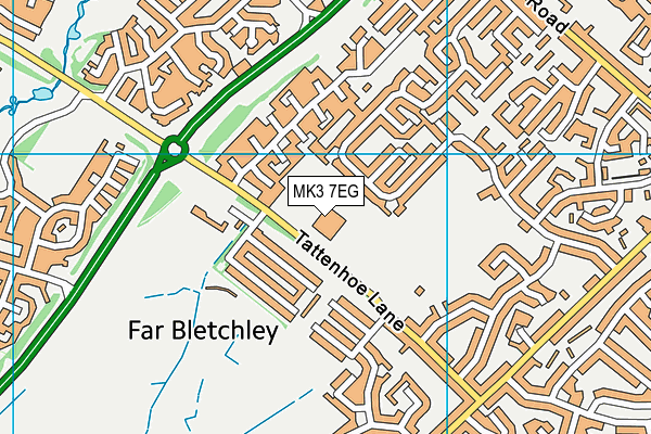
Milton Keynes Preparatory School is located in Milton Keynes and falls under the local authority of Milton Keynes. This mixed-sex school has 346 pupils, with a capacity of 500, aged up to eleven, and the type of establishment is other independent school.
| Address | Milton Keynes Preparatory School Tattenhoe Lane Milton Keynes Buckinghamshire MK3 7EG |
| Website | http://www.mkprep.co.uk |
| Headteacher | Mr Simon Driver |
GetTheData
Source: Get Information About Schools
Licence: Open Government Licence
| Phase of Education | Not applicable |
| Type of Establishment | Other independent school |
| Admissions Policy | Not applicable |
| Statutory High Age | 11 |
| Boarders | No boarders |
| Boarding Establishment | Does not have boarders |
| Official Sixth Form | Does not have a sixth form |
| Gender | Mixed |
| Religious Character | None |
| Diocese | Not applicable |
| Special Classes | No Special Classes |
GetTheData
Source: Get Information About Schools
Licence: Open Government Licence
| Census Date | 20th January 2022 | |
| School Capacity | 500 | |
| Number of Pupils | 346 | 69% capacity |
| Number of Boys | 183 | 53% |
| Number of Girls | 163 | 47% |
GetTheData
Source: Get Information About Schools
Licence: Open Government Licence
| Street Address | Tattenhoe Lane |
| Town | Milton Keynes |
| County | Buckinghamshire |
| Postcode | MK3 7EG |
| ➜ More MK3 7EG open data | |
GetTheData
Source: Get Information About Schools
Licence: Open Government Licence

GetTheData
Source: OS VectorMap District (Ordnance Survey)
Licence: Open Government Licence (requires attribution)
| Ofsted Special Measures | Not applicable |
GetTheData
Source: Get Information About Schools
Licence: Open Government Licence
| Establishment Name | Milton Keynes Preparatory School |
| Establishment Number | 6004 |
| Previous Establishment Number | 6143 |
| Unique Reference Number | 110565 |
| Local Authority | Milton Keynes |
| Local Authority Code | 826 |
| Previous Local Authority | Pre LGR (1997) Buckinghamshire |
| Previous Local Authority Code | 904 |
| Government Statistical Service Local Authority Code | E06000042 |
| Government Office Region | South East |
| District | Milton Keynes |
| District Code | E06000042 |
| Ward | Bletchley Park |
| Parliamentary Constituency | Milton Keynes South |
| Urban/Rural Description | (England/Wales) Urban city and town |
| Middle Super Output Area | Milton Keynes 029 |
| Lower Super Output Area | Milton Keynes 029B |
GetTheData
Source: Get Information About Schools
Licence: Open Government Licence
| Establishment Status | Open |
| Last Changed Date | 26th September 2023 |
| Reason Establishment Opened | Not applicable |
| Open Date | 11th May 1984 |
| Reason Establishment Closed | Not applicable |
GetTheData
Source: Get Information About Schools
Licence: Open Government Licence
| Teenage Mothers | Not applicable |
| Child Care Facilities | Not applicable |
| Special Educational Needs (SEN) Provision in Primary Care Unit | Not applicable |
| Pupil Referral Unit (PRU) Provides for Educational and Behavioural Difficulties (EBD) | Not applicable |
| Pupil Referral Unit (PRU) Offers Tuition by Another Provider | Not applicable |
GetTheData
Source: Get Information About Schools
Licence: Open Government Licence
| Section 41 Approved | Not approved |
GetTheData
Source: Get Information About Schools
Licence: Open Government Licence
| Trust flag | Not applicable |
| School Sponsor flag | Not applicable |
GetTheData
Source: Get Information About Schools
Licence: Open Government Licence
| Federation flag | Not applicable |
GetTheData
Source: Get Information About Schools
Licence: Open Government Licence
| UK Provider Reference Number | 10078223 |
| Further Education Type | Not applicable |
GetTheData
Source: Get Information About Schools
Licence: Open Government Licence
| Easting | 484711 |
| Northing | 233837 |
| Latitude | 51.99652 |
| Longitude | -0.76757 |
GetTheData
Source: Get Information About Schools
Licence: Open Government Licence
| School | Phase of Education | Distance |
|---|---|---|
| Milton Keynes Primary Pupil Referral Unit Manor Road, Bletchley, Milton Keynes, MK2 2HP | Not applicable | 692m |
| Romans Field School Shenley Road, Bletchley, Milton Keynes, MK3 7AW | Not applicable | 759m |
| Chestnuts Primary School Buckingham Road, Bletchley, Milton Keynes, MK3 5EN | Primary | 859m |
| Cambian Bletchley Park School Whaddon Way, Bletchley, Milton Keynes, MK3 7EB | Not applicable | 887m |
| Howe Park School Bowland Drive, Emerson Valley, Milton Keynes, MK4 2SH | Primary | 960m |
| St Thomas Aquinas Catholic Primary School St Mary's Avenue, Bletchley, Milton Keynes, MK3 5DT | Primary | 1km |
| Barleyhurst Park Primary Forfar Drive, Bletchley, Barleyhurst Park Primary School, Milton Keynes, MK3 7NA | Primary | 1.1km |
| Rickley Park Primary School Rickley Lane, Bletchley, MK3 6EW | Primary | 1.1km |
| White Spire School Rickley Lane, Bletchley, Milton Keynes, MK3 6EW | Not applicable | 1.2km |
| Emerson Valley School Hodder Lane, Emerson Valley, Milton Keynes, MK4 2JR | Primary | 1.2km |
GetTheData
Source: Get Information About Schools
Licence: Open Government Licence