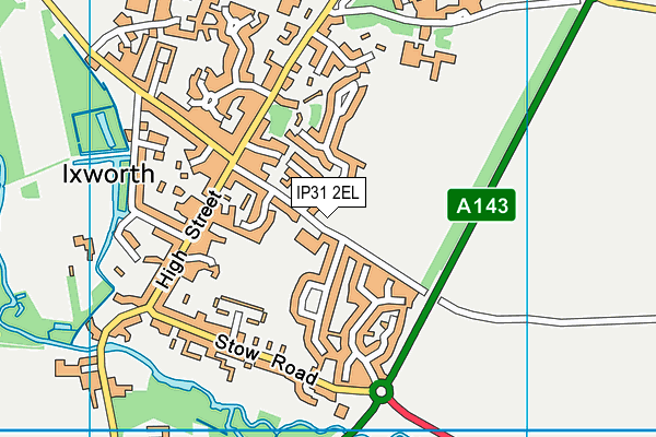
Ixworth Church of England Primary School is located in Ixworth, Bury St. Edmunds and falls under the local authority of Suffolk. The school's religious denomination is Church of England. This mixed-sex primary school has 138 pupils, with a capacity of 236, aged from three up to eleven, and the type of establishment is academy sponsor led. The most recend Ofsted inspection was 18th May 2022 resulting in an good rating.
| Address | Ixworth Church of England Primary School Crown Lane Ixworth Bury St. Edmunds Suffolk IP31 2EL |
| Headteacher | Mrs Lyndsey Allsopp |
GetTheData
Source: Get Information About Schools
Licence: Open Government Licence
| Phase of Education | Primary |
| Type of Establishment | Academy sponsor led |
| Admissions Policy | Not applicable |
| Statutory Low Age | 3 |
| Statutory High Age | 11 |
| Boarders | No boarders |
| Official Sixth Form | Not applicable |
| Gender | Mixed |
| Religious Character | Church of England |
| Diocese | Diocese of St Edmundsbury and Ipswich |
| Special Classes | Not applicable |
GetTheData
Source: Get Information About Schools
Licence: Open Government Licence
| Census Date | 19th January 2023 | |
| School Capacity | 236 | |
| Number of Pupils | 138 | 58% capacity |
| Number of Boys | 68 | 49% |
| Number of Girls | 70 | 51% |
| Free School Meals (%) | 19.40% |
GetTheData
Source: Get Information About Schools
Licence: Open Government Licence
| Street Address | Crown Lane |
| Locality | Ixworth |
| Town | Bury St. Edmunds |
| County | Suffolk |
| Postcode | IP31 2EL |
| ➜ More IP31 2EL open data | |
GetTheData
Source: Get Information About Schools
Licence: Open Government Licence

GetTheData
Source: OS VectorMap District (Ordnance Survey)
Licence: Open Government Licence (requires attribution)
| Ofsted Last Inspection | 18th May 2022 |
| Ofsted Rating | Good |
| Ofsted Special Measures | Not applicable |
GetTheData
Source: Get Information About Schools
Licence: Open Government Licence
| Establishment Name | Ixworth Church of England Primary School |
| Establishment Number | 2212 |
| Unique Reference Number | 145234 |
| Local Authority | Suffolk |
| Local Authority Code | 935 |
| Previous Local Authority Code | 999 |
| Government Statistical Service Local Authority Code | E10000029 |
| Government Office Region | East of England |
| District | West Suffolk |
| District Code | E07000245 |
| Ward | Ixworth |
| Parliamentary Constituency | West Suffolk |
| Urban/Rural Description | (England/Wales) Rural town and fringe |
| Middle Super Output Area | West Suffolk 006 |
| Lower Super Output Area | West Suffolk 006B |
GetTheData
Source: Get Information About Schools
Licence: Open Government Licence
| Establishment Status | Open |
| Last Changed Date | 16th January 2024 |
| Reason Establishment Opened | New Provision |
| Open Date | 1st December 2017 |
GetTheData
Source: Get Information About Schools
Licence: Open Government Licence
| Teenage Mothers | Not applicable |
| Special Educational Needs (SEN) Provision in Primary Care Unit | Not applicable |
| Pupil Referral Unit (PRU) Provides for Educational and Behavioural Difficulties (EBD) | Not applicable |
GetTheData
Source: Get Information About Schools
Licence: Open Government Licence
| Section 41 Approved | Not applicable |
GetTheData
Source: Get Information About Schools
Licence: Open Government Licence
| Trust flag | Supported by a multi-academy trust |
| Trust | THE TILIAN PARTNERSHIP |
| School Sponsor flag | Linked to a sponsor |
| School Sponsor | The Tilian Partnership |
GetTheData
Source: Get Information About Schools
Licence: Open Government Licence
| Federation flag | Not applicable |
GetTheData
Source: Get Information About Schools
Licence: Open Government Licence
| UK Provider Reference Number | 10066002 |
GetTheData
Source: Get Information About Schools
Licence: Open Government Licence
| Easting | 593547 |
| Northing | 270482 |
| Latitude | 52.29835 |
| Longitude | 0.837 |
GetTheData
Source: Get Information About Schools
Licence: Open Government Licence
| School | Phase of Education | Distance |
|---|---|---|
| Set Ixworth School Walsham Road, Ixworth, IP31 2HS | Secondary | 444m |
| Bardwell Church of England Primary School School Lane, Bardwell, Bury St Edmunds, IP31 1AD | Primary | 3.5km |
| Stanton Community Primary School Upthorpe Road, Stanton, Bury St. Edmunds, IP31 2AW | Primary | 4.4km |
| Honington Church of England Voluntary Controlled Primary School Malting Row, Honington, Bury St Edmunds, IP31 1RE | Primary | 4.7km |
| Norton CEVC Primary School School Close, Norton, Bury St Edmunds, IP31 3LZ | Primary | 5.2km |
| Thurston Community College Norton Road, Thurston, Bury St Edmunds, IP31 3PB | Secondary | 5.2km |
| Thurston Church of England Primary Academy Pond Field Road, Bury St. Edmunds, IP31 3FT | Primary | 5.3km |
| Great Barton Church of England Primary Academy School Road, Great Barton, Bury St Edmunds, IP31 2RJ | Primary | 5.5km |
| Barningham Church of England Voluntary Controlled Primary School Church Road, Barningham, Bury St Edmunds, IP31 1DD | Primary | 7km |
| Walsham-le-Willows Church of England Voluntary Controlled Primary School Wattisfield Road, Walsham-le-Willows, Bury St Edmunds, IP31 3BD | Primary | 7.2km |
GetTheData
Source: Get Information About Schools
Licence: Open Government Licence