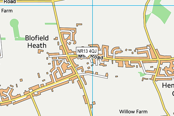
Hemblington Primary School is located in Blofield Heath, Norwich and falls under the local authority of Norfolk. This mixed-sex primary school has 143 pupils, with a capacity of 196, aged from five up to eleven, and the type of establishment is academy converter. The most recend Ofsted inspection was 13th October 2021 resulting in an requires improvement rating.
| Address | Hemblington Primary School Mill Road Blofield Heath Norwich Norfolk NR13 4QJ |
| Website | http://www.hemblingtonprimaryschool.org.uk |
| Headteacher | Mrs Louise Norgate |
GetTheData
Source: Get Information About Schools
Licence: Open Government Licence
| Phase of Education | Primary |
| Type of Establishment | Academy converter |
| Admissions Policy | Not applicable |
| Statutory Low Age | 5 |
| Statutory High Age | 11 |
| Boarders | No boarders |
| Official Sixth Form | Does not have a sixth form |
| Gender | Mixed |
| Religious Character | Does not apply |
| Diocese | Not applicable |
| Special Classes | No Special Classes |
GetTheData
Source: Get Information About Schools
Licence: Open Government Licence
| Census Date | 19th January 2023 | |
| School Capacity | 196 | |
| Number of Pupils | 143 | 73% capacity |
| Number of Boys | 86 | 60% |
| Number of Girls | 57 | 40% |
| Free School Meals (%) | 13.30% |
GetTheData
Source: Get Information About Schools
Licence: Open Government Licence
| Street Address | Mill Road |
| Locality | Blofield Heath |
| Town | Norwich |
| County | Norfolk |
| Postcode | NR13 4QJ |
| ➜ More NR13 4QJ open data | |
GetTheData
Source: Get Information About Schools
Licence: Open Government Licence

GetTheData
Source: OS VectorMap District (Ordnance Survey)
Licence: Open Government Licence (requires attribution)
| Ofsted Last Inspection | 13th October 2021 |
| Ofsted Rating | Requires improvement |
| Ofsted Special Measures | Not applicable |
GetTheData
Source: Get Information About Schools
Licence: Open Government Licence
| Establishment Name | Hemblington Primary School |
| Establishment Number | 2077 |
| Unique Reference Number | 144574 |
| Local Authority | Norfolk |
| Local Authority Code | 926 |
| Previous Local Authority Code | 999 |
| Government Statistical Service Local Authority Code | E10000020 |
| Government Office Region | East of England |
| District | Broadland |
| District Code | E07000144 |
| Ward | Blofield with South Walsham |
| Parliamentary Constituency | Broadland |
| Urban/Rural Description | (England/Wales) Rural village |
| Middle Super Output Area | Broadland 014 |
| Lower Super Output Area | Broadland 014C |
GetTheData
Source: Get Information About Schools
Licence: Open Government Licence
| Establishment Status | Open |
| Last Changed Date | 8th January 2024 |
| Reason Establishment Opened | Academy Converter |
| Open Date | 1st July 2017 |
GetTheData
Source: Get Information About Schools
Licence: Open Government Licence
| Teenage Mothers | Not applicable |
| Child Care Facilities | Not applicable |
| Special Educational Needs (SEN) Provision in Primary Care Unit | Not applicable |
| Pupil Referral Unit (PRU) Provides for Educational and Behavioural Difficulties (EBD) | Not applicable |
| Pupil Referral Unit (PRU) Offers Tuition by Another Provider | Not applicable |
GetTheData
Source: Get Information About Schools
Licence: Open Government Licence
| Section 41 Approved | Not applicable |
GetTheData
Source: Get Information About Schools
Licence: Open Government Licence
| Trust flag | Supported by a multi-academy trust |
| Trust | BROAD HORIZONS EDUCATION TRUST |
| School Sponsor flag | Linked to a sponsor |
| School Sponsor | Broad Horizons Education Trust |
GetTheData
Source: Get Information About Schools
Licence: Open Government Licence
| Federation flag | Not applicable |
GetTheData
Source: Get Information About Schools
Licence: Open Government Licence
| UK Provider Reference Number | 10064465 |
| Further Education Type | Not applicable |
GetTheData
Source: Get Information About Schools
Licence: Open Government Licence
| Easting | 632949 |
| Northing | 311603 |
| Latitude | 52.65209 |
| Longitude | 1.44252 |
GetTheData
Source: Get Information About Schools
Licence: Open Government Licence
| School | Phase of Education | Distance |
|---|---|---|
| Blofield Primary School North Street, Blofield, Norwich, NR13 4RH | Primary | 1.7km |
| Little Plumstead Church of England Primary Academy Old Hall Road, Little Plumstead, Norwich, NR13 5FA | Primary | 2.5km |
| Salhouse CofE Primary School Cheyney Avenue, Salhouse, NR13 6RJ | Primary | 3.3km |
| Brundall Primary School Braydeston Avenue, Brundall, Norwich, NR13 5JX | Primary | 3.4km |
| Rackheath Primary School Willoughby Way, Rackheath, Norwich, NR13 6SL | Primary | 4.5km |
| Fairhaven Church of England Voluntary Aided Primary School School Road, South Walsham, Norwich, NR13 6DZ | Primary | 4.6km |
| Lingwood Primary Academy Station Road, Norwich, Lingwood, NR13 4AZ | Primary | 4.7km |
| Surlingham Primary School Walnut Hill, Surlingham, 518 Earlham Road, Norwich, NR14 7DQ | Primary | 5.4km |
| Horning Community Primary School School Road, Horning, Norwich, NR12 8PX | Primary | 5.5km |
| Dussindale Primary School Vane Close, Thorpe St Andrew, Norwich, NR7 0US | Primary | 5.8km |
GetTheData
Source: Get Information About Schools
Licence: Open Government Licence