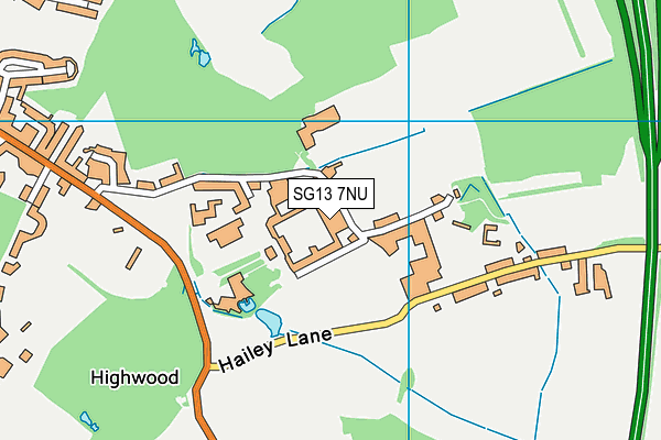
Haileybury and Imperial Service College is located in Hertford and falls under the local authority of Hertfordshire. The school's religious denomination is Church of England. This mixed-sex school has 892 pupils, with a capacity of 925, aged from eleven up to eighteen, and the type of establishment is other independent school.
| Address | Haileybury and Imperial Service College Hertford Hertfordshire SG13 7NU |
| Website | http://www.haileybury.com |
| Headteacher | Mr Martin Collier |
GetTheData
Source: Get Information About Schools
Licence: Open Government Licence
| Phase of Education | Not applicable |
| Type of Establishment | Other independent school |
| Admissions Policy | Not applicable |
| Statutory Low Age | 11 |
| Statutory High Age | 18 |
| Boarders | Boarding school |
| Boarding Establishment | Has boarders |
| Official Sixth Form | Has a sixth form |
| Gender | Mixed |
| Religious Character | Church of England |
| Diocese | Not applicable |
| Special Classes | No Special Classes |
GetTheData
Source: Get Information About Schools
Licence: Open Government Licence
| Census Date | 20th January 2022 | |
| School Capacity | 925 | |
| Number of Pupils | 892 | 96% capacity |
| Number of Boys | 462 | 52% |
| Number of Girls | 430 | 48% |
| Free School Meals (%) | 0.0% |
GetTheData
Source: Get Information About Schools
Licence: Open Government Licence
| Town | Hertford |
| County | Hertfordshire |
| Postcode | SG13 7NU |
| ➜ More SG13 7NU open data | |
GetTheData
Source: Get Information About Schools
Licence: Open Government Licence

GetTheData
Source: OS VectorMap District (Ordnance Survey)
Licence: Open Government Licence (requires attribution)
| Ofsted Special Measures | Not applicable |
GetTheData
Source: Get Information About Schools
Licence: Open Government Licence
| Establishment Name | Haileybury and Imperial Service College |
| Establishment Number | 6015 |
| Unique Reference Number | 117607 |
| Local Authority | Hertfordshire |
| Local Authority Code | 919 |
| Previous Local Authority Code | 999 |
| Government Statistical Service Local Authority Code | E10000015 |
| Government Office Region | East of England |
| District | East Hertfordshire |
| District Code | E07000242 |
| Ward | Hertford Heath & Brickendon |
| Parliamentary Constituency | Hertford and Stortford |
| Urban/Rural Description | (England/Wales) Rural hamlet and isolated dwellings |
| Middle Super Output Area | East Hertfordshire 018 |
| Lower Super Output Area | East Hertfordshire 018D |
GetTheData
Source: Get Information About Schools
Licence: Open Government Licence
| Establishment Status | Open |
| Last Changed Date | 23rd January 2024 |
| Reason Establishment Opened | Not applicable |
| Open Date | 1st January 1920 |
| Reason Establishment Closed | Not applicable |
GetTheData
Source: Get Information About Schools
Licence: Open Government Licence
| Teenage Mothers | Not applicable |
| Child Care Facilities | Not applicable |
| Special Educational Needs (SEN) Provision in Primary Care Unit | Not applicable |
| Pupil Referral Unit (PRU) Provides for Educational and Behavioural Difficulties (EBD) | Not applicable |
| Pupil Referral Unit (PRU) Offers Tuition by Another Provider | Not applicable |
GetTheData
Source: Get Information About Schools
Licence: Open Government Licence
| Section 41 Approved | Not approved |
GetTheData
Source: Get Information About Schools
Licence: Open Government Licence
| Trust flag | Not applicable |
| School Sponsor flag | Not applicable |
GetTheData
Source: Get Information About Schools
Licence: Open Government Licence
| Federation flag | Not applicable |
GetTheData
Source: Get Information About Schools
Licence: Open Government Licence
| UK Provider Reference Number | 10017921 |
| Further Education Type | Not applicable |
GetTheData
Source: Get Information About Schools
Licence: Open Government Licence
| Easting | 535720 |
| Northing | 210783 |
| Latitude | 51.77926 |
| Longitude | -0.03406 |
GetTheData
Source: Get Information About Schools
Licence: Open Government Licence
| School | Phase of Education | Distance |
|---|---|---|
| Hertford Heath Primary and Nursery School Woodland Road, Hertford Heath, Hertford, SG13 7QW | Primary | 950m |
| Roselands Primary School High Wood Road, Hoddesdon, EN11 9AR | Primary | 1.2km |
| Hailey Hall School Hailey Lane, Hertford, SG13 7PB | Not applicable | 1.2km |
| Westfield Community Primary School Westfield Road, Hoddesdon, EN11 8RA | Primary | 1.9km |
| The Cranbourne Primary School Bridleway North, Hoddesdon, EN11 9PP | Primary | 1.9km |
| Forres Primary School Stanstead Road, Hoddesdon, EN11 0RW | Primary | 2.1km |
| St John the Baptist Voluntary Aided Church of England Primary School Hillside Lane, Great Amwell, Ware, SG12 9SE | Primary | 2.1km |
| Middleton School Walnut Tree Walk, Ware, SG12 9PD | Not applicable | 2.3km |
| The John Warner School Stanstead Road, Hoddesdon, EN11 0QF | Secondary | 2.3km |
| Amwell View School Station Road, Stanstead Abbotts, Ware, SG12 8EH | Not applicable | 2.3km |
GetTheData
Source: Get Information About Schools
Licence: Open Government Licence