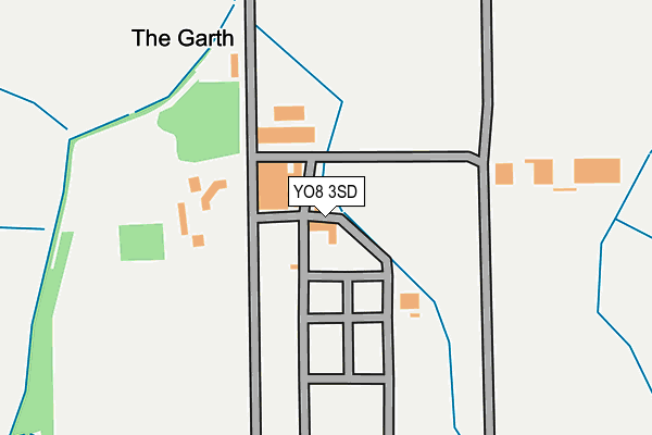
YO8 3SD is located in the Cawood & Escrick electoral ward, within the unitary authority of North Yorkshire and the English Parliamentary constituency of Selby and Ainsty. The Sub Integrated Care Board (ICB) Location is NHS Humber and North Yorkshire ICB - 03Q and the police force is North Yorkshire. This postcode has been in use since September 2008.


GetTheData
Source: OS OpenMap – Local (Ordnance Survey)
Source: OS VectorMap District (Ordnance Survey)
Licence: Open Government Licence (requires attribution)
| Easting | 456019 |
| Northing | 436849 |
| Latitude | 53.824919 |
| Longitude | -1.150465 |
GetTheData
Source: Open Postcode Geo
Licence: Open Government Licence
| Country | England |
| Postcode District | YO8 |
➜ See where YO8 is on a map | |
GetTheData
Source: Land Registry Price Paid Data
Licence: Open Government Licence
Elevation or altitude of YO8 3SD as distance above sea level:
| Metres | Feet | |
|---|---|---|
| Elevation | 10m | 33ft |
Elevation is measured from the approximate centre of the postcode, to the nearest point on an OS contour line from OS Terrain 50, which has contour spacing of ten vertical metres.
➜ How high above sea level am I? Find the elevation of your current position using your device's GPS.
GetTheData
Source: Open Postcode Elevation
Licence: Open Government Licence
| Ward | Cawood & Escrick |
| Constituency | Selby And Ainsty |
GetTheData
Source: ONS Postcode Database
Licence: Open Government Licence
| Stocksbridge Technology Centre (B1222) | Cawood | 660m |
| Stocksbridge Technology Centre (B1222) | Cawood | 675m |
| Castle Gatehouse (Thorpe Lane) | Cawood | 1,653m |
| Chapel (Thorpe Lane) | Cawood | 1,661m |
| Ulleskelf Station | 5.3km |
GetTheData
Source: NaPTAN
Licence: Open Government Licence
GetTheData
Source: ONS Postcode Database
Licence: Open Government Licence


➜ Get more ratings from the Food Standards Agency
GetTheData
Source: Food Standards Agency
Licence: FSA terms & conditions
| Last Collection | |||
|---|---|---|---|
| Location | Mon-Fri | Sat | Distance |
| 6 Bishops Close Cawood | 16:10 | 10:30 | 1,171m |
| Cawood Post Office | 18:50 | 10:30 | 1,644m |
| Cawood Holiday Park | 16:05 | 10:30 | 1,715m |
GetTheData
Source: Dracos
Licence: Creative Commons Attribution-ShareAlike
The below table lists the International Territorial Level (ITL) codes (formerly Nomenclature of Territorial Units for Statistics (NUTS) codes) and Local Administrative Units (LAU) codes for YO8 3SD:
| ITL 1 Code | Name |
|---|---|
| TLE | Yorkshire and The Humber |
| ITL 2 Code | Name |
| TLE2 | North Yorkshire |
| ITL 3 Code | Name |
| TLE22 | North Yorkshire CC |
| LAU 1 Code | Name |
| E07000169 | Selby |
GetTheData
Source: ONS Postcode Directory
Licence: Open Government Licence
The below table lists the Census Output Area (OA), Lower Layer Super Output Area (LSOA), and Middle Layer Super Output Area (MSOA) for YO8 3SD:
| Code | Name | |
|---|---|---|
| OA | E00142070 | |
| LSOA | E01027886 | Selby 002B |
| MSOA | E02005810 | Selby 002 |
GetTheData
Source: ONS Postcode Directory
Licence: Open Government Licence
| YO8 3UJ | Stockbridge House | 260m |
| YO8 3UA | The Close | 340m |
| YO8 3UD | Bell Lane | 758m |
| LS24 9EL | 938m | |
| YO8 3UB | Bishopdike Road | 956m |
| YO8 3SY | Castle Close | 1050m |
| YO8 3ST | Bishopdyke Road | 1076m |
| YO8 3SU | Wolsey Avenue | 1128m |
| YO8 3SX | Bishops Close | 1170m |
| YO8 3UH | Sylvan Close | 1287m |
GetTheData
Source: Open Postcode Geo; Land Registry Price Paid Data
Licence: Open Government Licence