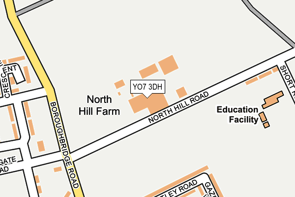
YO7 3DH is located in the Wathvale & Bishop Monkton electoral ward, within the unitary authority of North Yorkshire and the English Parliamentary constituency of Skipton and Ripon. The Sub Integrated Care Board (ICB) Location is NHS Humber and North Yorkshire ICB - 42D and the police force is North Yorkshire. This postcode has been in use since August 1992.


GetTheData
Source: OS OpenMap – Local (Ordnance Survey)
Source: OS VectorMap District (Ordnance Survey)
Licence: Open Government Licence (requires attribution)
| Easting | 439138 |
| Northing | 471165 |
| Latitude | 54.134861 |
| Longitude | -1.402504 |
GetTheData
Source: Open Postcode Geo
Licence: Open Government Licence
| Country | England |
| Postcode District | YO7 |
➜ See where YO7 is on a map | |
GetTheData
Source: Land Registry Price Paid Data
Licence: Open Government Licence
Elevation or altitude of YO7 3DH as distance above sea level:
| Metres | Feet | |
|---|---|---|
| Elevation | 30m | 98ft |
Elevation is measured from the approximate centre of the postcode, to the nearest point on an OS contour line from OS Terrain 50, which has contour spacing of ten vertical metres.
➜ How high above sea level am I? Find the elevation of your current position using your device's GPS.
GetTheData
Source: Open Postcode Elevation
Licence: Open Government Licence
| Ward | Wathvale & Bishop Monkton |
| Constituency | Skipton And Ripon |
GetTheData
Source: ONS Postcode Database
Licence: Open Government Licence
| Sycamore Drive (Boroughbridge Road) | Dishforth Airfield | 379m |
| Sycamore Drive (Boroughbridge Road) | Dishforth Airfield | 385m |
| Main Gates (Boroughbridge Road) | Dishforth Airfield | 474m |
| Main Gates (Boroughbridge Road) | Dishforth Airfield | 480m |
| Balk Top (Boroughbridge Road) | Dishforth Airfield | 576m |
GetTheData
Source: NaPTAN
Licence: Open Government Licence
GetTheData
Source: ONS Postcode Database
Licence: Open Government Licence


➜ Get more ratings from the Food Standards Agency
GetTheData
Source: Food Standards Agency
Licence: FSA terms & conditions
| Last Collection | |||
|---|---|---|---|
| Location | Mon-Fri | Sat | Distance |
| Norton Le Clay | 16:00 | 09:45 | 1,168m |
| Manor Drv Kirby Hill B/Bridge | 16:30 | 12:25 | 2,792m |
| Skelton Road Langthorpe | 16:15 | 12:15 | 3,849m |
GetTheData
Source: Dracos
Licence: Creative Commons Attribution-ShareAlike
The below table lists the International Territorial Level (ITL) codes (formerly Nomenclature of Territorial Units for Statistics (NUTS) codes) and Local Administrative Units (LAU) codes for YO7 3DH:
| ITL 1 Code | Name |
|---|---|
| TLE | Yorkshire and The Humber |
| ITL 2 Code | Name |
| TLE2 | North Yorkshire |
| ITL 3 Code | Name |
| TLE22 | North Yorkshire CC |
| LAU 1 Code | Name |
| E07000165 | Harrogate |
GetTheData
Source: ONS Postcode Directory
Licence: Open Government Licence
The below table lists the Census Output Area (OA), Lower Layer Super Output Area (LSOA), and Middle Layer Super Output Area (MSOA) for YO7 3DH:
| Code | Name | |
|---|---|---|
| OA | E00141256 | |
| LSOA | E01027737 | Harrogate 003D |
| MSOA | E02005763 | Harrogate 003 |
GetTheData
Source: ONS Postcode Directory
Licence: Open Government Licence
| YO7 3DE | The Close | 315m |
| YO7 3DF | The Close | 386m |
| YO61 2RS | 1111m | |
| YO7 3LF | Lingham Lane | 1777m |
| YO7 3LD | Old Post Office Row | 1936m |
| YO7 3LE | 1937m | |
| YO7 3LQ | Mowbray Avenue | 1966m |
| YO7 3LB | Hambleton View | 1974m |
| YO7 3LA | Dishforth Cottages | 2025m |
| YO7 3LG | Moor Lane | 2026m |
GetTheData
Source: Open Postcode Geo; Land Registry Price Paid Data
Licence: Open Government Licence