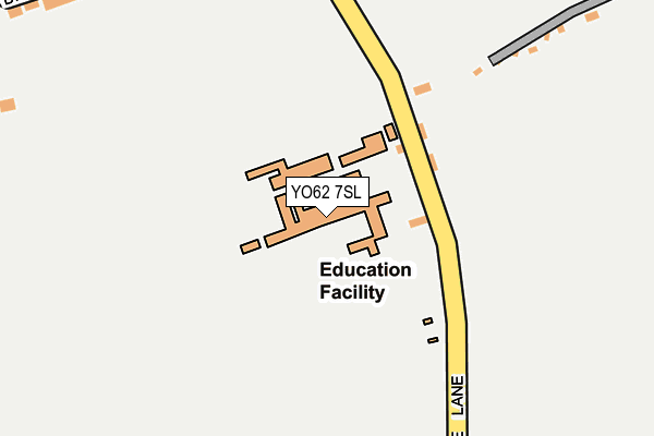
YO62 7SL is located in the Helmsley & Sinnington electoral ward, within the unitary authority of North Yorkshire and the English Parliamentary constituency of Thirsk and Malton. The Sub Integrated Care Board (ICB) Location is NHS Humber and North Yorkshire ICB - 03Q and the police force is North Yorkshire. This postcode has been in use since June 1998.


GetTheData
Source: OS OpenMap – Local (Ordnance Survey)
Source: OS VectorMap District (Ordnance Survey)
Licence: Open Government Licence (requires attribution)
| Easting | 465529 |
| Northing | 484352 |
| Latitude | 54.250664 |
| Longitude | -0.995775 |
GetTheData
Source: Open Postcode Geo
Licence: Open Government Licence
| Country | England |
| Postcode District | YO62 |
➜ See where YO62 is on a map ➜ Where is Beadlam? | |
GetTheData
Source: Land Registry Price Paid Data
Licence: Open Government Licence
Elevation or altitude of YO62 7SL as distance above sea level:
| Metres | Feet | |
|---|---|---|
| Elevation | 60m | 197ft |
Elevation is measured from the approximate centre of the postcode, to the nearest point on an OS contour line from OS Terrain 50, which has contour spacing of ten vertical metres.
➜ How high above sea level am I? Find the elevation of your current position using your device's GPS.
GetTheData
Source: Open Postcode Elevation
Licence: Open Government Licence
| Ward | Helmsley & Sinnington |
| Constituency | Thirsk And Malton |
GetTheData
Source: ONS Postcode Database
Licence: Open Government Licence
| Shelter (Gale Lane) | Beadlam | 277m |
| Howdale Lane (A170) | Beadlam | 286m |
| Nawton Garage (A170) | Beadlam | 458m |
| Nawton Garage (A170) | Beadlam | 464m |
| Highthorn (A170) | Beadlam | 477m |
GetTheData
Source: NaPTAN
Licence: Open Government Licence
GetTheData
Source: ONS Postcode Database
Licence: Open Government Licence


➜ Get more ratings from the Food Standards Agency
GetTheData
Source: Food Standards Agency
Licence: FSA terms & conditions
| Last Collection | |||
|---|---|---|---|
| Location | Mon-Fri | Sat | Distance |
| Village Hall Page Ln Wombleton | 17:45 | 11:30 | 1,507m |
| Railway Stationhelmsley | 17:15 | 12:00 | 3,862m |
| Pottergate Helmsley | 17:15 | 12:00 | 4,118m |
GetTheData
Source: Dracos
Licence: Creative Commons Attribution-ShareAlike
| Risk of YO62 7SL flooding from rivers and sea | Medium |
| ➜ YO62 7SL flood map | |
GetTheData
Source: Open Flood Risk by Postcode
Licence: Open Government Licence
The below table lists the International Territorial Level (ITL) codes (formerly Nomenclature of Territorial Units for Statistics (NUTS) codes) and Local Administrative Units (LAU) codes for YO62 7SL:
| ITL 1 Code | Name |
|---|---|
| TLE | Yorkshire and The Humber |
| ITL 2 Code | Name |
| TLE2 | North Yorkshire |
| ITL 3 Code | Name |
| TLE22 | North Yorkshire CC |
| LAU 1 Code | Name |
| E07000167 | Ryedale |
GetTheData
Source: ONS Postcode Directory
Licence: Open Government Licence
The below table lists the Census Output Area (OA), Lower Layer Super Output Area (LSOA), and Middle Layer Super Output Area (MSOA) for YO62 7SL:
| Code | Name | |
|---|---|---|
| OA | E00141481 | |
| LSOA | E01027780 | Ryedale 003B |
| MSOA | E02005790 | Ryedale 003 |
GetTheData
Source: ONS Postcode Directory
Licence: Open Government Licence
| YO62 7SJ | Gale Lane | 144m |
| YO62 7SN | Gale Lane | 218m |
| YO62 7SW | The Green | 274m |
| YO62 7ST | Main Road | 283m |
| YO62 7SU | Main Road | 292m |
| YO62 7RD | Main Road | 305m |
| YO62 7TP | East View | 342m |
| YO62 7SS | 375m | |
| YO62 7SG | Brier Park | 407m |
| YO62 7SB | Beckett Close | 414m |
GetTheData
Source: Open Postcode Geo; Land Registry Price Paid Data
Licence: Open Government Licence