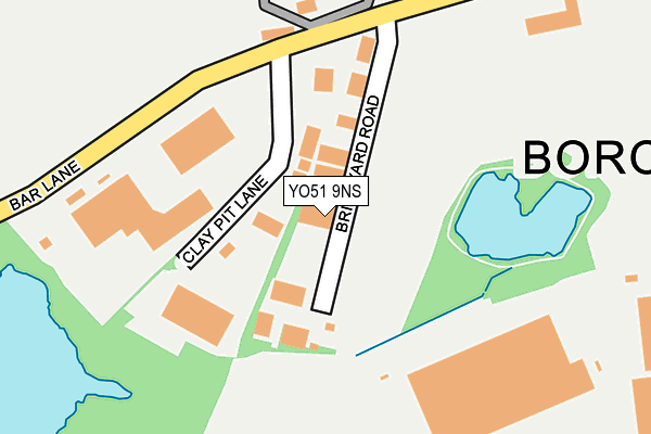
YO51 9NS lies on Brickyard Road in Roecliffe, York. YO51 9NS is located in the Wathvale & Bishop Monkton electoral ward, within the unitary authority of North Yorkshire and the English Parliamentary constituency of Skipton and Ripon. The Sub Integrated Care Board (ICB) Location is NHS Humber and North Yorkshire ICB - 42D and the police force is North Yorkshire. This postcode has been in use since June 1998.


GetTheData
Source: OS OpenMap – Local (Ordnance Survey)
Source: OS VectorMap District (Ordnance Survey)
Licence: Open Government Licence (requires attribution)
| Easting | 438429 |
| Northing | 465949 |
| Latitude | 54.088023 |
| Longitude | -1.414009 |
GetTheData
Source: Open Postcode Geo
Licence: Open Government Licence
| Street | Brickyard Road |
| Locality | Roecliffe |
| Town/City | York |
| Country | England |
| Postcode District | YO51 |
➜ See where YO51 is on a map ➜ Where is Roecliffe? | |
GetTheData
Source: Land Registry Price Paid Data
Licence: Open Government Licence
Elevation or altitude of YO51 9NS as distance above sea level:
| Metres | Feet | |
|---|---|---|
| Elevation | 20m | 66ft |
Elevation is measured from the approximate centre of the postcode, to the nearest point on an OS contour line from OS Terrain 50, which has contour spacing of ten vertical metres.
➜ How high above sea level am I? Find the elevation of your current position using your device's GPS.
GetTheData
Source: Open Postcode Elevation
Licence: Open Government Licence
| Ward | Wathvale & Bishop Monkton |
| Constituency | Skipton And Ripon |
GetTheData
Source: ONS Postcode Database
Licence: Open Government Licence
| Pasture Close (Bar Lane) | Roecliffe | 650m |
| Pasture Close (Bar Lane) | Roecliffe | 662m |
| Church (N/A) | Roecliffe | 789m |
| Three Arrows (Roecliffe Lane) | Boroughbridge | 937m |
| Morrisons Car Park (N/A) | Minskip | 1,034m |
GetTheData
Source: NaPTAN
Licence: Open Government Licence
| Median download speed | 40.0Mbps |
| Average download speed | 43.4Mbps |
| Maximum download speed | 80.00Mbps |
| Median upload speed | 10.0Mbps |
| Average upload speed | 10.4Mbps |
| Maximum upload speed | 20.00Mbps |
GetTheData
Source: Ofcom
Licence: Ofcom Terms of Use (requires attribution)
Estimated total energy consumption in YO51 9NS by fuel type, 2015.
| Consumption (kWh) | 99,322 |
|---|---|
| Meter count | 7 |
| Mean (kWh/meter) | 14,189 |
| Median (kWh/meter) | 7,318 |
GetTheData
Source: Postcode level gas estimates: 2015 (experimental)
Source: Postcode level electricity estimates: 2015 (experimental)
Licence: Open Government Licence
GetTheData
Source: ONS Postcode Database
Licence: Open Government Licence


➜ Get more ratings from the Food Standards Agency
GetTheData
Source: Food Standards Agency
Licence: FSA terms & conditions
| Last Collection | |||
|---|---|---|---|
| Location | Mon-Fri | Sat | Distance |
| West Garth Main St Roecliffe | 16:45 | 12:30 | 822m |
| Morrisons Supermarket | 17:30 | 12:35 | 1,099m |
| High Street Boroughbridge | 17:30 | 12:10 | 1,414m |
GetTheData
Source: Dracos
Licence: Creative Commons Attribution-ShareAlike
The below table lists the International Territorial Level (ITL) codes (formerly Nomenclature of Territorial Units for Statistics (NUTS) codes) and Local Administrative Units (LAU) codes for YO51 9NS:
| ITL 1 Code | Name |
|---|---|
| TLE | Yorkshire and The Humber |
| ITL 2 Code | Name |
| TLE2 | North Yorkshire |
| ITL 3 Code | Name |
| TLE22 | North Yorkshire CC |
| LAU 1 Code | Name |
| E07000165 | Harrogate |
GetTheData
Source: ONS Postcode Directory
Licence: Open Government Licence
The below table lists the Census Output Area (OA), Lower Layer Super Output Area (LSOA), and Middle Layer Super Output Area (MSOA) for YO51 9NS:
| Code | Name | |
|---|---|---|
| OA | E00141014 | |
| LSOA | E01027688 | Harrogate 003B |
| MSOA | E02005763 | Harrogate 003 |
GetTheData
Source: ONS Postcode Directory
Licence: Open Government Licence
| YO51 9LS | Bar Lane | 296m |
| YO51 9NR | Becklands Close | 384m |
| YO51 9LX | Orchard Cottages | 635m |
| YO51 9HY | Minskip Road | 747m |
| YO51 9NB | Church View | 808m |
| YO51 9LY | 847m | |
| YO51 9NA | Barrowgates | 914m |
| YO51 9UU | Lawson Avenue | 931m |
| YO51 9GN | Battle Close | 975m |
| YO51 9US | Abel Close | 985m |
GetTheData
Source: Open Postcode Geo; Land Registry Price Paid Data
Licence: Open Government Licence