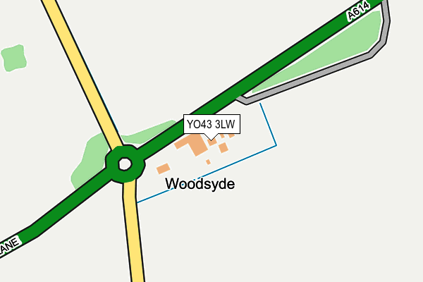
YO43 3LW is located in the Wolds Weighton electoral ward, within the unitary authority of East Riding of Yorkshire and the English Parliamentary constituency of East Yorkshire. The Sub Integrated Care Board (ICB) Location is NHS Humber and North Yorkshire ICB - 02Y and the police force is Humberside. This postcode has been in use since June 1998.


GetTheData
Source: OS OpenMap – Local (Ordnance Survey)
Source: OS VectorMap District (Ordnance Survey)
Licence: Open Government Licence (requires attribution)
| Easting | 487628 |
| Northing | 443810 |
| Latitude | 53.883108 |
| Longitude | -0.668407 |
GetTheData
Source: Open Postcode Geo
Licence: Open Government Licence
| Country | England |
| Postcode District | YO43 |
➜ See where YO43 is on a map | |
GetTheData
Source: Land Registry Price Paid Data
Licence: Open Government Licence
Elevation or altitude of YO43 3LW as distance above sea level:
| Metres | Feet | |
|---|---|---|
| Elevation | 60m | 197ft |
Elevation is measured from the approximate centre of the postcode, to the nearest point on an OS contour line from OS Terrain 50, which has contour spacing of ten vertical metres.
➜ How high above sea level am I? Find the elevation of your current position using your device's GPS.
GetTheData
Source: Open Postcode Elevation
Licence: Open Government Licence
| Ward | Wolds Weighton |
| Constituency | East Yorkshire |
GetTheData
Source: ONS Postcode Database
Licence: Open Government Licence
| Goodmanham Main Street (Main Street) | Goodmanham | 1,564m |
| Goodmanham Main Street (Goodmanham Road) | Goodmanham | 1,564m |
| Market Weighton York Rd (York Road) | Market Weighton | 1,734m |
| Market Weighton York Rd (York Road) | Market Weighton | 1,763m |
GetTheData
Source: NaPTAN
Licence: Open Government Licence
GetTheData
Source: ONS Postcode Database
Licence: Open Government Licence


➜ Get more ratings from the Food Standards Agency
GetTheData
Source: Food Standards Agency
Licence: FSA terms & conditions
| Last Collection | |||
|---|---|---|---|
| Location | Mon-Fri | Sat | Distance |
| Hollyhock Cottage Goodmanham | 16:00 | 10:15 | 1,422m |
| 34 Londesborough Road Mar/Weton | 17:45 | 11:30 | 1,525m |
| Londesborough Village | 17:00 | 10:00 | 1,840m |
GetTheData
Source: Dracos
Licence: Creative Commons Attribution-ShareAlike
The below table lists the International Territorial Level (ITL) codes (formerly Nomenclature of Territorial Units for Statistics (NUTS) codes) and Local Administrative Units (LAU) codes for YO43 3LW:
| ITL 1 Code | Name |
|---|---|
| TLE | Yorkshire and The Humber |
| ITL 2 Code | Name |
| TLE1 | East Yorkshire and Northern Lincolnshire |
| ITL 3 Code | Name |
| TLE12 | East Riding of Yorkshire |
| LAU 1 Code | Name |
| E06000011 | East Riding of Yorkshire |
GetTheData
Source: ONS Postcode Directory
Licence: Open Government Licence
The below table lists the Census Output Area (OA), Lower Layer Super Output Area (LSOA), and Middle Layer Super Output Area (MSOA) for YO43 3LW:
| Code | Name | |
|---|---|---|
| OA | E00066221 | |
| LSOA | E01013120 | East Riding of Yorkshire 015A |
| MSOA | E02002698 | East Riding of Yorkshire 015 |
GetTheData
Source: ONS Postcode Directory
Licence: Open Government Licence
| YO43 3HS | Londesborough Road | 1317m |
| YO43 3LP | Easthorpe Wold | 1391m |
| YO43 3HG | 1435m | |
| YO43 3HY | Edwins Garth | 1459m |
| YO43 3PP | Driffield Lane | 1478m |
| YO43 3JD | 1491m | |
| YO43 3HZ | London Terrace | 1498m |
| YO43 3HT | Goodmanham Road | 1507m |
| YO43 3HR | Londesborough Road | 1508m |
| YO43 3JB | 1508m |
GetTheData
Source: Open Postcode Geo; Land Registry Price Paid Data
Licence: Open Government Licence