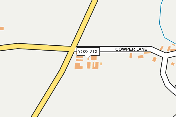
YO23 2TX is located in the Bishopthorpe electoral ward, within the unitary authority of York and the English Parliamentary constituency of York Outer. The Sub Integrated Care Board (ICB) Location is NHS Humber and North Yorkshire ICB - 03Q and the police force is North Yorkshire. This postcode has been in use since June 1998.


GetTheData
Source: OS OpenMap – Local (Ordnance Survey)
Source: OS VectorMap District (Ordnance Survey)
Licence: Open Government Licence (requires attribution)
| Easting | 458570 |
| Northing | 445827 |
| Latitude | 53.905303 |
| Longitude | -1.110001 |
GetTheData
Source: Open Postcode Geo
Licence: Open Government Licence
| Country | England |
| Postcode District | YO23 |
➜ See where YO23 is on a map ➜ Where is Acaster Malbis? | |
GetTheData
Source: Land Registry Price Paid Data
Licence: Open Government Licence
Elevation or altitude of YO23 2TX as distance above sea level:
| Metres | Feet | |
|---|---|---|
| Elevation | 10m | 33ft |
Elevation is measured from the approximate centre of the postcode, to the nearest point on an OS contour line from OS Terrain 50, which has contour spacing of ten vertical metres.
➜ How high above sea level am I? Find the elevation of your current position using your device's GPS.
GetTheData
Source: Open Postcode Elevation
Licence: Open Government Licence
| Ward | Bishopthorpe |
| Constituency | York Outer |
GetTheData
Source: ONS Postcode Database
Licence: Open Government Licence
| Memorial Institute (Mill Lane) | Acaster Malbis | 487m |
| Memorial Institute (Mill Lane) | Acaster Malbis | 498m |
| Ship Inn (Hauling Lane) | Acaster Malbis | 580m |
| Ship Inn (Hauling Lane) | Acaster Malbis | 589m |
| Temple Lane Post Box (Temple Lane) | Copmanthorpe | 665m |
GetTheData
Source: NaPTAN
Licence: Open Government Licence
GetTheData
Source: ONS Postcode Database
Licence: Open Government Licence


➜ Get more ratings from the Food Standards Agency
GetTheData
Source: Food Standards Agency
Licence: FSA terms & conditions
| Last Collection | |||
|---|---|---|---|
| Location | Mon-Fri | Sat | Distance |
| Mill Lane Acaster Malbis | 17:45 | 10:30 | 469m |
| 127 Temple Lane Copmanthorpe | 17:45 | 12:00 | 661m |
| Mill Lane Acaster Malbis | 17:45 | 10:30 | 1,031m |
GetTheData
Source: Dracos
Licence: Creative Commons Attribution-ShareAlike
The below table lists the International Territorial Level (ITL) codes (formerly Nomenclature of Territorial Units for Statistics (NUTS) codes) and Local Administrative Units (LAU) codes for YO23 2TX:
| ITL 1 Code | Name |
|---|---|
| TLE | Yorkshire and The Humber |
| ITL 2 Code | Name |
| TLE2 | North Yorkshire |
| ITL 3 Code | Name |
| TLE21 | York |
| LAU 1 Code | Name |
| E06000014 | York |
GetTheData
Source: ONS Postcode Directory
Licence: Open Government Licence
The below table lists the Census Output Area (OA), Lower Layer Super Output Area (LSOA), and Middle Layer Super Output Area (MSOA) for YO23 2TX:
| Code | Name | |
|---|---|---|
| OA | E00170155 | |
| LSOA | E01013342 | York 024C |
| MSOA | E02002795 | York 024 |
GetTheData
Source: ONS Postcode Directory
Licence: Open Government Licence
| YO23 2UQ | Moor End | 364m |
| YO23 2UH | Moor End | 548m |
| YO23 2LX | Tyn Garth | 628m |
| YO23 3TE | Temple Lane | 689m |
| YO23 2TZ | Holly Close | 694m |
| YO23 2UL | Mill Lane | 773m |
| YO23 2UJ | Mill Lane | 842m |
| YO23 2UF | Moor Lane | 1144m |
| YO19 4SB | The Walled Garden | 1190m |
| YO19 4RY | Maypole Grove | 1237m |
GetTheData
Source: Open Postcode Geo; Land Registry Price Paid Data
Licence: Open Government Licence