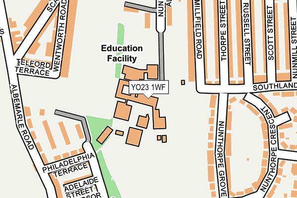
YO23 1WF is located in the Micklegate electoral ward, within the unitary authority of York and the English Parliamentary constituency of York Central. The Sub Integrated Care Board (ICB) Location is NHS Humber and North Yorkshire ICB - 03Q and the police force is North Yorkshire. This postcode has been in use since June 1998.


GetTheData
Source: OS OpenMap – Local (Ordnance Survey)
Source: OS VectorMap District (Ordnance Survey)
Licence: Open Government Licence (requires attribution)
| Easting | 459794 |
| Northing | 450690 |
| Latitude | 53.948884 |
| Longitude | -1.090432 |
GetTheData
Source: Open Postcode Geo
Licence: Open Government Licence
| Country | England |
| Postcode District | YO23 |
➜ See where YO23 is on a map ➜ Where is York? | |
GetTheData
Source: Land Registry Price Paid Data
Licence: Open Government Licence
Elevation or altitude of YO23 1WF as distance above sea level:
| Metres | Feet | |
|---|---|---|
| Elevation | 20m | 66ft |
Elevation is measured from the approximate centre of the postcode, to the nearest point on an OS contour line from OS Terrain 50, which has contour spacing of ten vertical metres.
➜ How high above sea level am I? Find the elevation of your current position using your device's GPS.
GetTheData
Source: Open Postcode Elevation
Licence: Open Government Licence
| Ward | Micklegate |
| Constituency | York Central |
GetTheData
Source: ONS Postcode Database
Licence: Open Government Licence
| Scarcroft Primary School (Scarcroft Road) | Scarcroft | 274m |
| Scarcroft Primary School (Scarcroft Road) | Scarcroft | 314m |
| Southlands Methodist Church (Bishopthorpe Road) | Bishopthorpe Road | 333m |
| The Winning Post (Bishopthorpe Road) | South Bank | 371m |
| Queen Victoria Street | South Bank | 376m |
| York Station | 1km |
| Poppleton Station | 4.9km |
GetTheData
Source: NaPTAN
Licence: Open Government Licence
GetTheData
Source: ONS Postcode Database
Licence: Open Government Licence


➜ Get more ratings from the Food Standards Agency
GetTheData
Source: Food Standards Agency
Licence: FSA terms & conditions
| Last Collection | |||
|---|---|---|---|
| Location | Mon-Fri | Sat | Distance |
| Scarcroft Hill | 18:15 | 12:30 | 279m |
| 31 Southlands Road York | 17:45 | 12:45 | 345m |
| Upper Price Street | 18:15 | 12:30 | 372m |
GetTheData
Source: Dracos
Licence: Creative Commons Attribution-ShareAlike
The below table lists the International Territorial Level (ITL) codes (formerly Nomenclature of Territorial Units for Statistics (NUTS) codes) and Local Administrative Units (LAU) codes for YO23 1WF:
| ITL 1 Code | Name |
|---|---|
| TLE | Yorkshire and The Humber |
| ITL 2 Code | Name |
| TLE2 | North Yorkshire |
| ITL 3 Code | Name |
| TLE21 | York |
| LAU 1 Code | Name |
| E06000014 | York |
GetTheData
Source: ONS Postcode Directory
Licence: Open Government Licence
The below table lists the Census Output Area (OA), Lower Layer Super Output Area (LSOA), and Middle Layer Super Output Area (MSOA) for YO23 1WF:
| Code | Name | |
|---|---|---|
| OA | E00067725 | |
| LSOA | E01013413 | York 017D |
| MSOA | E02002788 | York 017 |
GetTheData
Source: ONS Postcode Directory
Licence: Open Government Licence
| YO23 1NG | Southlands Road | 146m |
| YO23 1NQ | Millfield Road | 155m |
| YO23 1PF | Nunthorpe Avenue | 161m |
| YO23 1DS | Nunthorpe Grove | 176m |
| YO23 1NH | Millfield Road | 183m |
| YO23 1DT | Nunthorpe Grove | 189m |
| YO23 1NJ | Thorpe Street | 196m |
| YO23 1DH | Philadelphia Terrace | 205m |
| YO23 1DL | Adelaide Street | 214m |
| YO23 1NL | Thorpe Street | 214m |
GetTheData
Source: Open Postcode Geo; Land Registry Price Paid Data
Licence: Open Government Licence